MyTopo
Classic USGS Lombard Buttes Wyoming 7.5'x7.5' Topo Map
Regular price
$16.95
Regular price
Sale price
$16.95
Unit price
per
Couldn't load pickup availability
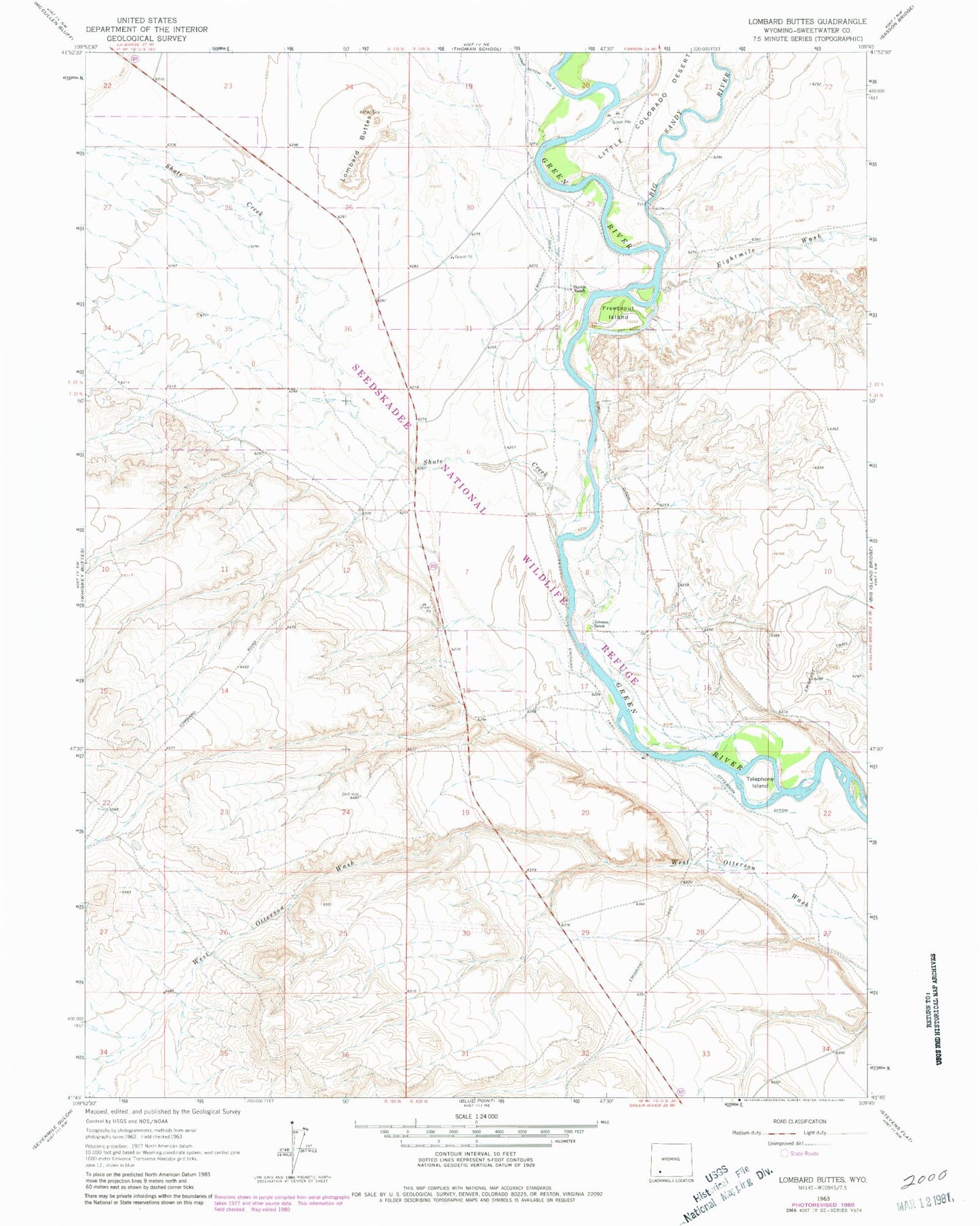
Historical USGS topographic quad map of Lombard Buttes in the state of Wyoming. Map scale may vary for some years, but is generally around 1:24,000. Print size is approximately 24" x 27"
This quadrangle is in the following counties: Sweetwater.
The map contains contour lines, roads, rivers, towns, and lakes. Printed on high-quality waterproof paper with UV fade-resistant inks, and shipped rolled.
Contains the following named places: Big Sandy River, Dunkle Ranch, Eightmile Wash, Freezeout Island, Johnson Ranch, Lombard Buttes, Otterson Ditch, Rood Ditch, Seedskadee National Wildlife Refuge, Shute Creek, Telephone Island