MyTopo
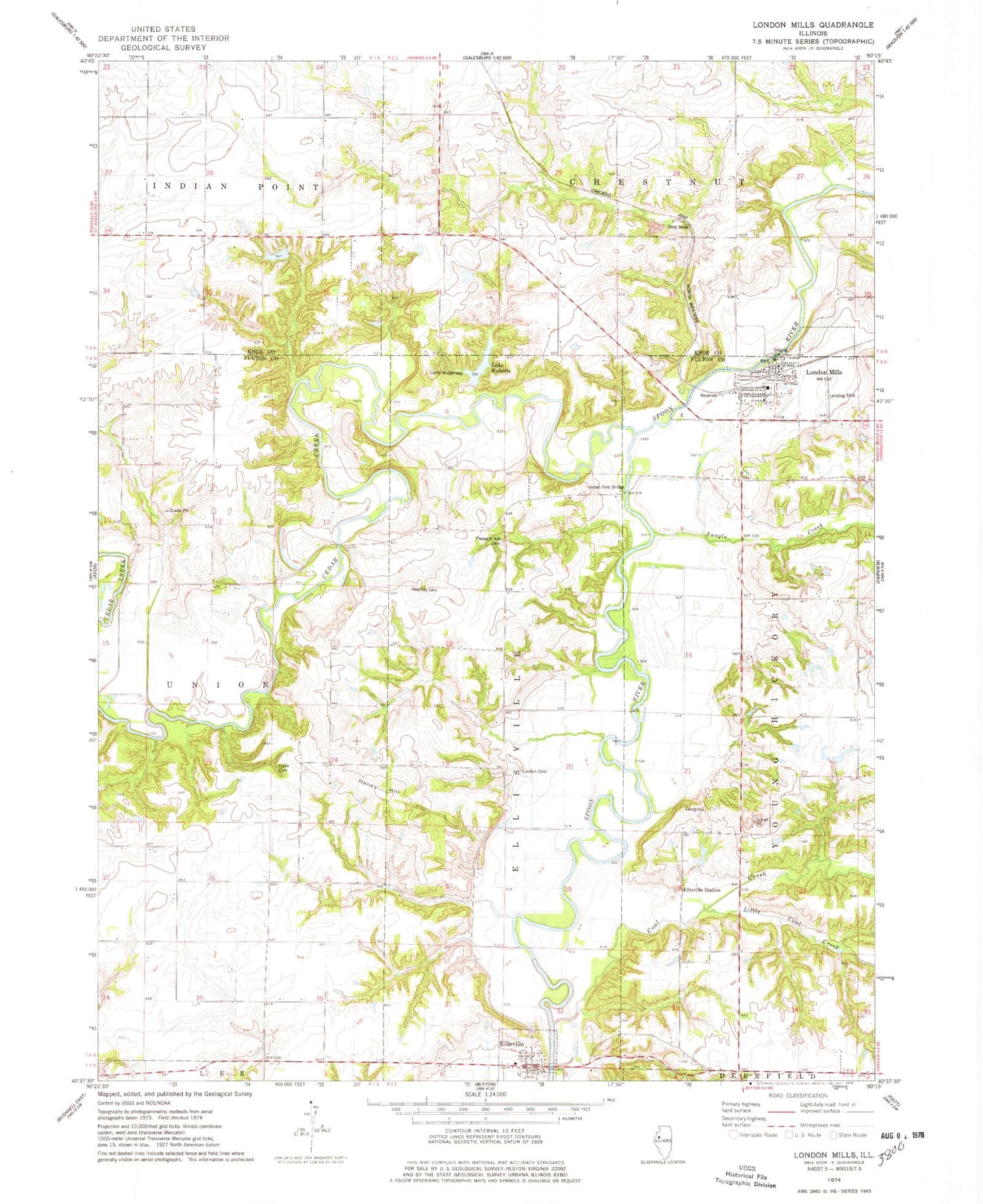
Classic USGS London Mills Illinois 7.5'x7.5' Topo Map
Couldn't load pickup availability
Historical USGS topographic quad map of London Mills in the state of Illinois. Typical map scale is 1:24,000, but may vary for certain years, if available. Print size: 24" x 27"
This quadrangle is in the following counties: Fulton, Knox.
The map contains contour lines, roads, rivers, towns, and lakes. Printed on high-quality waterproof paper with UV fade-resistant inks, and shipped rolled.
Contains the following named places: Camp Wilderness, Cedar Creek, Coal Creek, Ellisville, Ellisville Station, Flake Cemetery, Haney Hill, Heartley Cemetery, Landon Cemetery, Little Coal Creek, London Mills, Pleasant Hill Cemetery, Lake Roberts, Swegle Creek, Indian Ford Bridge (historical), Township of Ellisville, Township of Young Hickory, Lake Roberts Dam, Knox Company Conservation Club Lake Dam, Knox Company Conservation Club Lake, Council Corner School (historical), Flake School (historical), Hazel Ridge School (historical), Oak Mound School (historical), Pleasant Ridge School (historical), Troy School (historical), Fair Mound School (historical), Gooseneck School (historical), Pleasant Valley School (historical), South Grove School (historical), Ellisville Cemetery, London Mills Bridge (historical), Troy (historical), Indian Ford, London Mills School (historical), Mount Joy School (historical), Pleasant Hill School (historical), Pleasant Ridge (historical), Village of London Mills, Village of Ellisville, London Mills Community Fire Protection District, Ellisville Post Office