MyTopo
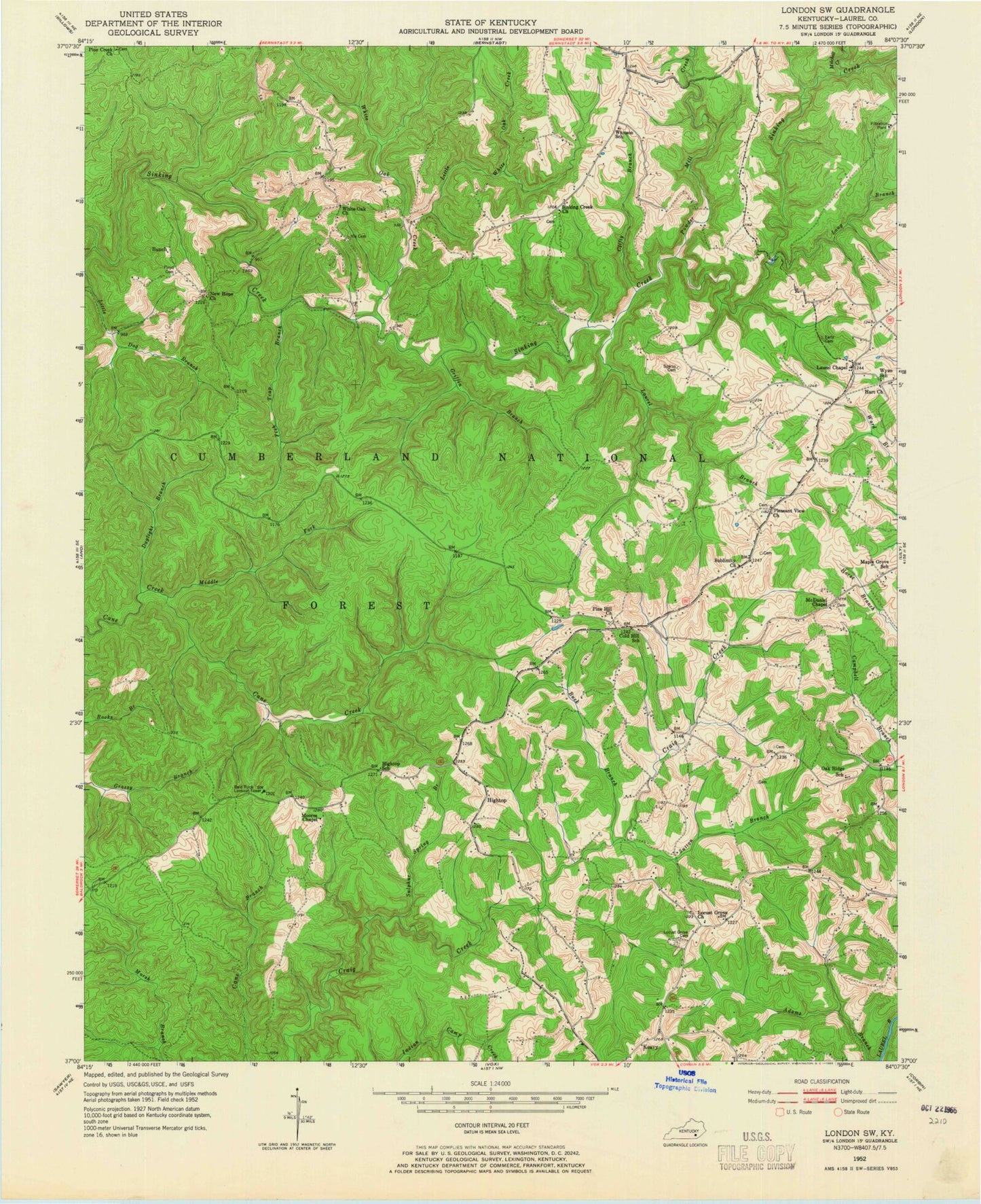
Classic USGS London SW Kentucky 7.5'x7.5' Topo Map
Couldn't load pickup availability
Historical USGS topographic quad map of London SW in the state of Kentucky. Map scale may vary for some years, but is generally around 1:24,000. Print size is approximately 24" x 27"
This quadrangle is in the following counties: Laurel.
The map contains contour lines, roads, rivers, towns, and lakes. Printed on high-quality waterproof paper with UV fade-resistant inks, and shipped rolled.
Contains the following named places: Adams Branch, Bald Rock Lookout Tower, Bald Rock Picnic Area, Benge General Store, Big Dog Branch, Buck Branch, Bunch, Clifty Branch, Cold Hill, Cold Hill School, Daylight Branch, Early Cemetery, East Prong White Oak Creek, Fish Trap Branch, Floyd Cemetery, Griffin Branch, Hart Baptist Church, Hightop, Hightop School, Keavy, Keavy Division, Keavy Fire Department Station 1, Keavy Fire Department Station 2, Keavy Post Office, Laurel Branch, Laurel Chapel Christian Church, Laurel County Fire Department Station 2, Little Dog Branch, Little White Oak Creek, Locust Grove Cemetery, Locust Grove Church, London Community Church, Long Branch, Maple Grove School, McDaniel Chapel, Middle Fork Cane Creek, Mitchell Creek, Moores Chapel, New Hope Church, Nix Cemetery, Oak Ridge School, Pine Creek Church, Pine Hill United Baptist Church, Pleasant View Cemetery, Pleasant View Church, Powder Mill Creek, Sinking Creek Baptist Church, Sparks Cemetery, Sublimity Church, Sulphur Spring Branch, Sutton Branch, West Prong White Oak Creek, White Oak Baptist Church, White Oak Creek, Whitson School, Wyan School