MyTopo
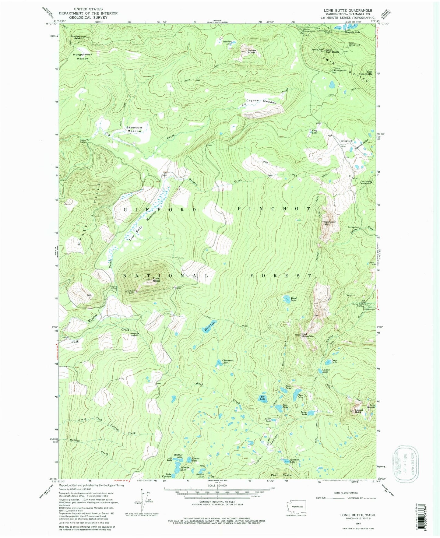
Classic USGS Lone Butte Washington 7.5'x7.5' Topo Map
Couldn't load pickup availability
Historical USGS topographic quad map of Lone Butte in the state of Washington. Typical map scale is 1:24,000, but may vary for certain years, if available. Print size: 24" x 27"
This quadrangle is in the following counties: Skamania.
The map contains contour lines, roads, rivers, towns, and lakes. Printed on high-quality waterproof paper with UV fade-resistant inks, and shipped rolled.
Contains the following named places: Acker Lake, Bear Lake, Bird Mountain, Brader Lake, Cayuse Meadow, Chenamus Lake, Clear Lake, Cold Spring Campground, Cultus Creek Station, Cultus Lake, Dee Lake, Deep Lake, Deer Lake, East Twin Butte, Elk Lake, Eunice Lake, Frog Lake, Heather Lake, Hungry Peak, Hungry Peak Meadow, Indian View Point, Junction Lake, Lake Kwaddis, Lemei Lake, Lemei Rock, Little Mosquito Lake, Lone Butte, Lone Butte Meadows, Lone Butte Quarry, Meadow Creek, Meadow Lake, Mosquito Lake Station, Placid Lake, Saddle Campground, Sawtooth Mountain, Skookum Meadow, South Campground, Squaw Butte, Surprise Lakes, Thomas Lake, Tillicum Campground, Twin Buttes, West Twin Butte, Wood Lake, Surprise Lake Indian Camp, Mount Saint Helens Viewpoint, Meadow Creek Indian Camp, Indian Heaven Wilderness, Cultus Creek Campground, Cold Spring Lake, Hungry Peak Lookout, Indian Heaven Lakes, West Twin Butte Lookout