MyTopo
Classic USGS Lone Mountain Texas 7.5'x7.5' Topo Map
Couldn't load pickup availability
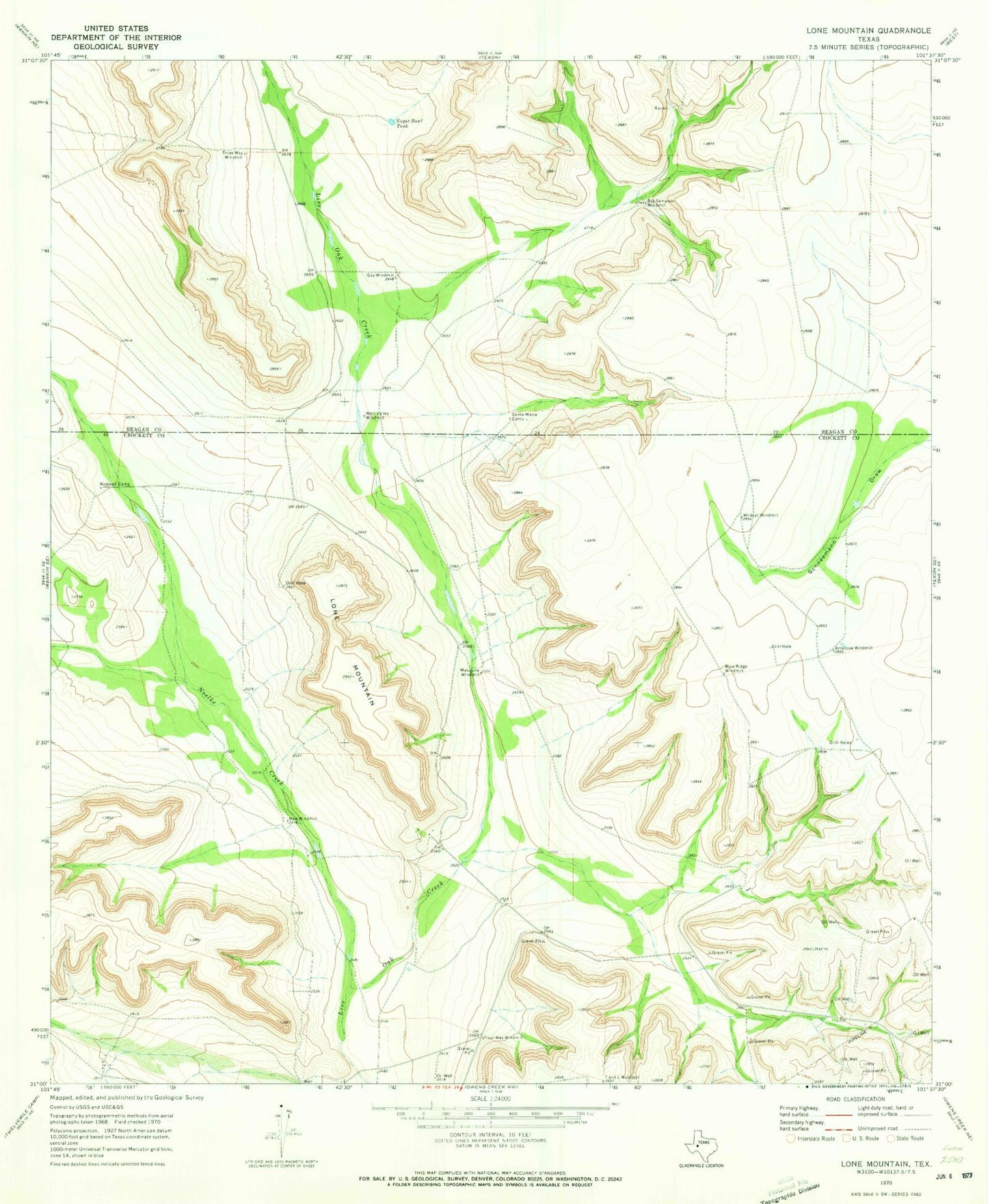
Historical USGS topographic quad map of Lone Mountain in the state of Texas. Map scale may vary for some years, but is generally around 1:24,000. Print size is approximately 24" x 27"
This quadrangle is in the following counties: Crockett, Reagan.
The map contains contour lines, roads, rivers, towns, and lakes. Printed on high-quality waterproof paper with UV fade-resistant inks, and shipped rolled.
Contains the following named places: Antelope Windmill, Big Sampson Windmill, Blue Ridge Windmill, Four Way Windmill, Gay Windmill, Lone Mountain, Mesquite Windmill, New Windmill, Noelke Creek, Redman Camp, Santa Maria Camp, Sugar Bowl Tank, T and L Windmill, Three Way Windmill, West Valley Windmill, Wildcat Windmill