MyTopo
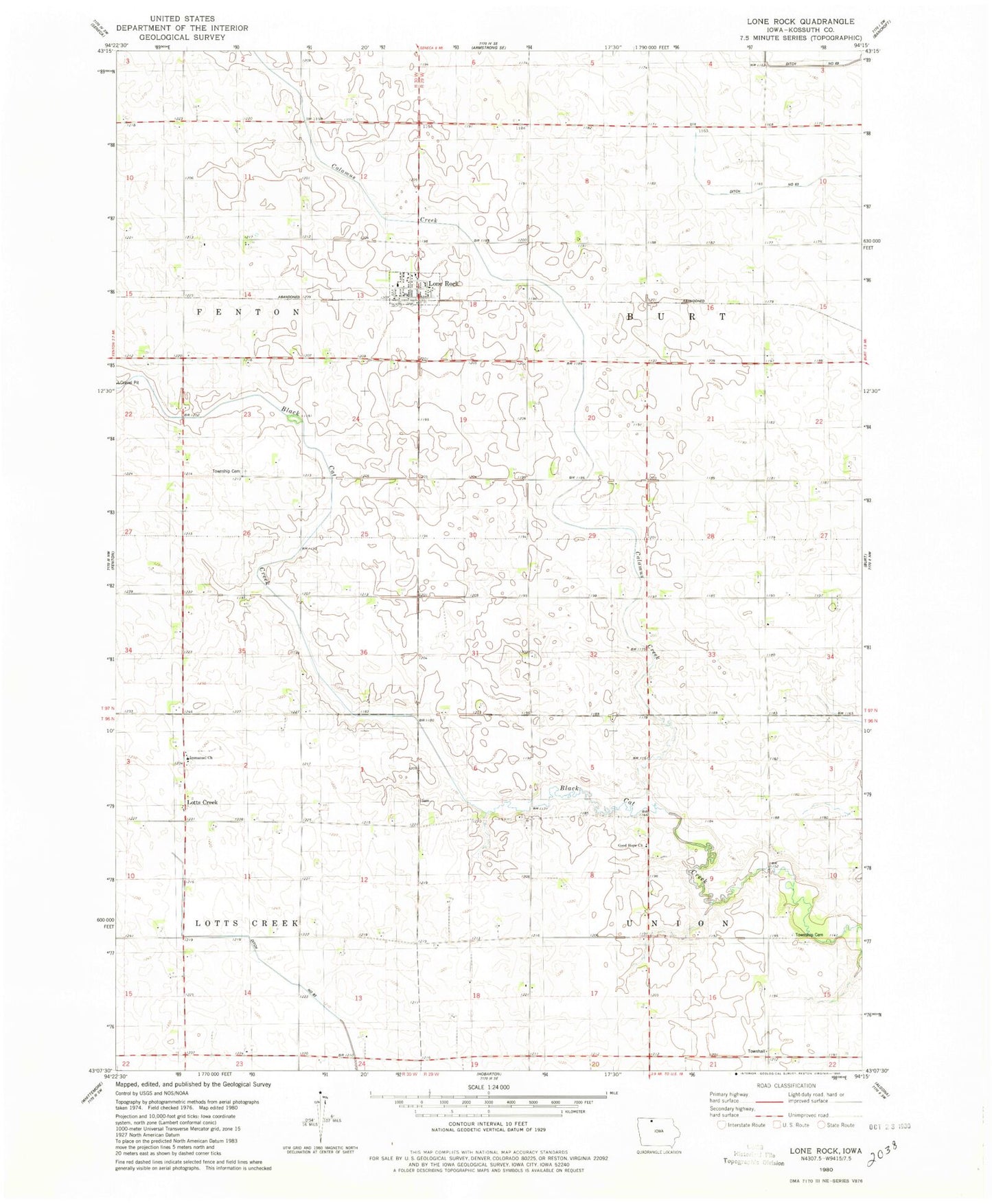
Classic USGS Lone Rock Iowa 7.5'x7.5' Topo Map
Couldn't load pickup availability
Historical USGS topographic quad map of Lone Rock in the state of Iowa. Map scale may vary for some years, but is generally around 1:24,000. Print size is approximately 24" x 27"
This quadrangle is in the following counties: Kossuth.
The map contains contour lines, roads, rivers, towns, and lakes. Printed on high-quality waterproof paper with UV fade-resistant inks, and shipped rolled.
Contains the following named places: Calamus Creek, Cherland Hog Farm, City of Lone Rock, Fenton Township Cemetery, Good Hope Church, Immanuel Church, Johnson's Settlement Post Office, Lone Rock, Lone Rock City Hall, Lone Rock Co-operative Exchange Elevator, Lone Rock Fire Department, Lone Rock Post Office, Lone Rock United Presbyterian Church, Lonerock, Lotts Creek, Lotts Creek Lutheran Cemetery, Lotts Creek Post Office, Township of Burt, Township of Union, Union Town Hall, Union Township Cemetery, ZIP Code: 50559