MyTopo
Classic USGS Lone Rock Wisconsin 7.5'x7.5' Topo Map
Couldn't load pickup availability
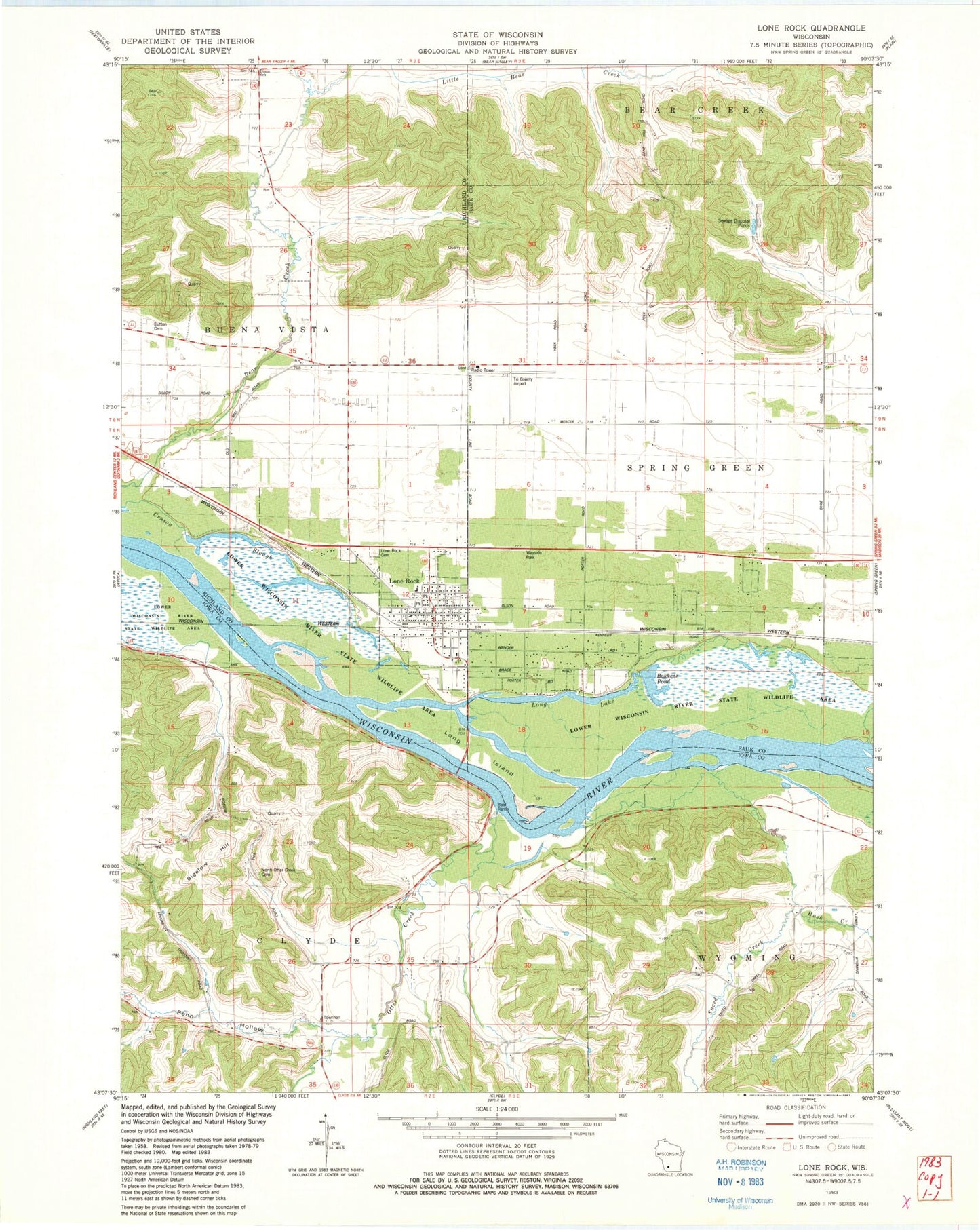
Historical USGS topographic quad map of Lone Rock in the state of Wisconsin. Map scale may vary for some years, but is generally around 1:24,000. Print size is approximately 24" x 27"
This quadrangle is in the following counties: Iowa, Richland, Sauk.
The map contains contour lines, roads, rivers, towns, and lakes. Printed on high-quality waterproof paper with UV fade-resistant inks, and shipped rolled.
Contains the following named places: Bakkens Pond, Bakkens Pond H2.117 Dam, Bakken's Pond State Natural Area, Bigelow Hill, Button Cemetery, Cruson Slough, Cruson Slough H2.117 Dam, Dixon School, Garrelts Farm, Gilbertson Farms, Lake Labelle, Lake Labelle Farm, Lees Dairy Farm, Little Bear Creek, Lone Rock, Lone Rock Boat Landing, Lone Rock Cemetery, Lone Rock Fire Department, Lone Rock Post Office, Lone Rock Rescue Unit, Lone Rock Stock and Grain Farm, Long Island, Long Lake, Long Lake Flowage 3WR237 Dam, Mayflower Dairy Farm, Mount Pleasant Stock Farm, North Otter Creek Cemetery, Oak Grove School, Oak Grove Stock Farm, Otter Creek, Penn Hollow, Penn Hollow Creek, Pine Grove Farm, Pine Park Farm, Prairie Farm, River Valley Elementary - Lone Rock School, Rush Creek, School Number 8, Smith Lake, Smith Slough and Sand Prairie State Natural Area, Sneed Creek, Town of Buena Vista, Town of Clyde, Tri-County Regional Airport, Village of Lone Rock, Wyoming Valley, ZIP Code: 53556