MyTopo
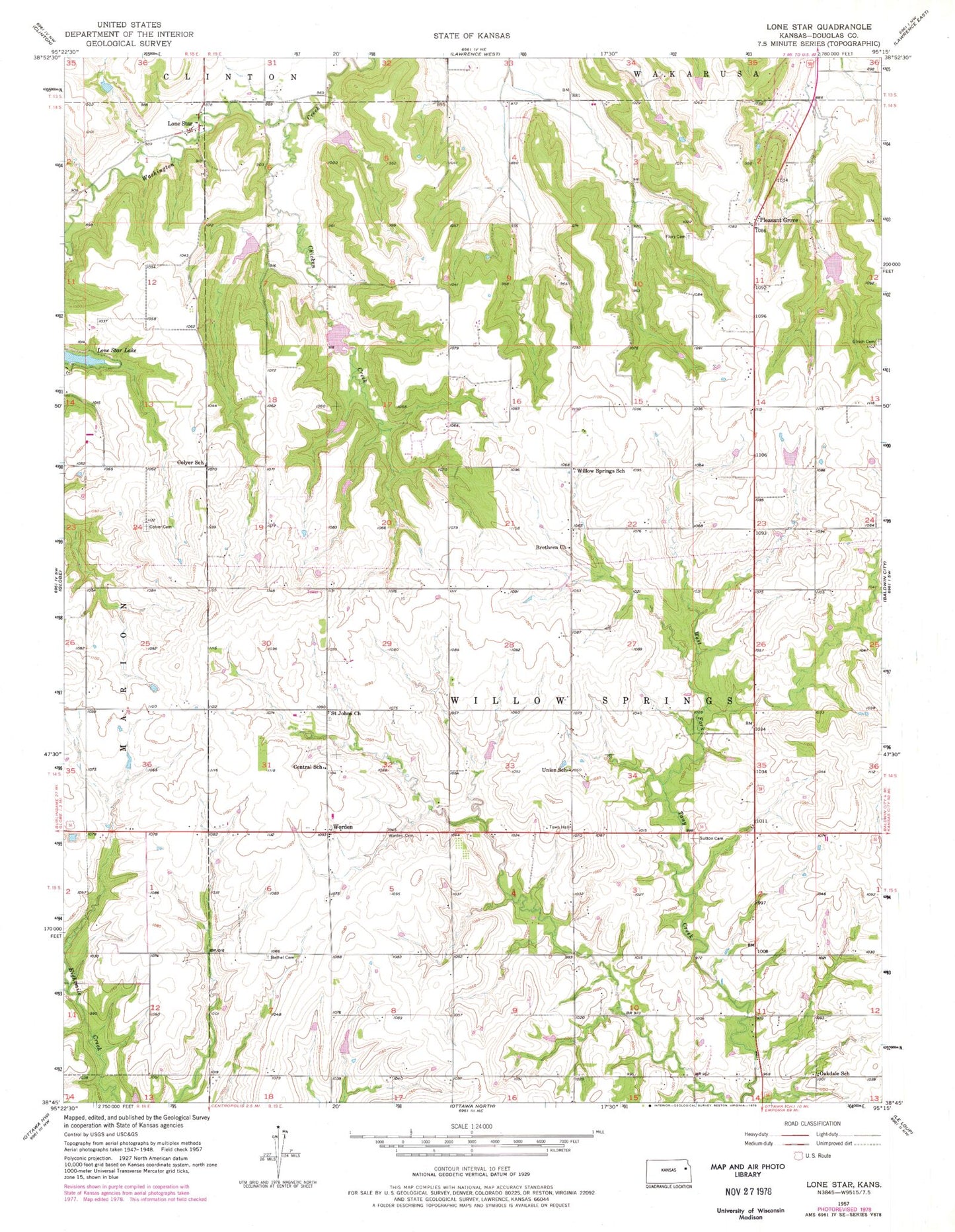
Classic USGS Lone Star Kansas 7.5'x7.5' Topo Map
Couldn't load pickup availability
Historical USGS topographic quad map of Lone Star in the state of Kansas. Map scale may vary for some years, but is generally around 1:24,000. Print size is approximately 24" x 27"
This quadrangle is in the following counties: Douglas.
The map contains contour lines, roads, rivers, towns, and lakes. Printed on high-quality waterproof paper with UV fade-resistant inks, and shipped rolled.
Contains the following named places: Bethel - Harbour Cemetery, Brethren Church, Central School, Chicken Creek, Colyer Cemetery, Colyer School, Echo, Exceline School, Flory - Pleasant Hill Cemetery, Flory Airport, Loma Vista Nursery, Lone Star, Marion Springs Elementary School, Maxwell Airport, Michael's Airport, Norris Airport, Oakdale School, Pleasant Grove, Route 56 and Route 59 Weigh Station, Saint Johns Cemetery, Saint John's United Church of Christ, Sutton Cemetery, Township of Willow Springs, Ulrich Cemetery, Union School, Western Plains Church of the Brethren, Williams Cemetery, Willow Springs, Willow Springs School, Willow Springs Township Fire Department, Worden, Worden Cemetery