MyTopo
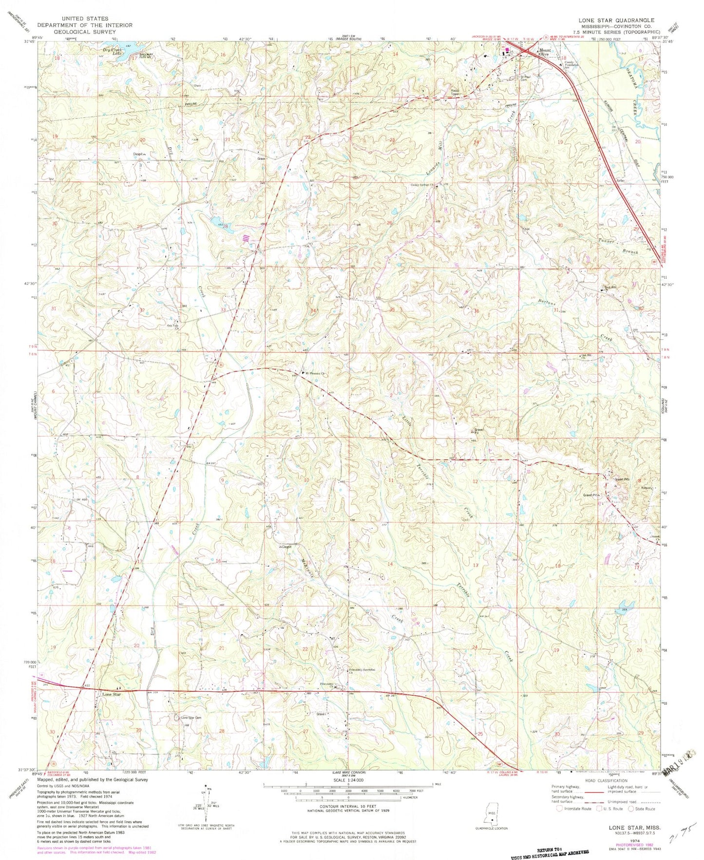
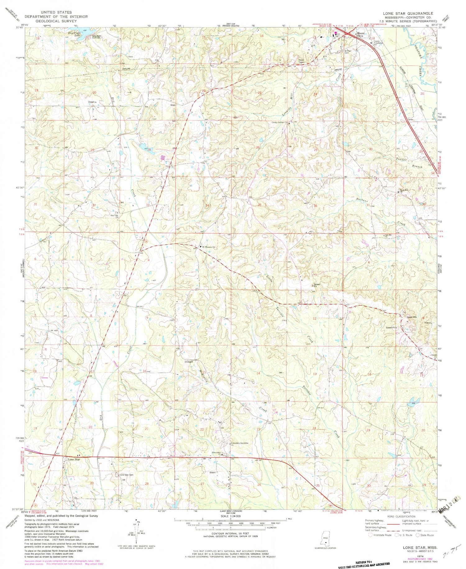
Classic USGS Lone Star Mississippi 7.5'x7.5' Topo Map
Couldn't load pickup availability
Historical USGS topographic quad map of Lone Star in the state of Mississippi. Map scale may vary for some years, but is generally around 1:24,000. Print size is approximately 24" x 27"
This quadrangle is in the following counties: Covington.
The map contains contour lines, roads, rivers, towns, and lakes. Printed on high-quality waterproof paper with UV fade-resistant inks, and shipped rolled.
Contains the following named places: Arbo, Black Jack School, Cooley Springs, Cooley Springs Cemetery, Cooley Springs Church, Cooley Springs School, County Foundation School, Dry Creek Structure 1 Dam, Dry Creek Structure 2 Dam, Dry Creek Watershed 4 Dam, Friendship, Friendship Baptist Church, Friendship Cemetery, Friendship Public School, Friendship Sanctified Church, Lenards Mill Creek, Lincoln Consolidated Shool, Linwood Vocational School, Little Terrible Creek, Lone Star, Lone Star Baptist Church, Lone Star Cemetery, Lone Star School, Lone Star United Methodist Church, Mount Olive First Baptist Church, Mount Pleasant, Mount Pleasant Cemetery, Mount Pleasant Church, New Prospect School, Oak Hill Church, Oak Hill School, Oakdale Cemetery, Oakvale Methodist Church, Oakvale School, Robert Hall Lake Dam, Rock Hill, Rock Hill Cemetery, Rock Hill Church, Saint Paul Baptist Church, Saint Paul Cemetery, Sleigo Presbyterian Church, Sunset, Supervisor District 4