MyTopo
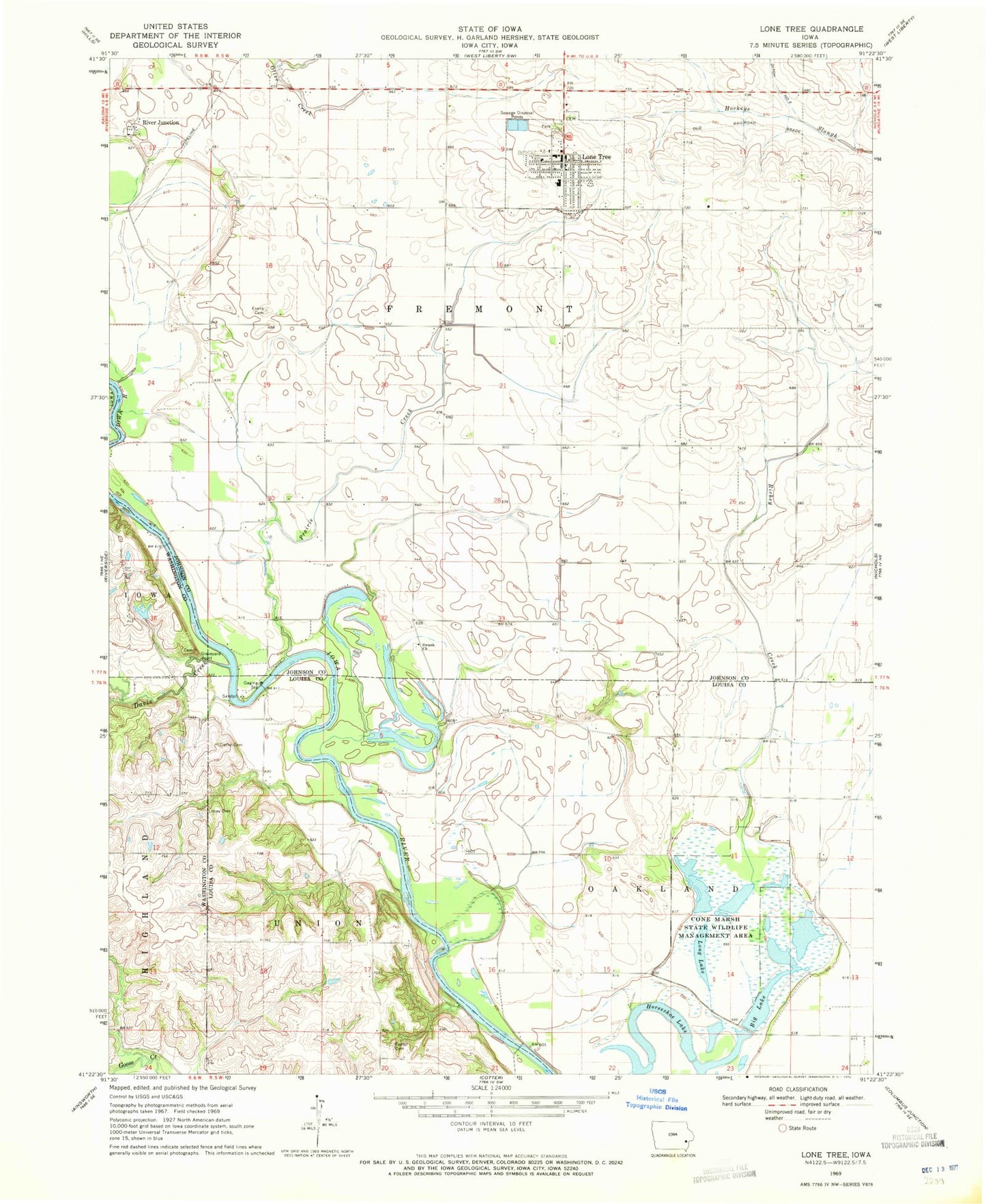
Classic USGS Lone Tree Iowa 7.5'x7.5' Topo Map
Couldn't load pickup availability
Historical USGS topographic quad map of Lone Tree in the state of Iowa. Map scale may vary for some years, but is generally around 1:24,000. Print size is approximately 24" x 27"
This quadrangle is in the following counties: Johnson, Louisa, Washington.
The map contains contour lines, roads, rivers, towns, and lakes. Printed on high-quality waterproof paper with UV fade-resistant inks, and shipped rolled.
Contains the following named places: Big Lake, Big Springs Post Office, City of Lone Tree, Clark Cemetery, Clarke Cemetery, Cone Marsh State Wildlife Management Area, Davis Creek, Des Moines River, Evans Cemetery, Forbes Cemetery, Foster Cemetery, Grave Yard Point Cemetery, Graveyard Point, Hills Lake, Horseshoe Lake, Knight Cemetery, Litsey Cemetery, Lone Tree, Lone Tree Cemetery, Lone Tree City Hall, Lone Tree Elementary School, Lone Tree Family Practice Center, Lone Tree Health Care Center, Lone Tree Junior - Senior High School, Lone Tree Post Office, Lone Tree Volunteer Fire and Rescue - First Responders, Long Lake, McDowell Lake, Palestine, Palestine Post Office, Prairie Creek, Richey Creek, River Junction, River Junction Cemetery, River Junction Post Office, Saint Marys Church, Saint Pauls Cemetery, Shoo Fly, Shoo Fly Post Office, Smith Family Cemetery, Swank Cemetery, Swank Church, Township of Fremont, Township of Oakland, United Presbyterian Church, White Ash, White Ash Post Office, ZIP Code: 52755