MyTopo
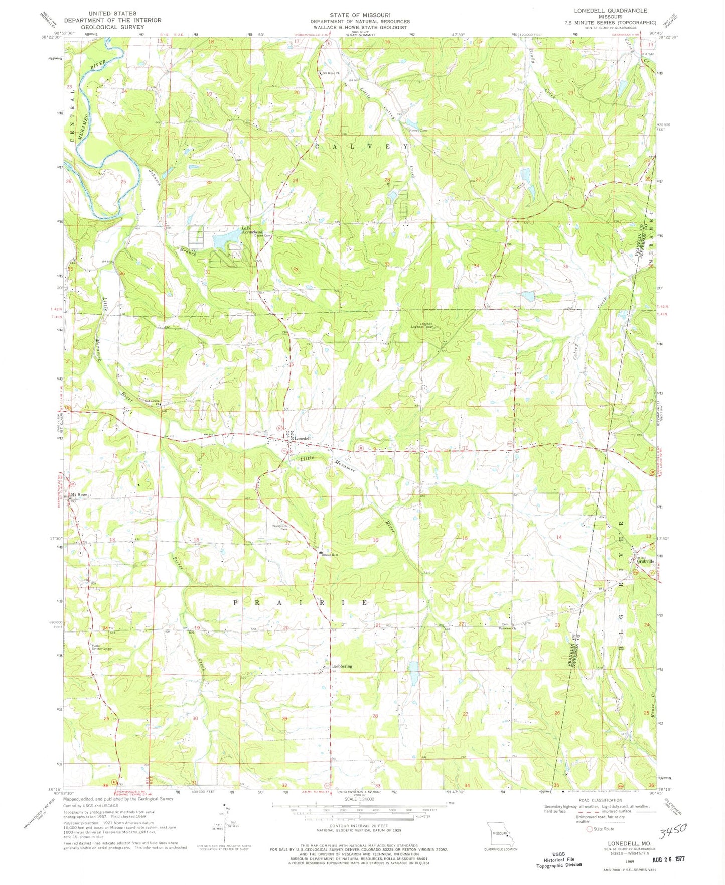
Classic USGS Lonedell Missouri 7.5'x7.5' Topo Map
Couldn't load pickup availability
Historical USGS topographic quad map of Lonedell in the state of Missouri. Map scale may vary for some years, but is generally around 1:24,000. Print size is approximately 24" x 27"
This quadrangle is in the following counties: Franklin, Jefferson.
The map contains contour lines, roads, rivers, towns, and lakes. Printed on high-quality waterproof paper with UV fade-resistant inks, and shipped rolled.
Contains the following named places: Al Swantner Reservoir, Anderson Lake Dam, Calvey, Diamond School, Drake School, Emmett Brison Dam, Emmett Brison Reservoir, Fairview Church, Faith Revival Center, Finney Cemetery, G Williams Dam, Grubville, Hemker, Hickory Flat School, Johnson Branch, Lake Arrowhead, Lake Arrowhead Dam, Lake Marion Dam, Lake Torino, Lake Torino Dam, Lake Von Der Rosa Dam, Little Meramec River, Lone Dell Camp, Lonedell, Lonedell Lookout Tower, Lonedell Post Office, Luebbering, Mount Hope, Mount Olive Church, Mount Pleasant School, Oak Grove Cemetery, Oak Grove Church, Pierce Creek, Prairie School, Rockford School, Saint Clair Fire Protection District Station 2, Saint Francis of Assisi Catholic Cemetery, School R-14, Swantner Lake Dam, Sycamore School, Township of Prairie, Von Der Ahe Dam, Von Der Rosa Number 2 Reservoir, Von Derosa Number 2 Lake Dam, Von Derosa Number 3 Lake Dam, Waits Sawmill, Watters Lake Dam, Williams Lake, Willow Ford, Woodcock Cemetery, ZIP Codes: 63041, 63061, 63072