MyTopo
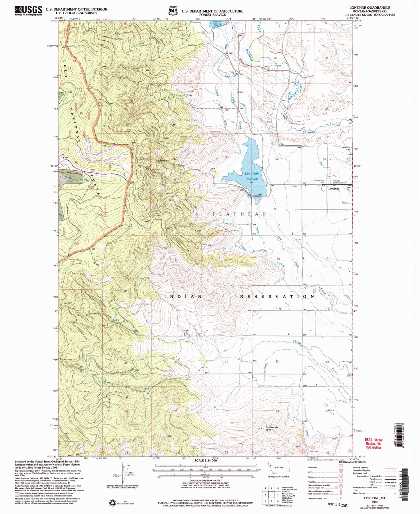
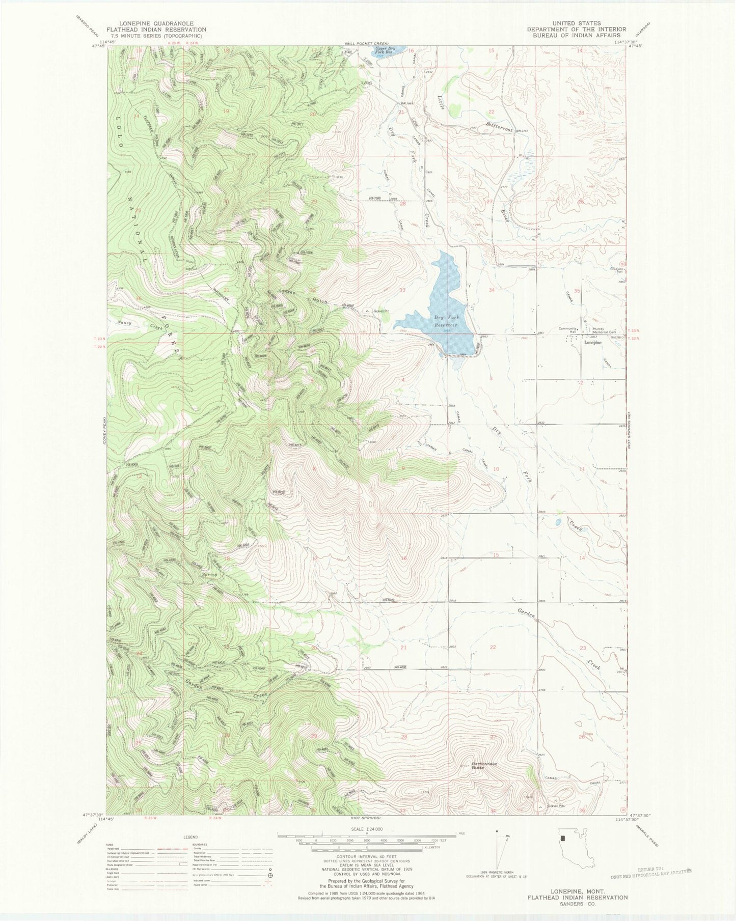
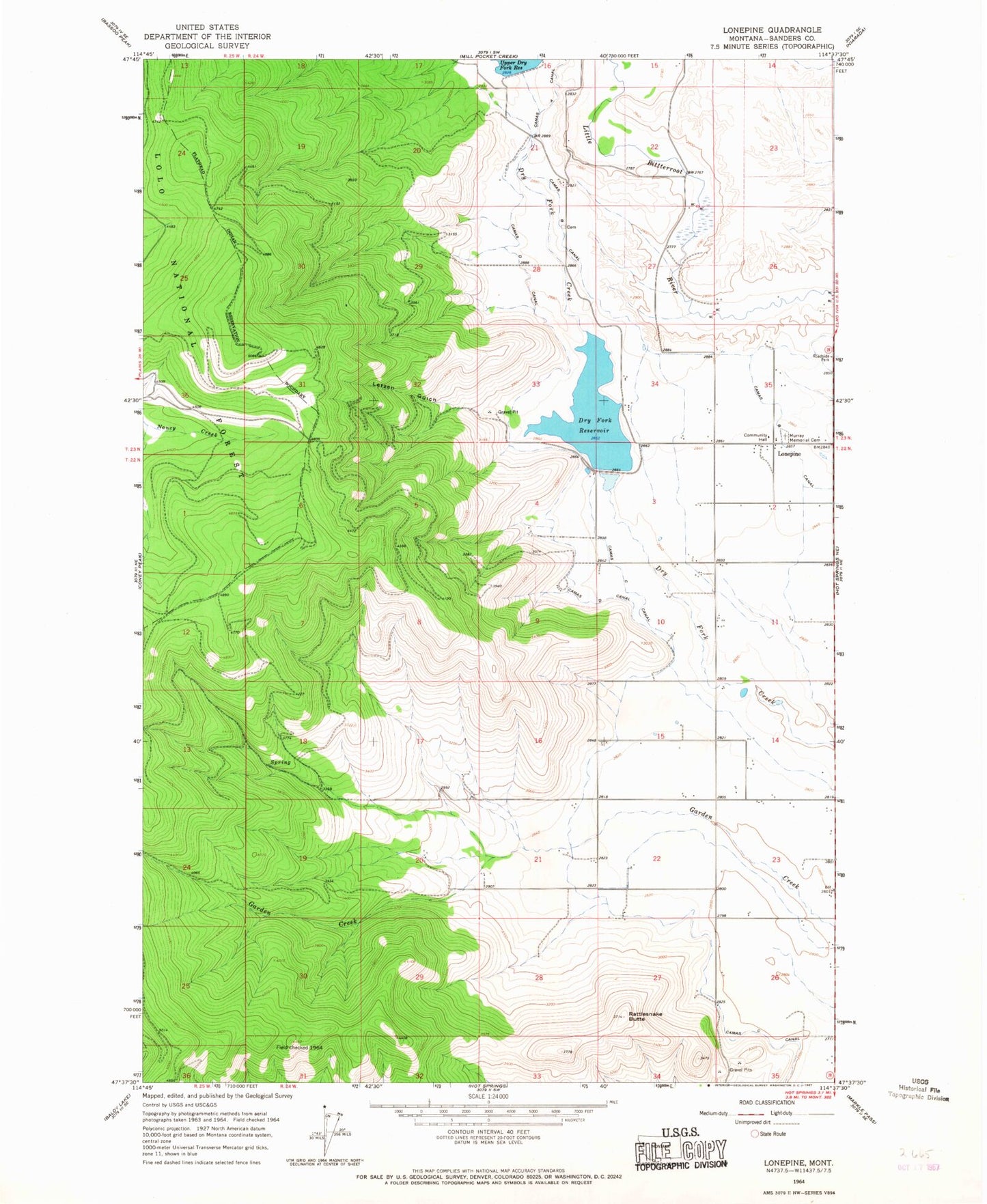
Classic USGS Lonepine Montana 7.5'x7.5' Topo Map
Couldn't load pickup availability
Historical USGS topographic quad map of Lonepine in the state of Montana. Map scale may vary for some years, but is generally around 1:24,000. Print size is approximately 24" x 27"
This quadrangle is in the following counties: Sanders.
The map contains contour lines, roads, rivers, towns, and lakes. Printed on high-quality waterproof paper with UV fade-resistant inks, and shipped rolled.
Contains the following named places: 22N24W02ABB_01 Well, 22N24W02DAAB01 Well, 22N24W03DAAB01 Well, 22N24W04ABBA01 Well, 22N24W04ABBA02 Well, 22N24W04ABBA03 Well, 22N24W04ABBA04 Well, 22N24W04ABBA05 Well, 22N24W10ABA_01 Well, 22N24W10DDA_01 Well, 22N24W11ADC_01 Well, 22N24W11CBB_01 Well, 22N24W11DAD_01 Well, 22N24W11DAD_02 Well, 22N24W14CDD_01 Well, 22N24W15CAB_01 Well, 22N24W16DDCD01 Well, 22N24W21ACD_01 Well, 22N24W21DAA_01 Well, 22N24W22CAB_01 Well, 22N24W23AAA_01 Well, 22N24W23ABAB01 Well, 22N24W23CDC_01 Well, 22N24W23DDA_01 Well, 22N24W26AAD_01 Well, 22N24W26BCC_01 Well, 22N24W27ADD_01 Well, 22N24W35AADA01 Well, 23N24W15DCA_01 Well, 23N24W22DACA01 Well, 23N24W27CDDD01 Well, 23N24W34ADA_01 Well, 23N24W34ADAA01 Well, 23N24W34CAC_01 Well, 23N24W34CBDD01 Well, 23N24W34DCD_01 Well, 23N24W35BAA_01 Well, 23N24W35CDD_01 Well, 23N24W35DCCC01 Well, 23N24W35DDC_01 Well, 23N24W35DDD_01 Well, 24N24W27ABDB01 Well, 59848, Camas Canal, Camas D Canal, Dry Fork Dam, Dry Fork Reservoir, Indian Cemetery, Letzen Gulch, Lonepine, Lonepine Census Designated Place, Lonepine Post Office, LONEPINE_CANAL Well, Murray Memorial Cemetery, Rattlesnake Butte, Upper Dry Fork Dam, Upper Lookout Mine