MyTopo
Classic USGS Lonesome Peak Montana 7.5'x7.5' Topo Map
Couldn't load pickup availability
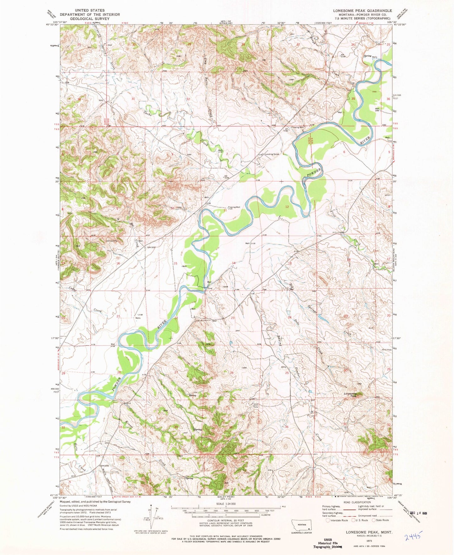
Historical USGS topographic quad map of Lonesome Peak in the state of Montana. Map scale may vary for some years, but is generally around 1:24,000. Print size is approximately 24" x 27"
This quadrangle is in the following counties: Powder River.
The map contains contour lines, roads, rivers, towns, and lakes. Printed on high-quality waterproof paper with UV fade-resistant inks, and shipped rolled.
Contains the following named places: 05S50E26DA__01 Well, 05S50E26DDA_02 Well, 05S50E26DDAB01 Well, 05S50E26DDBA01 Well, 05S50E27ABDD01 Well, 05S50E35CBDD01 Well, 06S50E01ABBD01 Well, 06S50E01BCDC01 Well, 06S50E12CADC01 Well, 06S50E13CDDD01 Well, 06S50E14CCBD01 Well, 06S50E15BD__01 Well, 06S50E16AAAC01 Well, 06S50E21ACDA01 Well, 06S50E21CDDD01 Well, 06S50E24CC__01 Well, 06S50E32DDCB01 Well, 06S50E36AAA_01 Well, 06S51E05BB__01 Well, 06S51E06AC__01 Well, 06S51E06BDAB01 Well, 06S51E31CCCC01 Well, 07S50E01BDBB01 Well, Baking Powder Creek, Bog Springs Creek, Butte Creek, Cache Creek, Cedar Creek, Clay Butte Creek, Deep Gulch Creek, Dobe Creek, Dripping Spring Creek, Ernest Creek, First Creek, Flood Creek, Lonesome Peak, Moores, North Bar Creek, Rough Creek, Second Creek, Upper Daily Creek, Wilson Creek