MyTopo
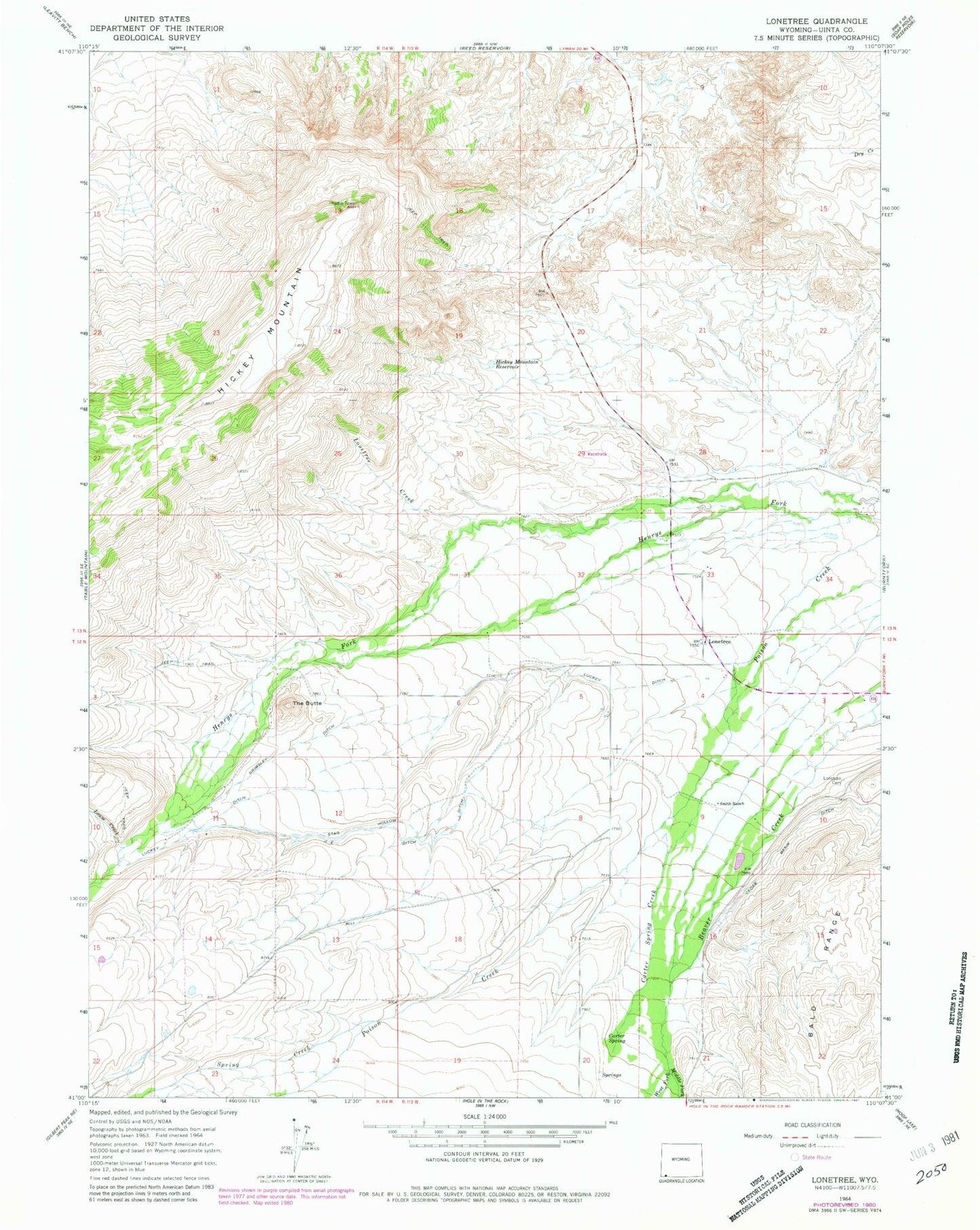
Classic USGS Lonetree Wyoming 7.5'x7.5' Topo Map
Couldn't load pickup availability
Historical USGS topographic quad map of Lonetree in the state of Wyoming. Map scale may vary for some years, but is generally around 1:24,000. Print size is approximately 24" x 27"
This quadrangle is in the following counties: Uinta.
The map contains contour lines, roads, rivers, towns, and lakes. Printed on high-quality waterproof paper with UV fade-resistant inks, and shipped rolled.
Contains the following named places: Carter Spring, Carter Spring Creek, Cedar Basin Ditch, Grimsley Ditch, Hickey Mountain Reservoir, Hickey Ranch, J E Ditch, Lonetree, Lonetree Cemetery, Lonetree Census Designated Place, Lonetree Creek, Louse Creek, Luckey Ditch, Middle Fork Beaver Creek, Smith Ranch, Stag Hollow Ditch, The Butte, West Fork Beaver Creek, ZIP Code: 82936