
MyTopo
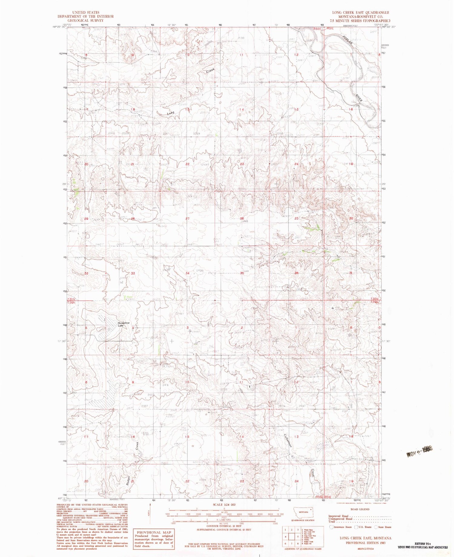
Classic USGS Long Creek East Montana 7.5'x7.5' Topo Map
Regular price
$16.95
Regular price
Sale price
$16.95
Unit price
per
Couldn't load pickup availability
Historical USGS topographic quad map of Long Creek East in the state of Montana. Map scale may vary for some years, but is generally around 1:24,000. Print size is approximately 24" x 27"
This quadrangle is in the following counties: Roosevelt.
The map contains contour lines, roads, rivers, towns, and lakes. Printed on high-quality waterproof paper with UV fade-resistant inks, and shipped rolled.
Contains the following named places: 29N50E10CDCD01 Well, 29N50E14CDAD01 Well, 29N50E14CDDD01 Well, 29N50E15BB__01 Well, 29N50E23BAAA01 Well, 29N51E17CCCC01 Well, 30N50E20ABAA01 Well, 30N50E21CACA01 Well, 30N50E35ABAC01 Well, 30N51E30DDAB01 Well, 35N50E19CCDB01 Well, Fairview School, Horseshoe Lake, Long Creek


