
MyTopo
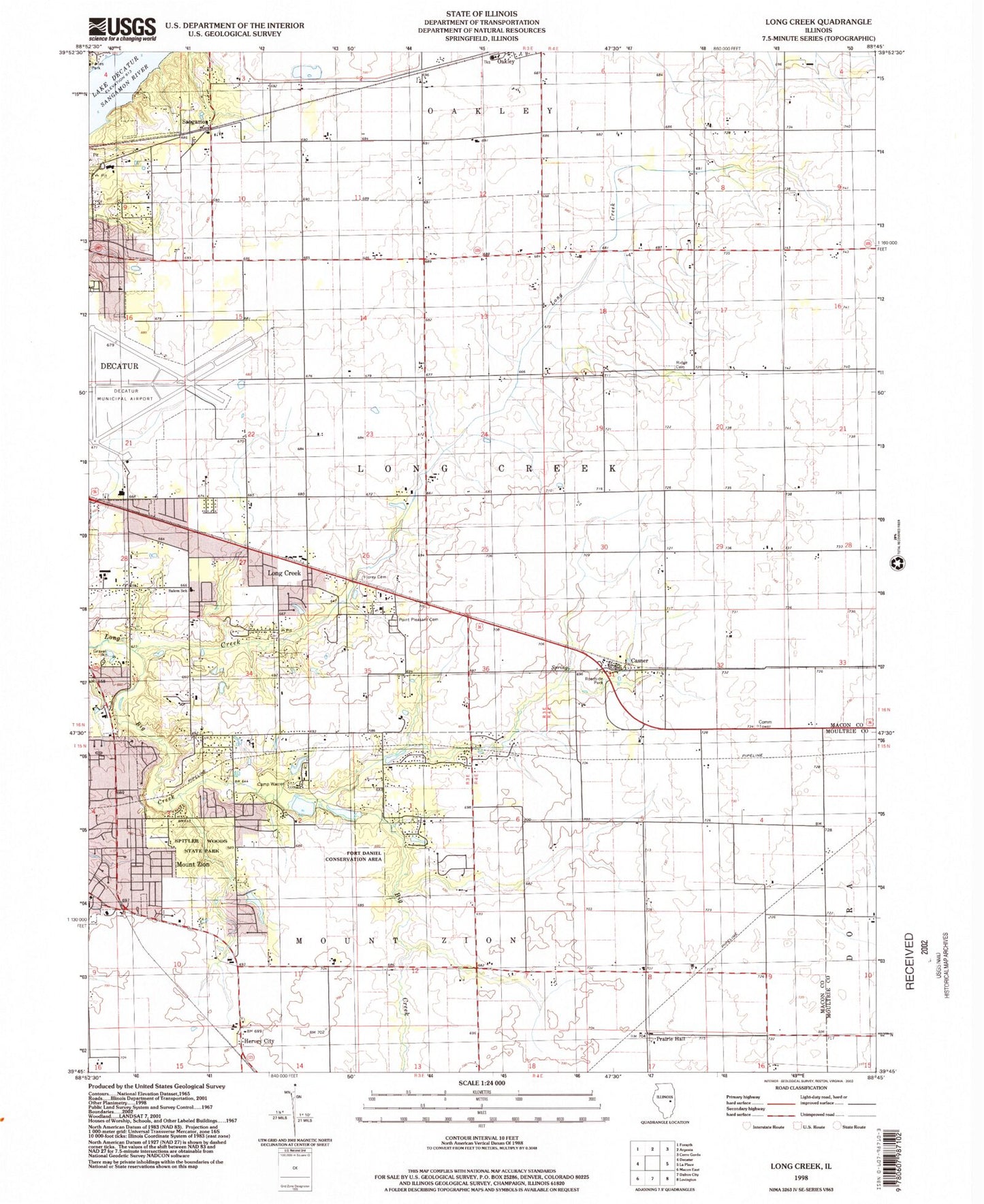
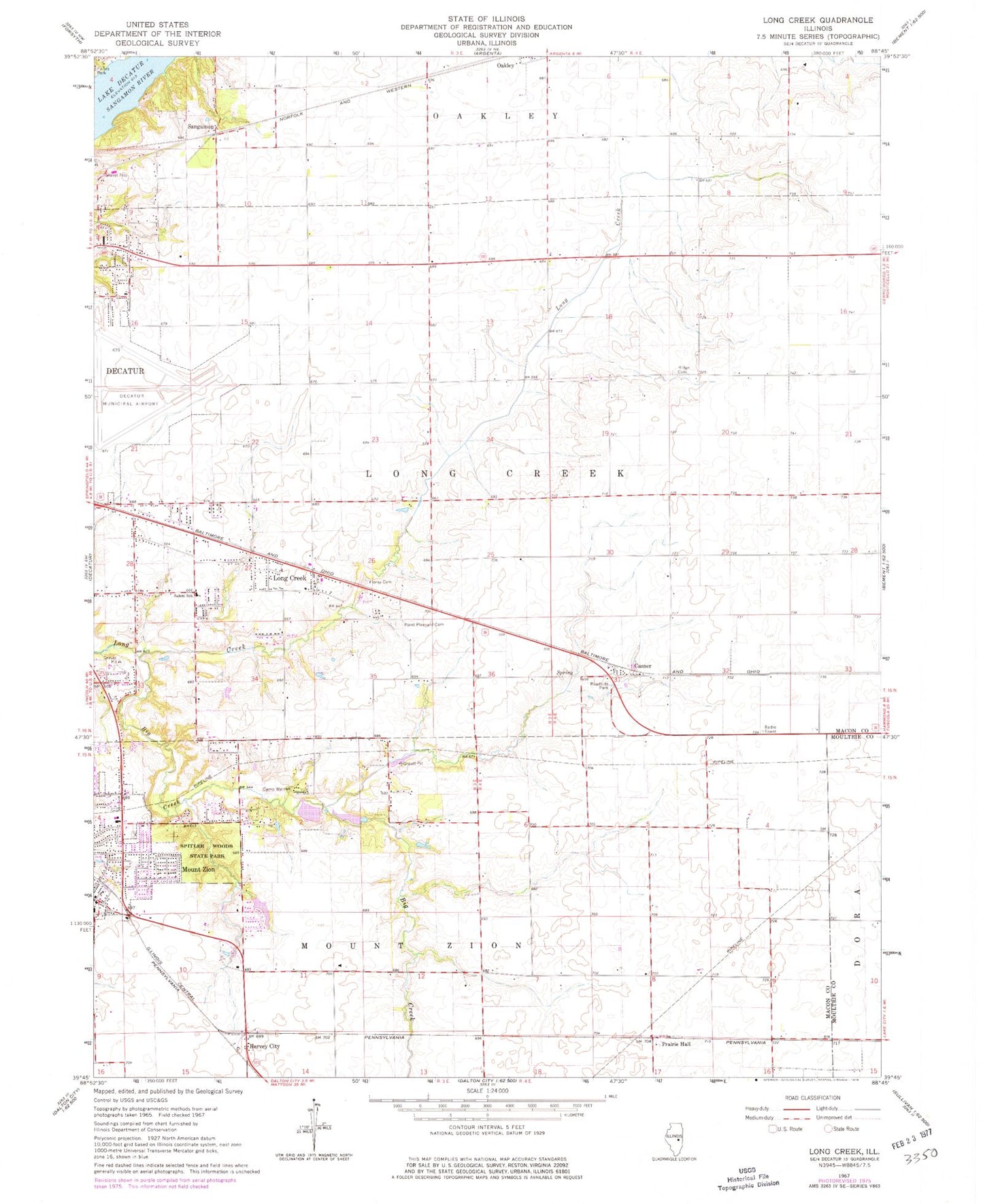
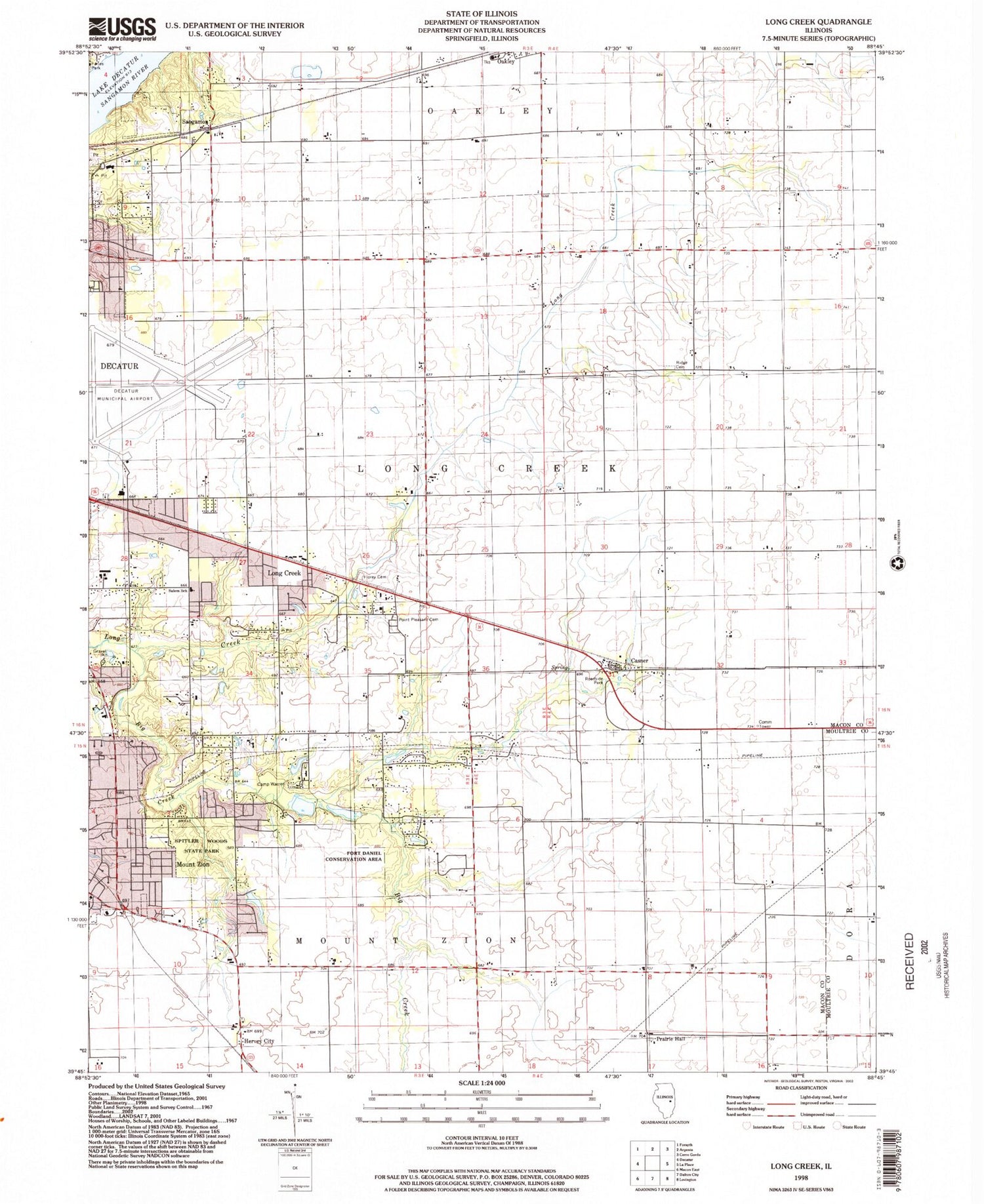
Classic USGS Long Creek Illinois 7.5'x7.5' Topo Map
Couldn't load pickup availability
Historical USGS topographic quad map of Long Creek in the state of Illinois. Map scale may vary for some years, but is generally around 1:24,000. Print size is approximately 24" x 27"
This quadrangle is in the following counties: Macon, Moultrie.
The map contains contour lines, roads, rivers, towns, and lakes. Printed on high-quality waterproof paper with UV fade-resistant inks, and shipped rolled.
Contains the following named places: Airport Industrial Park, Antioch Church, Big Creek, Blue Door School, Bois d'Arc School, Bois Du Sangamon Nature Preserve, Camp Warren, Casner, Corman Acres Airport, Ehrhart School, Excelsior School, Florey Cemetery, Fort Daniel Conservation Area, Fort Daniel School, Hervey City, Long Creek, Mount Zion, Mount Zion Elementary School, Mount Zion Fire Protection District, Mount Zion Police Department, North Fork Cemetery, Point Pleasant Cemetery, Prairie Hall, Prairie Hall School, Ridge Cemetery, Ridge School, Salem Elementary School, Sangamon, Spitler Woods Nature Preserve, Spitler Woods State Park, Township of Long Creek, Village of Long Creek, ZIP Code: 62549