MyTopo
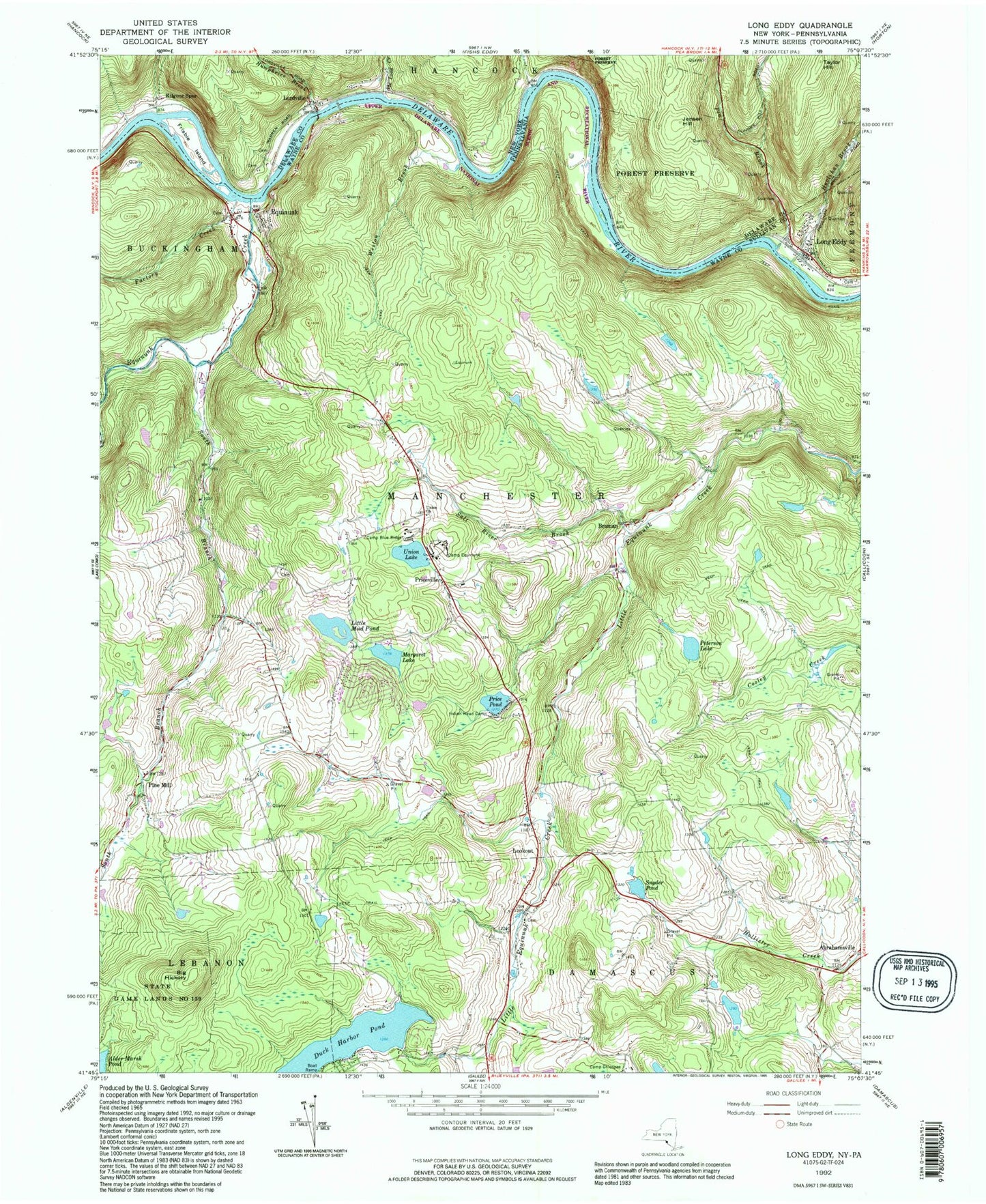
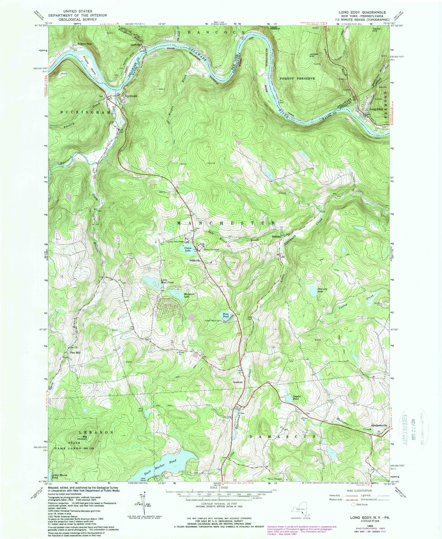
Classic USGS Long Eddy New York 7.5'x7.5' Topo Map
Couldn't load pickup availability
Historical USGS topographic quad map of Long Eddy in the states of New York, Pennsylvania. Typical map scale is 1:24,000, but may vary for certain years, if available. Print size: 24" x 27"
This quadrangle is in the following counties: Delaware, Sullivan, Wayne.
The map contains contour lines, roads, rivers, towns, and lakes. Printed on high-quality waterproof paper with UV fade-resistant inks, and shipped rolled.
Contains the following named places: Abe Lord Creek, Bouchoux Brook, Frisbie Island, Hoolihan Brook, Humphries Brook, Jensen Hill, Kilgour Spur, Long Eddy, Lordville, Pea Brook, Long Eddy Hose Company, Long Eddy Post Office, Big Hickory, Camp Blue Ridge, Camp Equinunk, Duck Harbor Pond, Equinunk, Equinunk Creek, Factory Creek, Indian Head Camp, Little Mud Pond, Braman, Lookout, Margaret Lake, Peterson Lake, Lenape Lake, Salt River Brook, Snyder Pond, South Branch Equinunk Creek, Union Church, Union Lake, Weston Brook, Duck Harbor Pond Dam, Little Mud Pond Dam, Pine Mill School, Lester School, Youngsville School (historical), Hilltown, Kellams School, Tyler Wood School (historical), Priceville School, South Branch School, Hankins School (historical), Pine Mill, Priceville, Saw Mill Dam, Township of Manchester, Equinunk Volunteer Fire Company Station 65, Equinunk Post Office