MyTopo
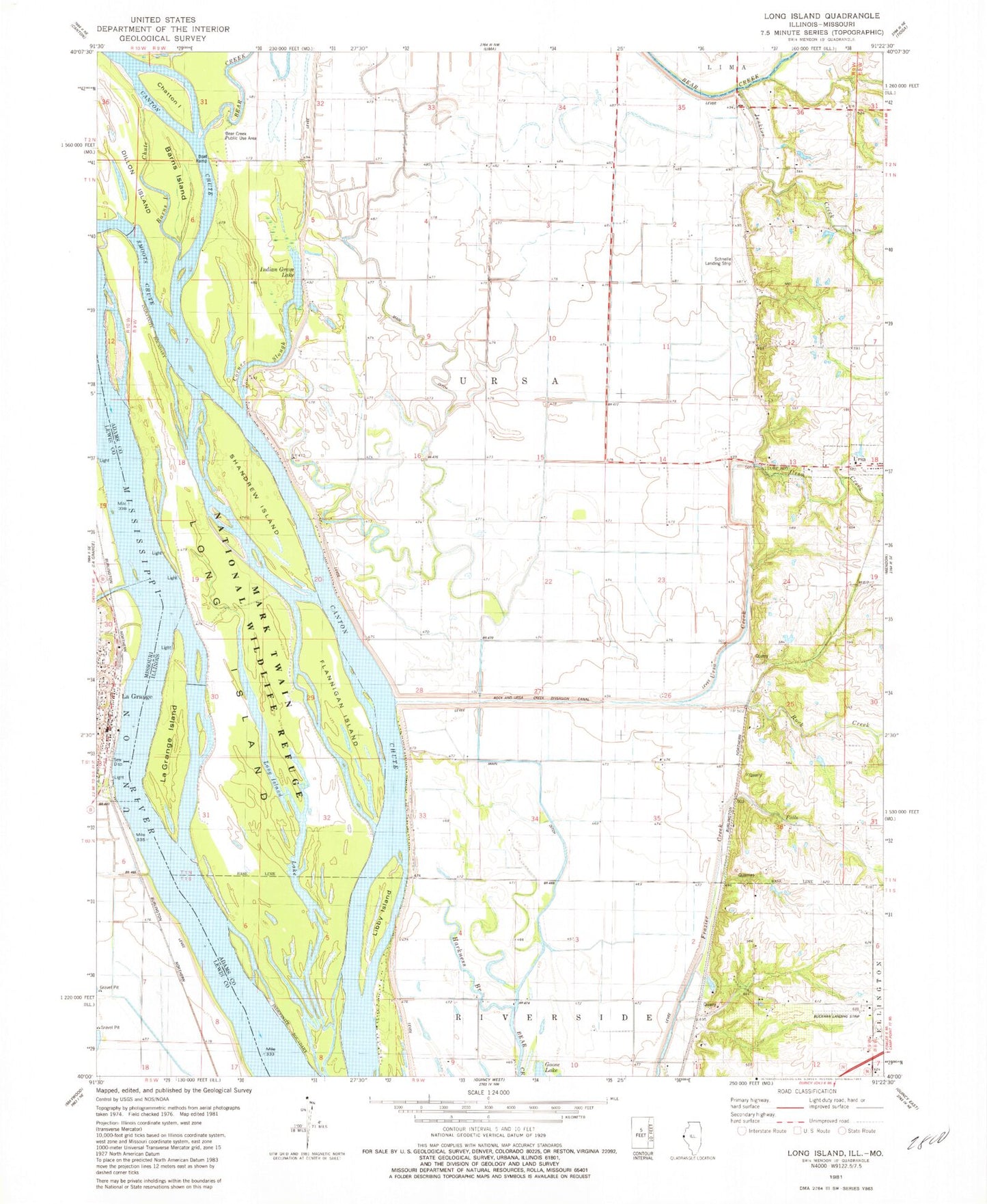
Classic USGS Long Island Illinois 7.5'x7.5' Topo Map
Couldn't load pickup availability
Historical USGS topographic quad map of Long Island in the states of Illinois, Missouri. Map scale may vary for some years, but is generally around 1:24,000. Print size is approximately 24" x 27"
This quadrangle is in the following counties: Adams, Lewis.
The map contains contour lines, roads, rivers, towns, and lakes. Printed on high-quality waterproof paper with UV fade-resistant inks, and shipped rolled.
Contains the following named places: Barns Island, Bear Creek Public Use Area, Blickhan Landing Area, Bowles School, Campbell Farms, Campbell Quarry, Canton Chute, Chatton Island, Corner Slough, Dillon Island, Fairview School, Flannigan Island, Gentry School, Great River National Wildlife Refuge, Harkness Branch, Hughes School, Indian Grave Lake, Indian Grave School, Island Number 419, Jenkins Creek, La Grange, La Grange Island, La Grange Police Department, La Grange Post Office, LeSueur's Port, Libby Island, Long Island, Long Island Lake, Main Ditch, Oyster Branch, Rock and Ursa Creek Diversion Canal, Rock Creek, Rock Creek School, Ruddell School, Schnelle Airport, Shandrew Island, Smoots Chute, Township of Ursa, Ursa Creek, Wyaconda River, ZIP Code: 62376