MyTopo
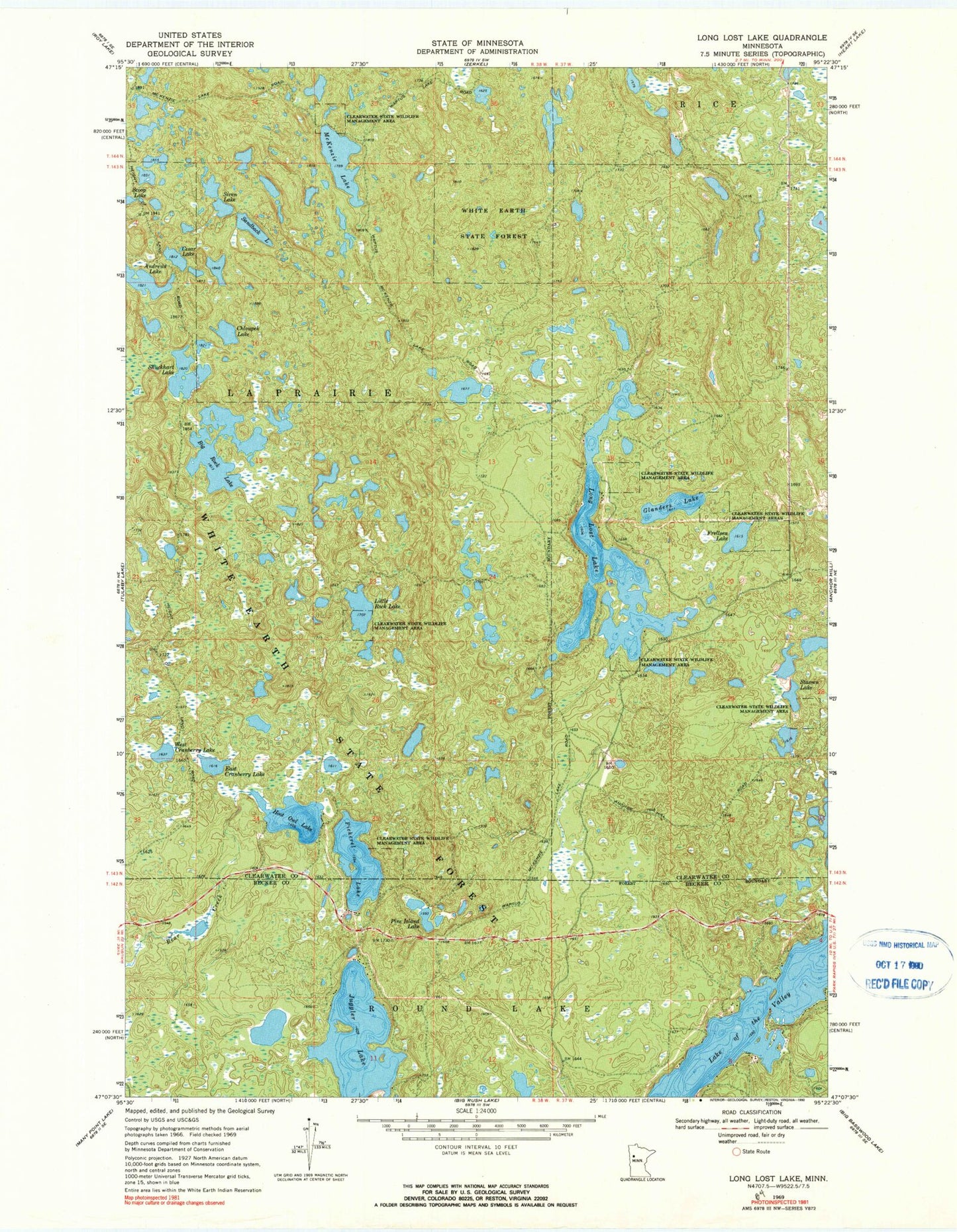
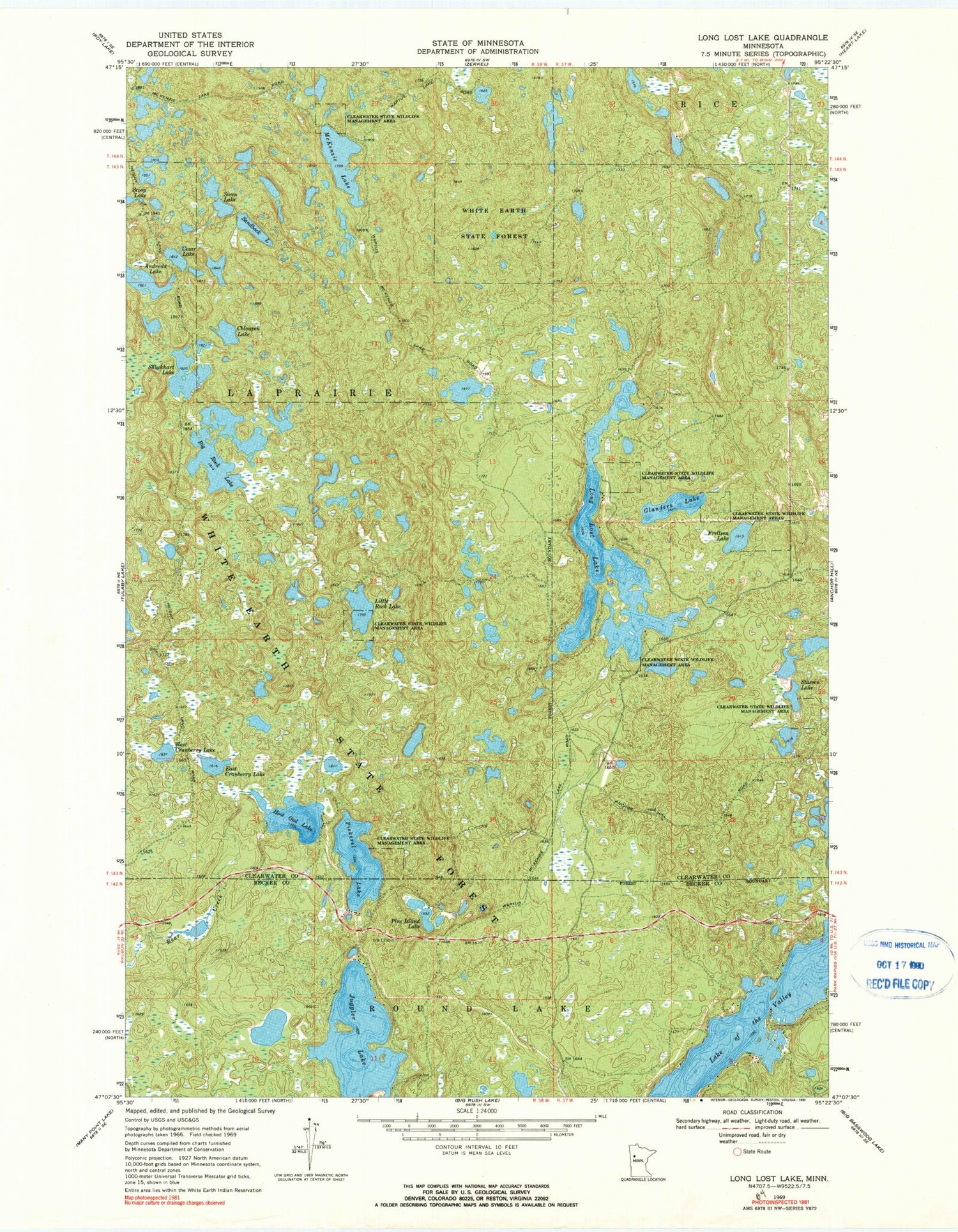
Classic USGS Long Lost Lake Minnesota 7.5'x7.5' Topo Map
Couldn't load pickup availability
Historical USGS topographic quad map of Long Lost Lake in the state of Minnesota. Map scale may vary for some years, but is generally around 1:24,000. Print size is approximately 24" x 27"
This quadrangle is in the following counties: Becker, Clearwater.
The map contains contour lines, roads, rivers, towns, and lakes. Printed on high-quality waterproof paper with UV fade-resistant inks, and shipped rolled.
Contains the following named places: Andrews Lake, Bad Medicine Lake, Big Rock Lake, Cesar Lake, Chloupek Lake, East Cranberry Lake, Frellsen Lake, Glanders Lake, Hoot Owl Lake, Juggler Lake, Little Rock Lake, Long Lost Lake, McKenzie Lake, Pickerel Lake, Pine Island Lake, Sandback Lake, Shuckhart Lake, Siren Lake, Stassen Lake, West Cranberry Lake