MyTopo
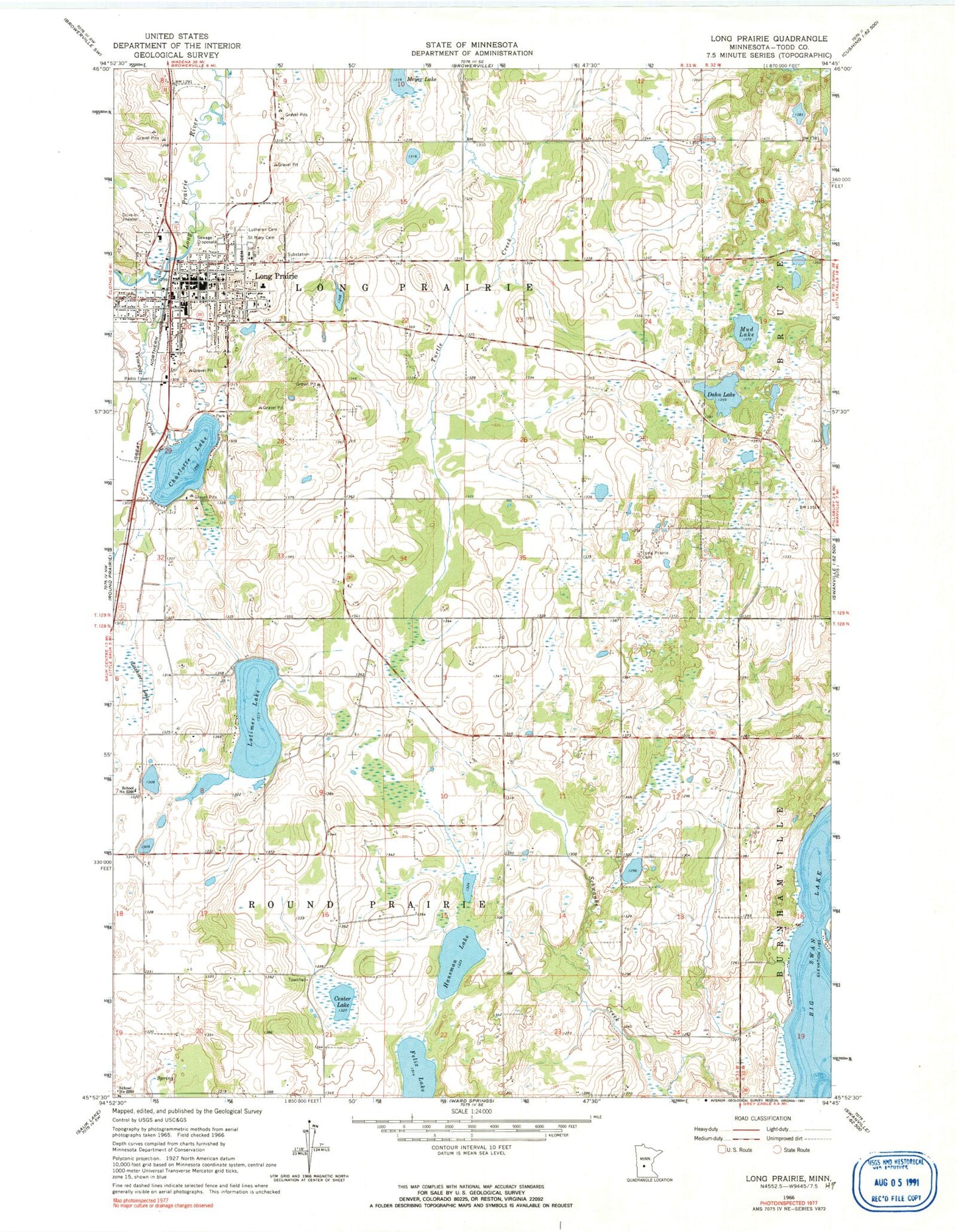
Classic USGS Long Prairie Minnesota 7.5'x7.5' Topo Map
Couldn't load pickup availability
Historical USGS topographic quad map of Long Prairie in the state of Minnesota. Map scale may vary for some years, but is generally around 1:24,000. Print size is approximately 24" x 27"
This quadrangle is in the following counties: Todd.
The map contains contour lines, roads, rivers, towns, and lakes. Printed on high-quality waterproof paper with UV fade-resistant inks, and shipped rolled.
Contains the following named places: American Lutheran Church, Assembly of God Church, Bernard Fry Structure Dam, Big Swan Lake, Camp RNL RV Park, Center Lake, Centracare Care Clinic, Charlotte Lake, City of Long Prairie, Dahn Lake, Emmanuel Lutheran Church, Evergreen Cemetery, Felix Lake, First Baptist Church, Hansman Lake, KEYL-AM (Long Prairie), Lake Charlotte Park, Lashier Lake, Latimer Lake, Long Drive-In, Long Prairie, Long Prairie Ambulance Service, Long Prairie Cemetery, Long Prairie City Hall, Long Prairie Country Club, Long Prairie Fire Department, Long Prairie High School, Long Prairie Library, Long Prairie Memorial Hospital and Home, Long Prairie Memorial Nursing Home, Long Prairie Middle School, Long Prairie Police Department, Long Prairie Post Office, Mud Lake, Saint Mary's Church, Saint Mary's School, School Number 2268, Todd County Courthouse, Todd County Fairgrounds, Todd County Jail, Todd County Museum, Todd County Sheriff's Office, Todd Field, Township of Long Prairie, Township of Round Prairie, Trinity Lutheran Church, United Methodist Church, Venewitz Creek, Zion United Church of Christ, ZIP Code: 56347