MyTopo
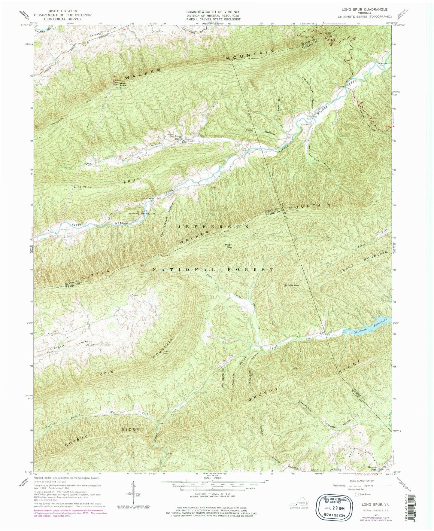
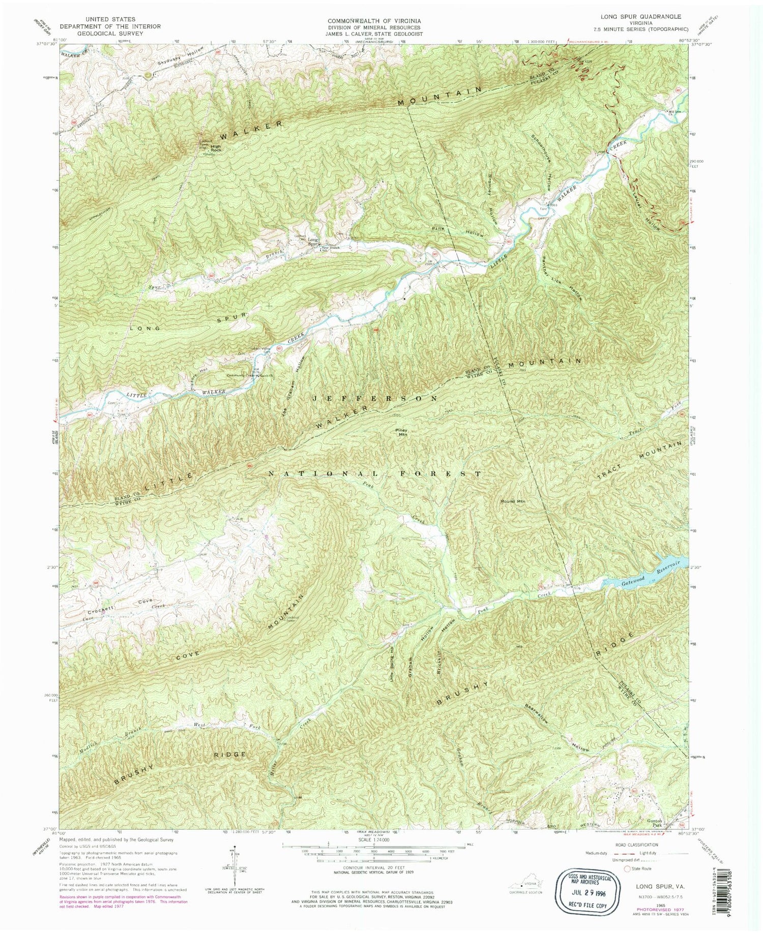
Classic USGS Long Spur Virginia 7.5'x7.5' Topo Map
Couldn't load pickup availability
Historical USGS topographic quad map of Long Spur in the state of Virginia. Typical map scale is 1:24,000, but may vary for certain years, if available. Print size: 24" x 27"
This quadrangle is in the following counties: Bland, Pulaski, Wythe.
The map contains contour lines, roads, rivers, towns, and lakes. Printed on high-quality waterproof paper with UV fade-resistant inks, and shipped rolled.
Contains the following named places: Bearwallow Hollow, Brickkiln Hollow, Bromley Hollow, Brushy Ridge, Cove Mountain, Davis Church, Goshen Cemetery, Graham Hollow, Gunton Park, Hickory Hollow, Hidden Valley Cemetery, High Rock, Little Spring Hollow, Joe Graham Hollow, Laurel Hollow, Long Spur, Mill Iron Church, Panther Lick Hollow, Pine Hollow, Piney Mountain, Schoolhouse Hollow, Spur Branch, Spur Branch School, West Fork Miller Creek, Big Hollow, Big Spring Branch, Bridge Hollow, Church Branch, Crow Hollow, Davis Gate Hollow, Davis School (historical), Hog Rock Hollow, Little Lot Hollow, Long Spur Post Office (historical), Raven Hollow, Sulphur Spring Hollow, Wash Place Hollow, Round Mountain, Forks of Road, Gunton Park Church of God of Prophecy, Holston School (historical), Mill Iron School (historical), Laurel Hollow Branch, Little Creek Volunteer Fire Department