MyTopo
Classic USGS Long Tom Reservoir Idaho 7.5'x7.5' Topo Map
Couldn't load pickup availability
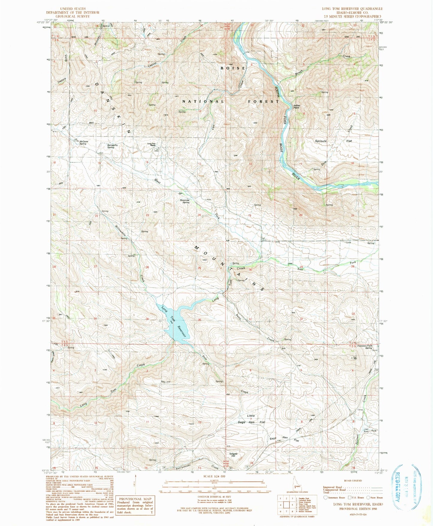
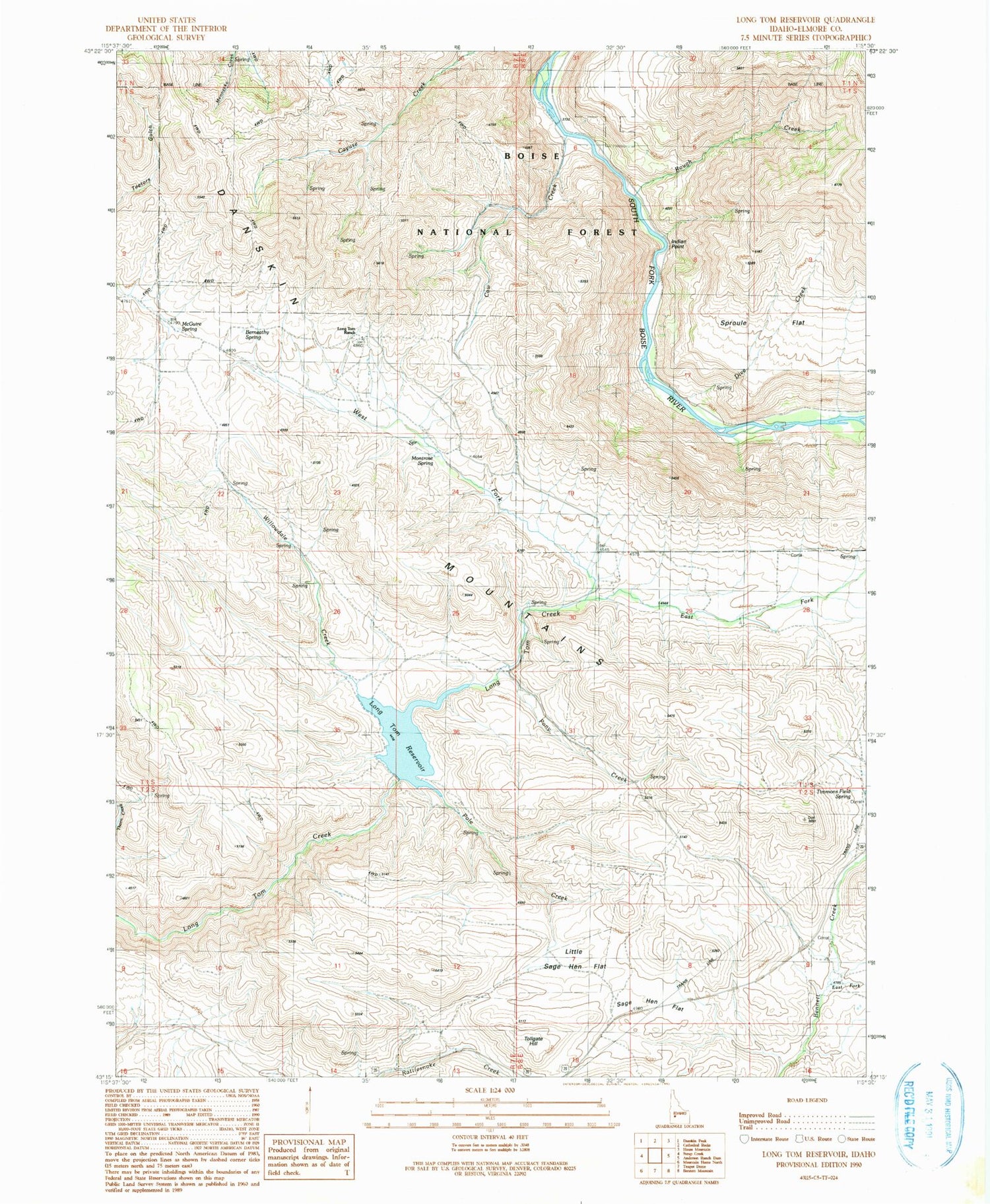
Historical USGS topographic quad map of Long Tom Reservoir in the state of Idaho. Map scale may vary for some years, but is generally around 1:24,000. Print size is approximately 24" x 27"
This quadrangle is in the following counties: Elmore.
The map contains contour lines, roads, rivers, towns, and lakes. Printed on high-quality waterproof paper with UV fade-resistant inks, and shipped rolled.
Contains the following named places: Berneathy Spring, Cow Creek, Cow Creek Forest Camp, Dive Creek, East Fork Bennett Creek, East Fork Long Tom Creek, Forest Camp, Indian Point, Little Sage Hen Flat, Long Tom Dam, Long Tom Ranch, Long Tom Reservoir, McGuire Spring, Montrose Spring, Pole Creek, Pony Creek, Rough Creek, Sage Hen Flat, Sproule Flat, Timmons Field Spring, Tollgate Hill, West Fork Long Tom Creek, Willowdale Creek