MyTopo
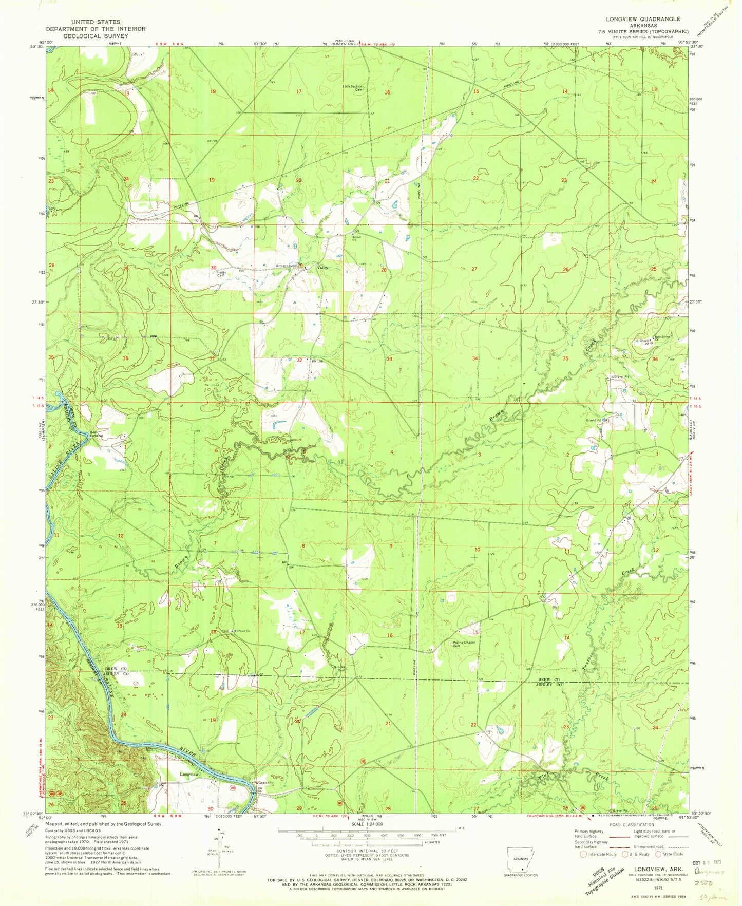
Classic USGS Longview Arkansas 7.5'x7.5' Topo Map
Couldn't load pickup availability
Historical USGS topographic quad map of Longview in the state of Arkansas. Map scale may vary for some years, but is generally around 1:24,000. Print size is approximately 24" x 27"
This quadrangle is in the following counties: Ashley, Bradley, Drew.
The map contains contour lines, roads, rivers, towns, and lakes. Printed on high-quality waterproof paper with UV fade-resistant inks, and shipped rolled.
Contains the following named places: Bear Creek, Bethel Missionary Baptist Church, Brooks Cemetery, Brown Creek, Hales Cemetery, Holy Divine Church, Long View Ferry, Longview, Moody, Mount Peter Cemetery, Mount Peter Church, Negro Bend, Ozment Cemetery, Panther Creek, Prairie Chapel Cemetery, Prairie Chapel Methodist Church, Sixteenth Section Cemetery, Township of Crook, Trouble Island, Valley, Valley Methodist Church, ZIP Code: 71642