MyTopo
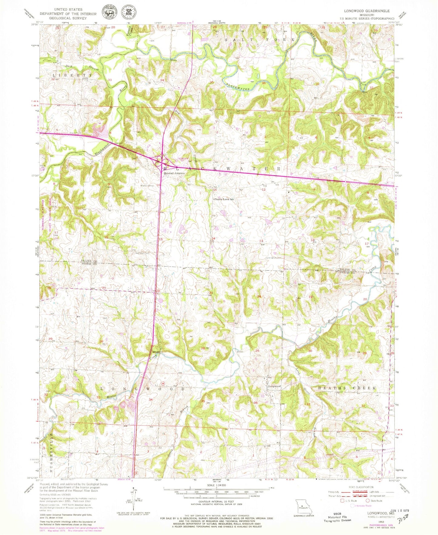
Classic USGS Longwood Missouri 7.5'x7.5' Topo Map
Couldn't load pickup availability
Historical USGS topographic quad map of Longwood in the state of Missouri. Map scale may vary for some years, but is generally around 1:24,000. Print size is approximately 24" x 27"
This quadrangle is in the following counties: Pettis, Saline.
The map contains contour lines, roads, rivers, towns, and lakes. Printed on high-quality waterproof paper with UV fade-resistant inks, and shipped rolled.
Contains the following named places: Anderson School, Bethlehem Cemetery, Buck Branch, Cunningham Cemetery, Dry Creek, Elk Hill School, Finney Creek, Forest Grove School, Greer Branch, Long Grove Branch, Longwood, Longwood Cemetery, Marshall Junction, Oak Grove School, Pettis County Fire Protection District Station 3, Pipertown, Pleasant Valley School, Prairie Lawn School, Prairie Ridge School, Township of Blackwater, Township of Longwood, Wanamaker, Witcher Family Cemetery, Woodson, Woodson School