MyTopo
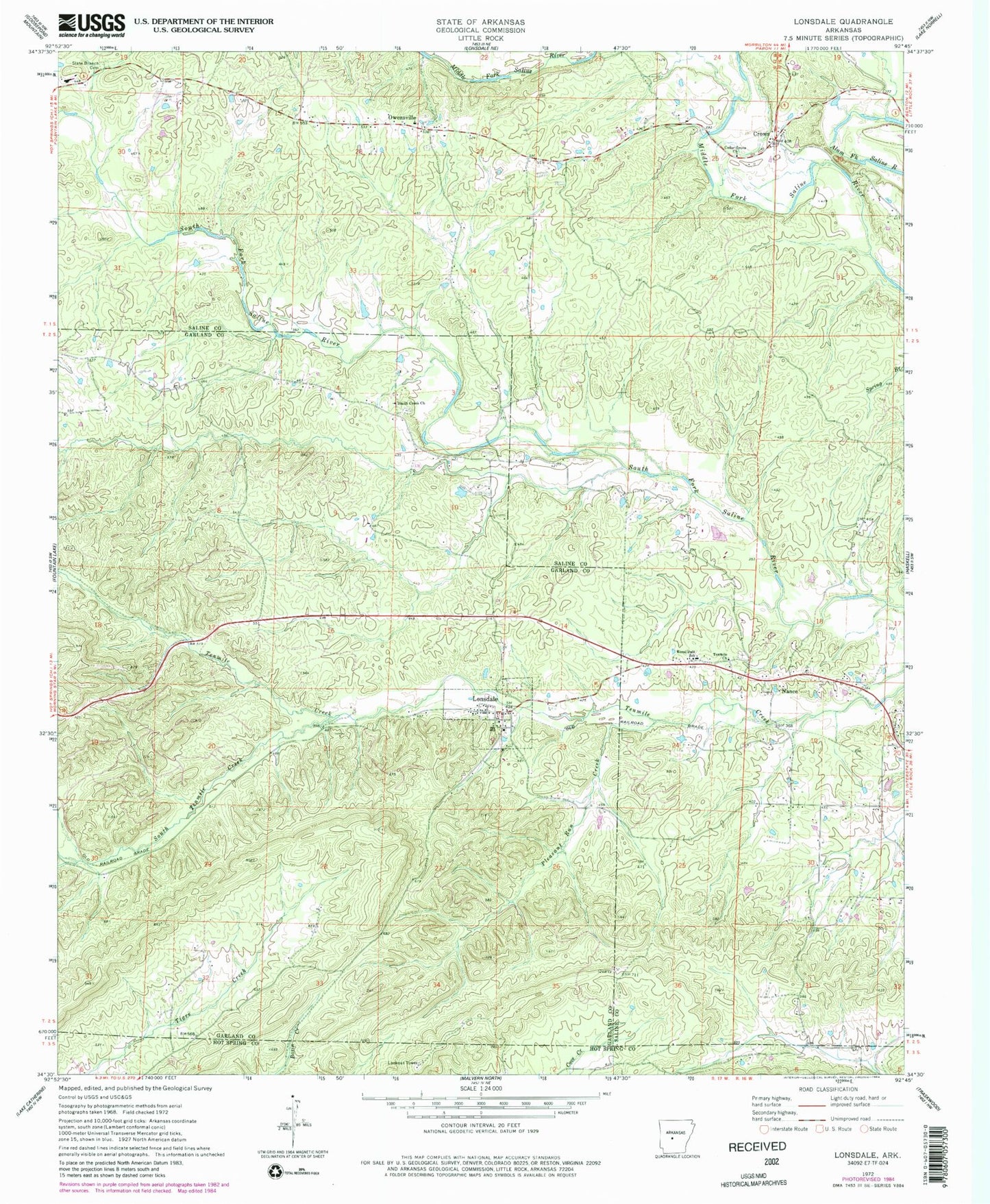
Classic USGS Lonsdale Arkansas 7.5'x7.5' Topo Map
Couldn't load pickup availability
Historical USGS topographic quad map of Lonsdale in the state of Arkansas. Map scale may vary for some years, but is generally around 1:24,000. Print size is approximately 24" x 27"
This quadrangle is in the following counties: Garland, Hot Spring, Saline.
The map contains contour lines, roads, rivers, towns, and lakes. Printed on high-quality waterproof paper with UV fade-resistant inks, and shipped rolled.
Contains the following named places: Cedar Grove Church, Crows, Crows Volunteer Fire Department, Lake Isabella, Lonsdale, Lonsdale Fire Department Station 1, Lonsdale Fire Department Station 2, Lonsdale Post Office, Meaford, Nance, Owensville, Pleasant Run Creek, Rural Dale School, Slate Branch Cemetery, Smith Creek Church, South Tenmile Creek, Spring Lake, Spring Lake Dam, Ten Mile Missionary Baptist Church, Town of Lonsdale, Township of Liberty, Township of Phillips, ZIP Code: 72087