MyTopo
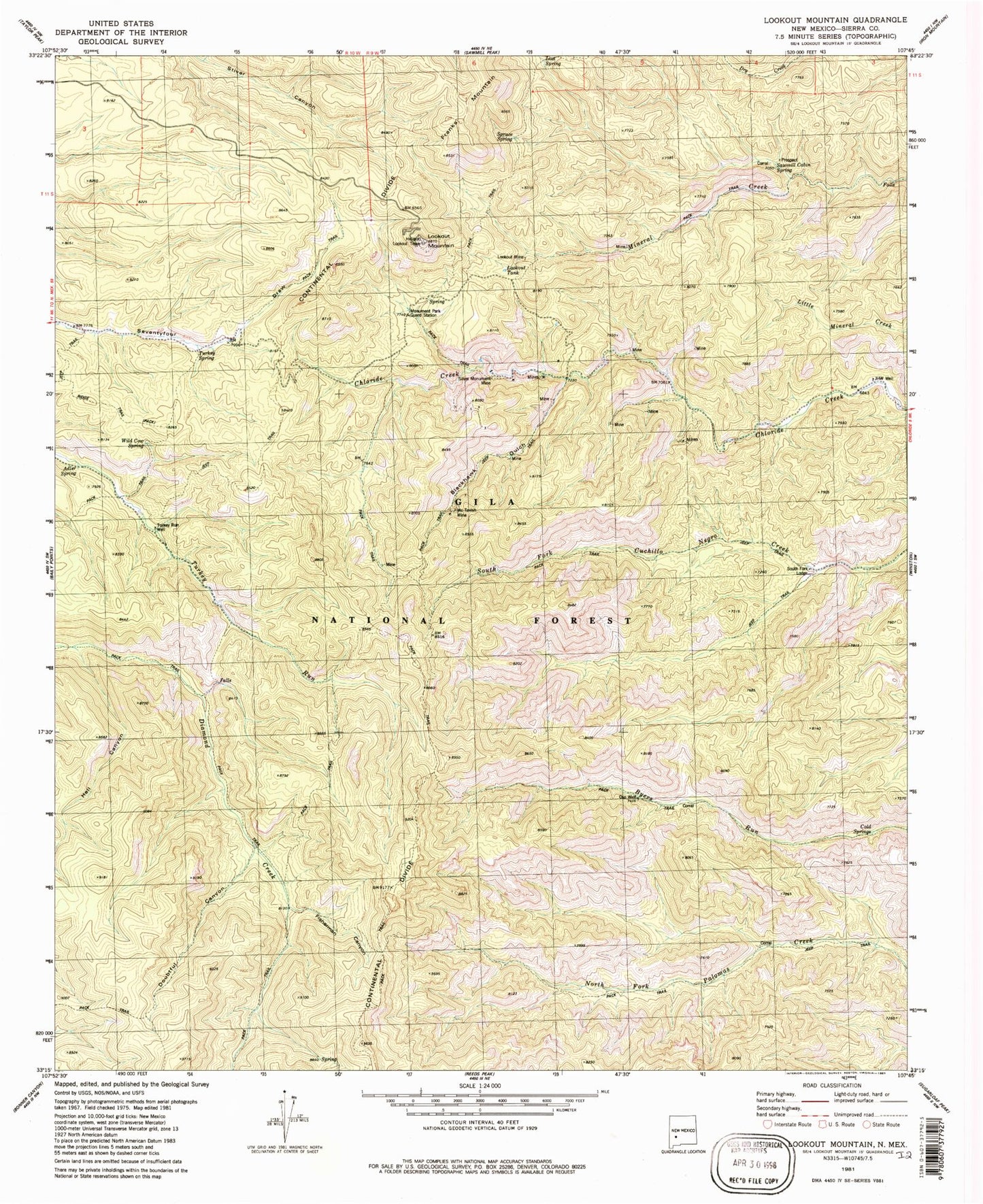
Classic USGS Lookout Mountain New Mexico 7.5'x7.5' Topo Map
Couldn't load pickup availability
Historical USGS topographic quad map of Lookout Mountain in the state of New Mexico. Typical map scale is 1:24,000, but may vary for certain years, if available. Print size: 24" x 27"
This quadrangle is in the following counties: Sierra.
The map contains contour lines, roads, rivers, towns, and lakes. Printed on high-quality waterproof paper with UV fade-resistant inks, and shipped rolled.
Contains the following named places: Adler Spring, Lookout Mountain Lookout, Blackhawk Gulch, Doubtful Canyon, Franks Mountain, Hell Canyon, James Cabin, Lookout Mountain, Monument Park Guard Station, Silver Monument Mine, South Fork Lodge, New Era, James Brothers Spring, Beu Spring, Silver Glance Mine, Silver Monument Mine, Tomahawk Mine, Silver Bar Mine, Cold Springs, JHW Well, Lookout Mine, Lookout Tank, Lost Spring, McTavish Mine, Oso Well, Sawmill Cabin Spring, Spruce Spring, Turkey Run Well, Turkey Spring, Wild Cow Spring, Fisherman Canyon