MyTopo
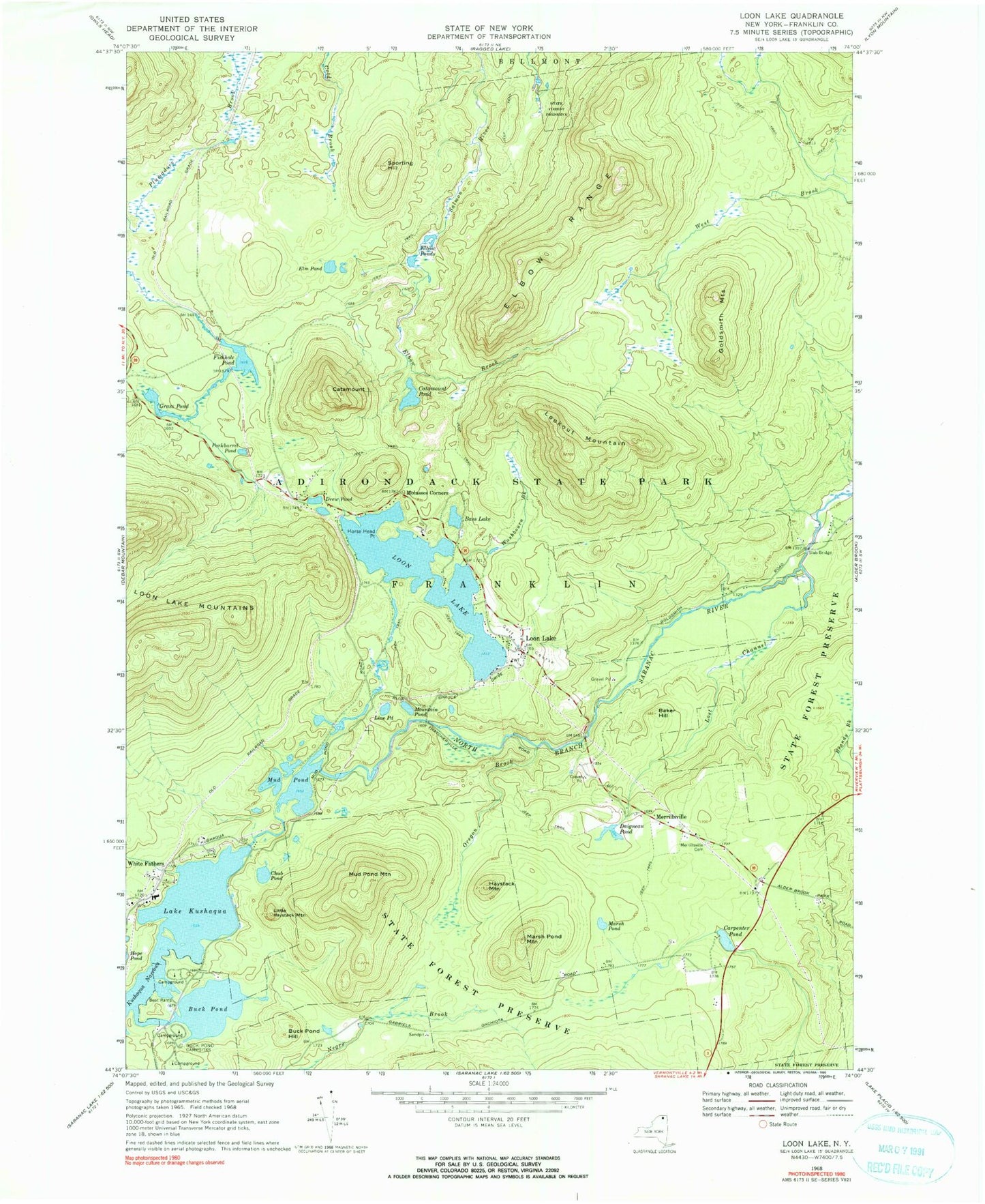
Classic USGS Loon Lake New York 7.5'x7.5' Topo Map
Couldn't load pickup availability
Historical USGS topographic quad map of Loon Lake in the state of New York. Typical map scale is 1:24,000, but may vary for certain years, if available. Print size: 24" x 27"
This quadrangle is in the following counties: Franklin.
The map contains contour lines, roads, rivers, towns, and lakes. Printed on high-quality waterproof paper with UV fade-resistant inks, and shipped rolled.
Contains the following named places: Baker Hill, Bass Lake, Buck Pond, Buck Pond Campsites, Buck Pond Hill, Carpenter Pond, Catamount, Catamount Pond, Club Pond, Daigneau Pond, Drew Pond, Elbow Brook, Elbow Ponds, Elbow Range, Elm Pond, Fishhole Pond, Goldsmith Mountains, Grass Pond, Haystack Mountain, Horse Head Point, Lake Kushaqua, Line Pond, Little Haystack Mountain, Lookout Mountain, Loon Lake, Loon Lake, Lost Channel, Marsh Pond, Marsh Pond Mountain, Merrillsville Cemetery, Molasses Corners, Mountain Pond, Mud Pond, Mud Pond Mountain, Oregon Brook, Porkbarrel Pond, Slab Bridge, Sporting Hill, Washbourn Brook, Kushaqua Narrows, White Fathers, Merrillsville, Town of Franklin, Lake Kushaqua Bridge