MyTopo
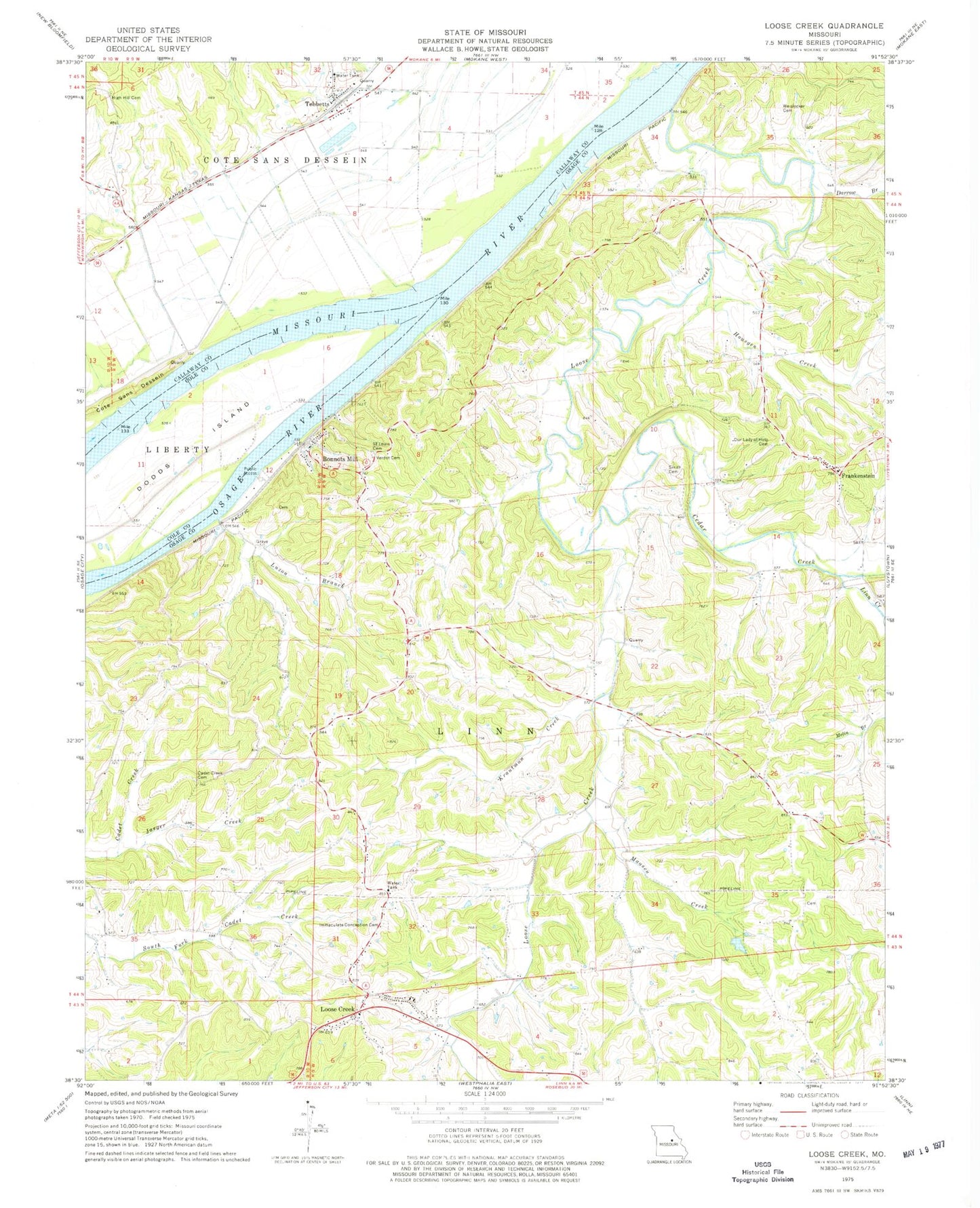
Classic USGS Loose Creek Missouri 7.5'x7.5' Topo Map
Couldn't load pickup availability
Historical USGS topographic quad map of Loose Creek in the state of Missouri. Map scale may vary for some years, but is generally around 1:24,000. Print size is approximately 24" x 27"
This quadrangle is in the following counties: Callaway, Osage.
The map contains contour lines, roads, rivers, towns, and lakes. Printed on high-quality waterproof paper with UV fade-resistant inks, and shipped rolled.
Contains the following named places: Boillot School, Bonnots Mill, Bonnots Mill Post Office, Cadet Creek Cemetery, Cadet Creek School, Camp Ground School, Cedar Creek, Cote Sans Dessein, Cote Sans Dessein Prairie, Darrow Branch, Dodds Island, Enterprise School, Frankenstein, French Village, Garden of Gethsemane Cemetery, High Hill Cemetery, High Point Church, Huesgen Creek, Immaculate Conception Cemetery, Isbell, Jaeger Creek, Krautman Creek, Kuper-Scott Ranch Dam, Kuper-Scott Ranch Lake, Linn Creek, Linn Fire Protection District Station 2, Loose Creek, Loose Creek Post Office, Luzon Branch, Maasen Creek, Muenks Dam, Oak Grove School, Osage River, Saint Louis Catholic Church, Saint Louis Cemetery, Smith Cemetery, South Callaway Fire Protection District Station 2, Tebbetts, Tebbetts Census Designated Place, Tebbetts Post Office, Tebbetts School, Township of Linn, Verdot Cemetery, Vosholl, Vosholl Church, Weislocker Cemetery, Zion Hope Church, ZIP Code: 65016