MyTopo
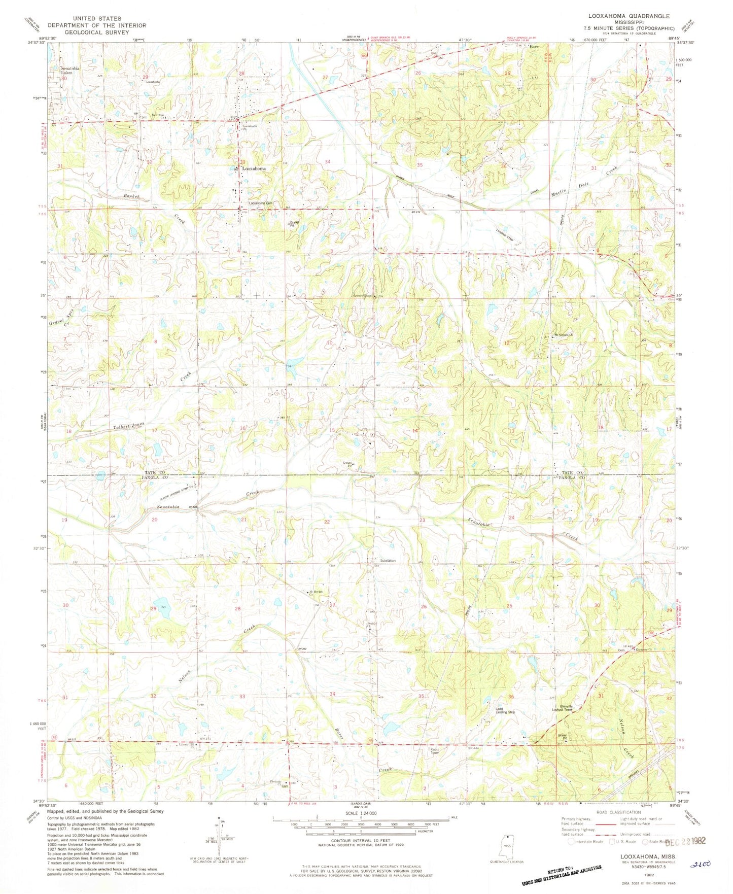
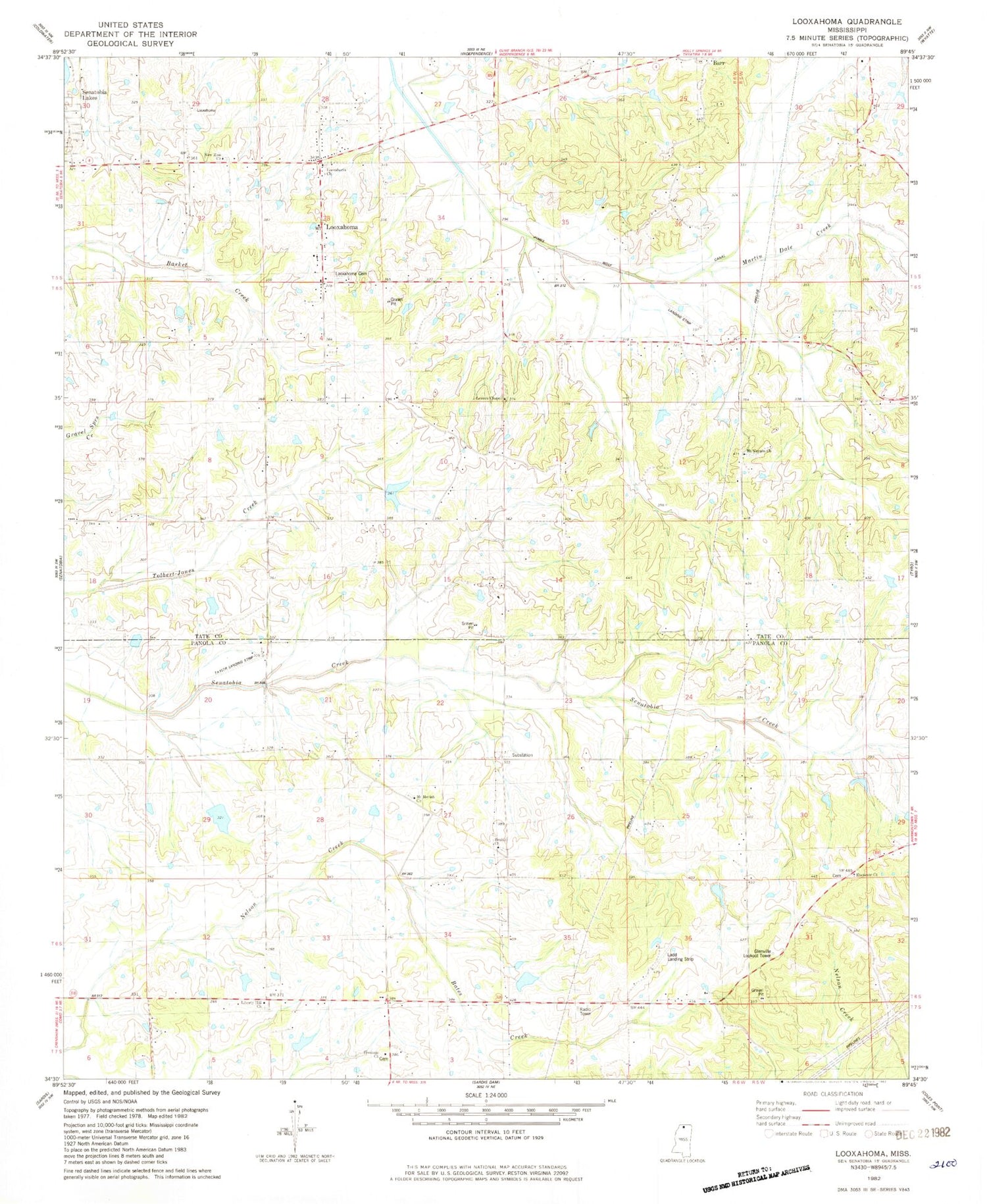
Classic USGS Looxahoma Mississippi 7.5'x7.5' Topo Map
Couldn't load pickup availability
Historical USGS topographic quad map of Looxahoma in the state of Mississippi. Map scale may vary for some years, but is generally around 1:24,000. Print size is approximately 24" x 27"
This quadrangle is in the following counties: Panola, Tate.
The map contains contour lines, roads, rivers, towns, and lakes. Printed on high-quality waterproof paper with UV fade-resistant inks, and shipped rolled.
Contains the following named places: A G Taylor Estate Pond Dam, Barr, Bates Creek, Beulah Cemetery, Beulah Church, Beulah School, Bobo School, Crossroad, Ebenezer Cemetery, Ebenezer Church, Ebenezer School, Fredonia Cemetery, Fredonia Church, Glenville Lookout Tower, Hickahala Creek Watershed C-34-9 Dam, Johnsons Chapel School, Lewers Chapel Cemetery, Lewers Chapel Church, Lewers Chapel School, Liberty Hill Cemetery, Liberty Hill Church, Liberty Hill School, Looxahoma, Looxahoma Cemetery, Looxahoma Church, Looxahoma Church of Christ, M P Moore Pond Dam, Martin Dale Creek, Mount Moriah Church, Mount Vernon Cemetery, Mount Vernon Church, Mrs Pauline Taylor Pond Dam, New Zion Church, Pilgrim Rest School, Pleasant Mount, Saint Maria Cemetery, Senatobia Creek Watershed Y-7-1 Dam, Senatobia Creek Watershed Y-7-7 Dam, Senatobia Creek Watershed Y-7-8 Dam, Supervisor District 4, W S Taylor Junior Pond Dam, ZIP Code: 38619