MyTopo
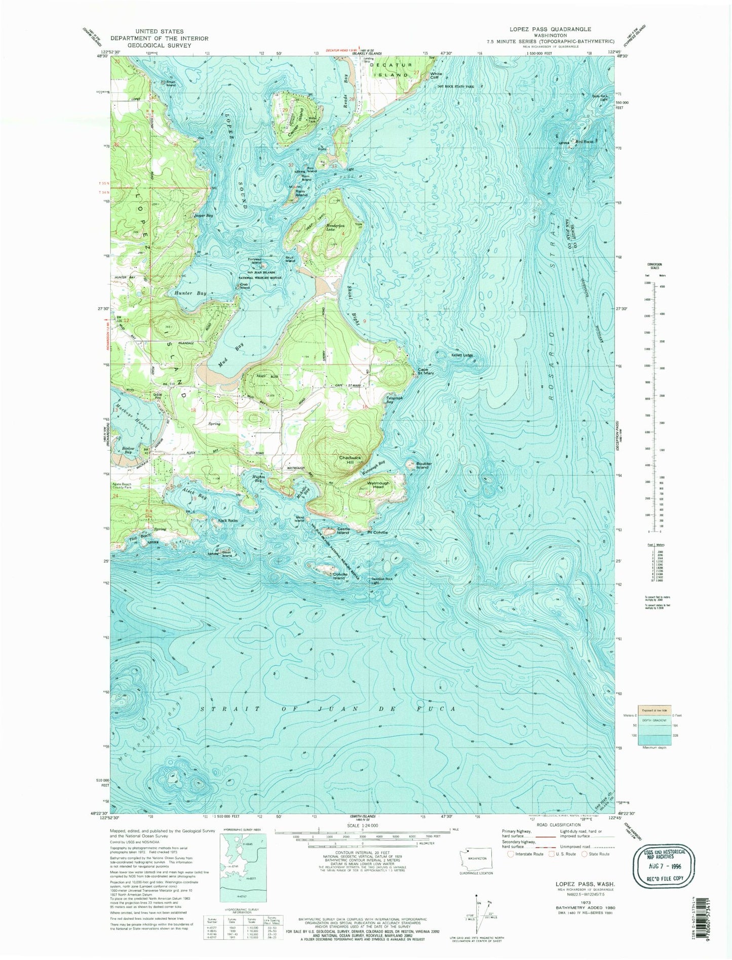
Classic USGS Lopez Pass Washington 7.5'x7.5' Topo Map
Couldn't load pickup availability
Historical USGS topographic quad map of Lopez Pass in the state of Washington. Map scale may vary for some years, but is generally around 1:24,000. Print size is approximately 24" x 27"
This quadrangle is in the following counties: Island, San Juan, Skagit.
The map contains contour lines, roads, rivers, towns, and lakes. Printed on high-quality waterproof paper with UV fade-resistant inks, and shipped rolled.
Contains the following named places: Aleck Bay, Aleck Rocks, Barlow Bay, Barnacle Rock, Belle Rock, Belle Rock Light, Bird Rocks, Blind Island, Boulder Island, Cape Saint Mary, Castle Island, Cayou Island, Center Island, Center Island Airport, Chadwick Hill, Colville Island, Crab Island, Cranberry Marsh, Davidson Rock, Davidson Rock Light, Decatur Island Schools, Decatur Shores Airport, Dot Rock, Dot Rock State Park, Flint Beach, Fortress Island, Henderson Lake, Hughes Bay, Hunter Bay, Islandale, Jasper Bay, Kellett Ledge, Lopez Division, Lopez Pass, Mackaye Harbor Public Dock, McArdle Bay, Mud Bay, Point Colville, Ram Island, Reads Bay, Rim Island, San Juan County Fire District 4 Station 42, San Juan Islands National Monument, Shoal Bight, Skull Island, Small Island, Sperry Point, Swirl Island, Telegraph Bay, Watmough Bay, Watmough Head, White Cliff