MyTopo
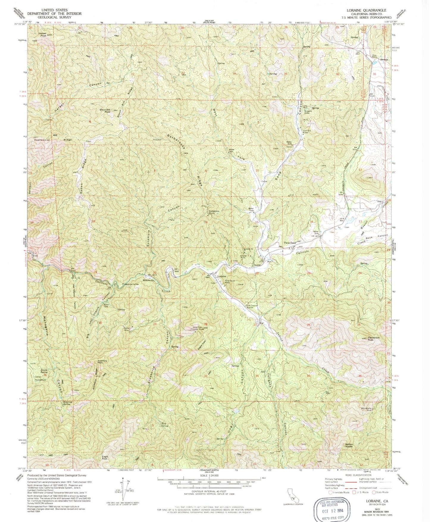
Classic USGS Loraine California 7.5'x7.5' Topo Map
Couldn't load pickup availability
Historical USGS topographic quad map of Loraine in the state of California. Map scale may vary for some years, but is generally around 1:24,000. Print size is approximately 24" x 27"
This quadrangle is in the following counties: Kern.
The map contains contour lines, roads, rivers, towns, and lakes. Printed on high-quality waterproof paper with UV fade-resistant inks, and shipped rolled.
Contains the following named places: Amalie Mine, Antimony Peak, Antimony Ridge, Arrastre, Back Canyon, Barbarossa Mines, Barbarossa Ridge, Beartrap Spring, Benner Ranch, Big Last Chance Canyon, Black Bill Peak, Black Bill Ridge, Casa de los Cerritos, Centennial Ridge, Eagle Peak, Eagles Nest, Gold Peak Cowboy Mines, Harper Peak, Hog Canyon, Hog Creek, Indian Creek, Juan Dos Mines, Kern County Sheriff's Office - Walker Basin Substation, King David Mine, Little Last Chance Canyon, Loraine, Menagerie Canyon, Millersville, Minnehaha Mine, Nellies Nipple, Piute Ranch, Rock Spring, Rodeo Ridge, Sand Canyon, Seneca Spring, Stevenson Creek, Stevenson Peak, Studhorse Canyon, Studhorse Creek, Suburu Ranch, Sycamore Canyon, Sycamore Creek, Tollgate Canyon, Twin Oaks, Twin Oaks School, Weaver Creek, West Fork Sand Canyon, Zenda Mine