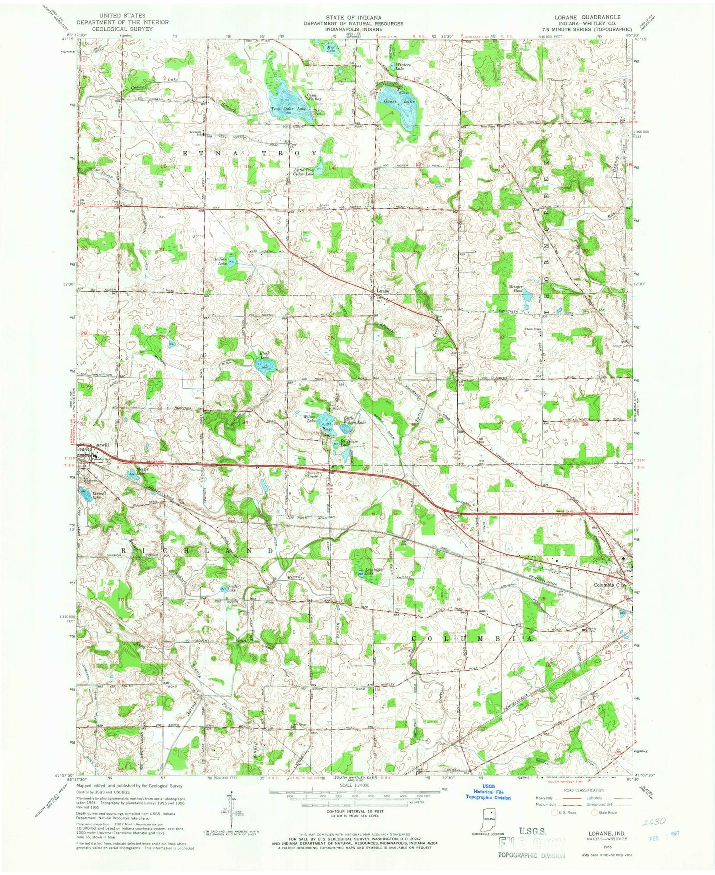
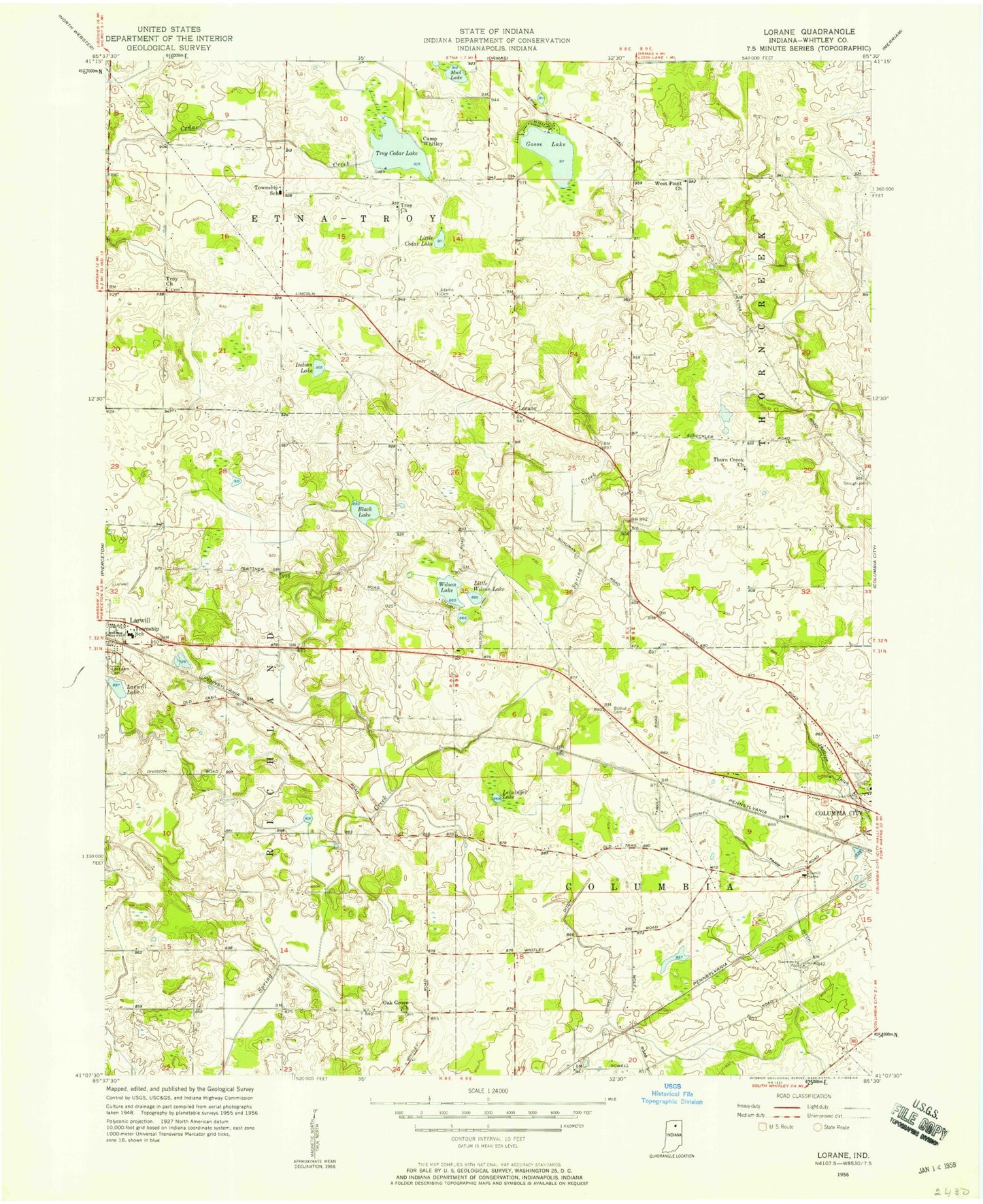
MyTopo
Classic USGS Lorane Indiana 7.5'x7.5' Topo Map
Couldn't load pickup availability
Historical USGS topographic quad map of Lorane in the state of Indiana. Map scale may vary for some years, but is generally around 1:24,000. Print size is approximately 24" x 27"
This quadrangle is in the following counties: Whitley.
The map contains contour lines, roads, rivers, towns, and lakes. Printed on high-quality waterproof paper with UV fade-resistant inks, and shipped rolled.
Contains the following named places: Adams Cemetery, Bethel Cemetery, Betzner Branch, Black Lake, Brown Ditch, Camp Whitley, Compton Ditch, County Farm Ditch, Dowell Ditch, Elon Maynard Ditch, Etna-Troy School, Ford Branch, Goose Lake, Ice House Lake, Indian Lake, Jones Branch, Kaler Branch, King Branch, Knisely Ditch, Lakeview Cemetery, Larwill Lake, Leininger Lake, Linvill Ditch, Little Troy Cedar Lake, Little Wilson Lake, Lorane, Maynard Ditch, McDonald Cunningham Ditch, Menzie Lake, Metzger Pond, Mud Lake, Oak Grove Church, Phillips Ditch, Plew Airport, Richland Township Fire and Rescue, Sattison Ditch, Schuman Ditch, Souder Lake, Stough Cemetery, Thorn Creek Church, Town of Larwill, Township of Columbia, Township of Richland, Troy Cedar Lake, Troy Church, West Point Church, Whitley County, Wilson Lake, Winters Lake, ZIP Code: 46764