MyTopo
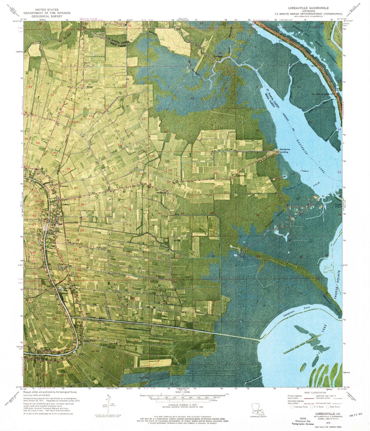
Classic USGS Loreauville Louisiana 7.5'x7.5' Topo Map
Couldn't load pickup availability
Historical USGS topographic quad map of Loreauville in the state of Louisiana. Map scale may vary for some years, but is generally around 1:24,000. Print size is approximately 24" x 27"
This quadrangle is in the following counties: Iberia, St. Martin.
The map contains contour lines, roads, rivers, towns, and lakes. Printed on high-quality waterproof paper with UV fade-resistant inks, and shipped rolled.
Contains the following named places: Bayou Alexandre, Bayou Benoit, Bayou Colin, Bayou Coline, Bayou Fredrick, Bayou Grand Gueule, Bayou Portage, Belle Church, Belle Place, Bronson, Broussard Switch, Caroline, Coteau Holmes Volunteer Fire Department, Coulee Coteau Holmes, Coulee du Portage, Dauterive Lake, Dauterive Landing, Eagle Point, Gondron, Gonsoulin, Gonsoulin Canal, Gonsoulins Cattle Ferry, John, Loreauville, Loreauville Canal, Loreauville Elementary School, Loreauville High School, Loreauville Police Department, Loreauville Volunteer Fire Department, Loreauville Wastewater Treatment Facility, Marshfield Canal, Mestayer, Mestayer Point, Mount Zion Baptist Church Number 1, Mount Zion Baptist Church Number 2, Mount Zion Number 1 Baptist Cemetery, Oubre, Our Lady of Salette Church, Our Lady of Victory Catholic Church, Parish Governing Authority District 1, Parish Governing Authority District 9, Portage, Saint John Baptist Church, Saint Joseph Catholic Church, Sampsons Cove, Shaw, Tony, Vida, Village of Loreauville, Walet, Ward Four, Ward One, ZIP Codes: 70552, 70563