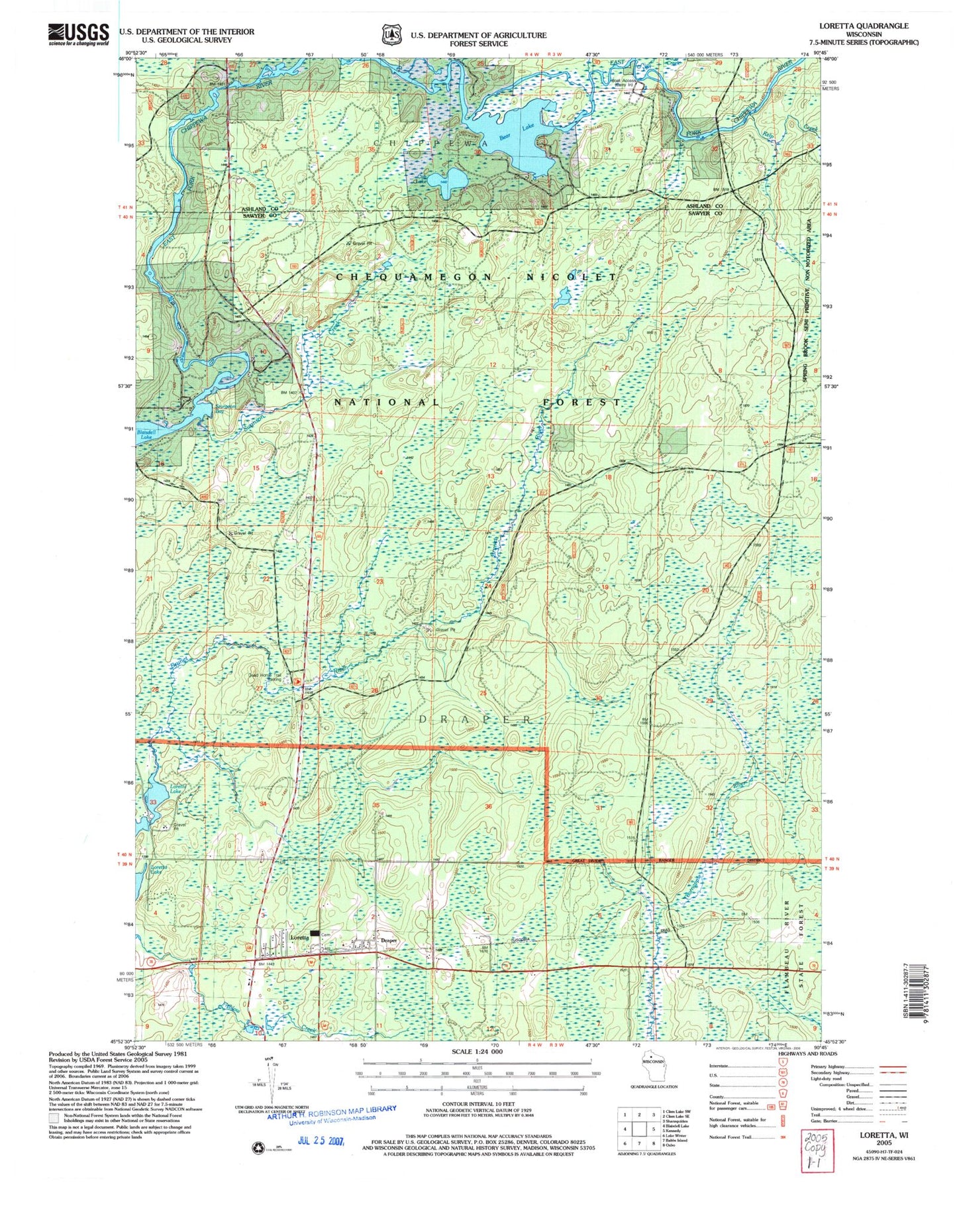
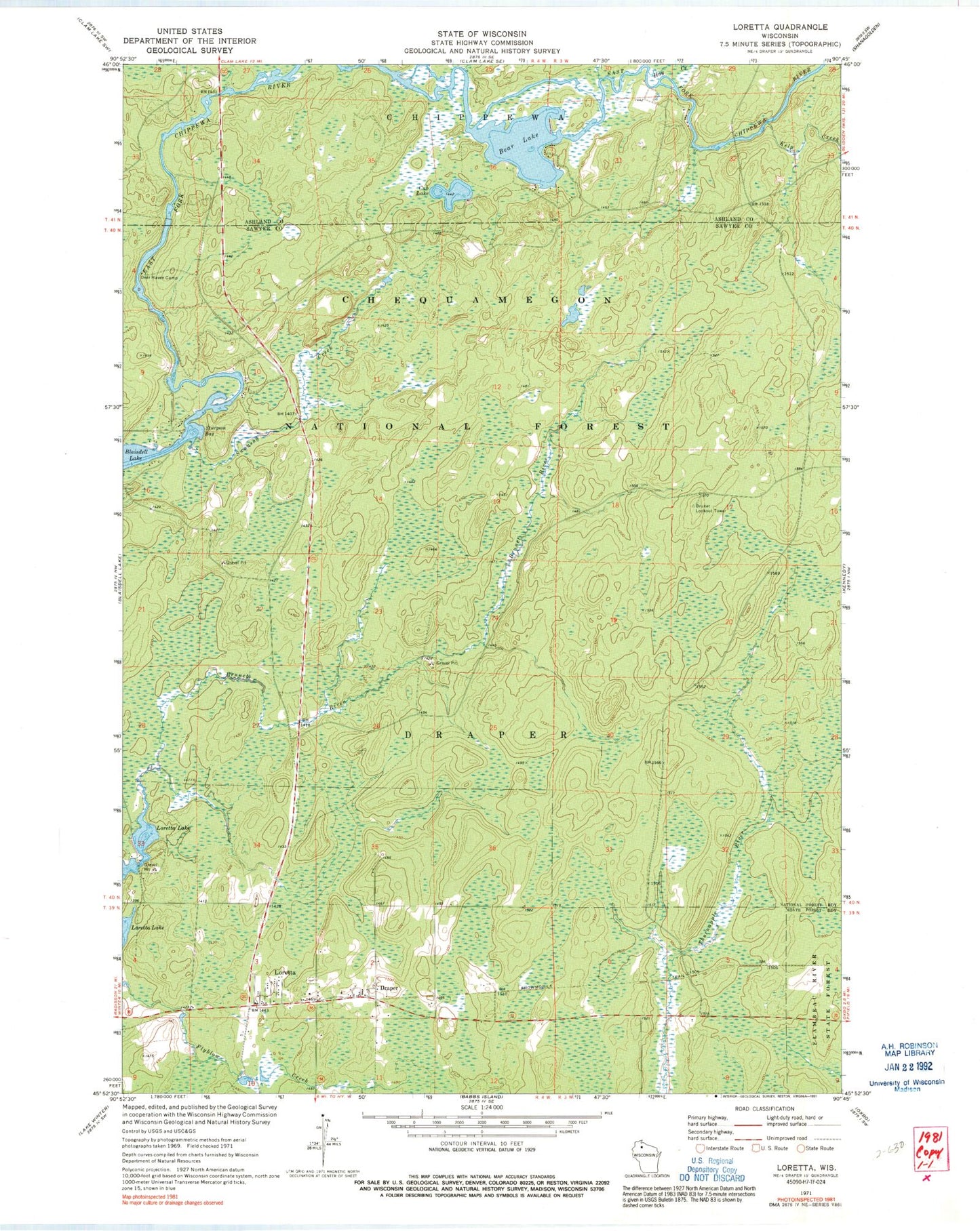
MyTopo
Classic USGS Loretta Wisconsin 7.5'x7.5' Topo Map
Regular price
$16.95
Regular price
Sale price
$16.95
Unit price
per
Couldn't load pickup availability
Historical USGS topographic quad map of Loretta in the state of Wisconsin. Map scale may vary for some years, but is generally around 1:24,000. Print size is approximately 24" x 27"
This quadrangle is in the following counties: Ashland, Sawyer.
The map contains contour lines, roads, rivers, towns, and lakes. Printed on high-quality waterproof paper with UV fade-resistant inks, and shipped rolled.
Contains the following named places: Bear Lake, Brunet Lookout Tower, Cub Lake, Deer Haven Camp, Draper, Draper - Loretta Fire Department, Draper Tower, Flyblow Creek, Hay Creek, Hungry Run, Kelp Creek, Loretta, Loretta - Draper Cemetery, Old LeMay Camp, Sturgeon Bay, Swanson Creek, Town of Draper