MyTopo
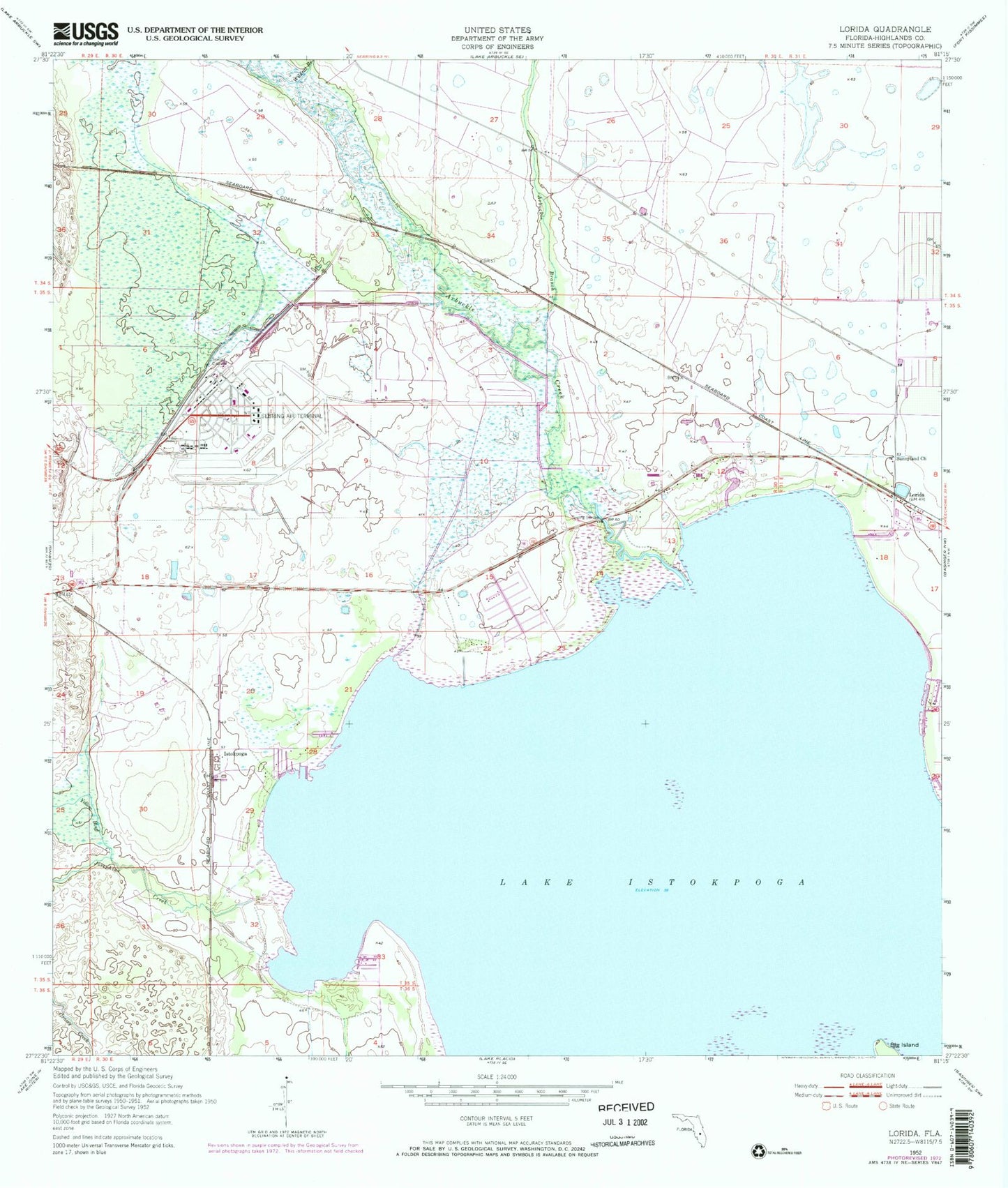
Classic USGS Lorida Florida 7.5'x7.5' Topo Map
Couldn't load pickup availability
Historical USGS topographic quad map of Lorida in the state of Florida. Map scale may vary for some years, but is generally around 1:24,000. Print size is approximately 24" x 27"
This quadrangle is in the following counties: Highlands.
The map contains contour lines, roads, rivers, towns, and lakes. Printed on high-quality waterproof paper with UV fade-resistant inks, and shipped rolled.
Contains the following named places: Arbuckle Branch, Arbuckle Creek, Istokpoga, Josephine Creek, Lorida, Lorida Fire Department Station 24, Lorida Post Office, Mallard Mobile Home Park, Sebring Division, Sebring Regional Airport, Spring Lake Community Center, Sunnyland Church, The Hamptons Golf Club, The Palms Mobile Home Park, Wildcat Branch, Yellow Bluff Creek, ZIP Code: 33876