MyTopo
Classic USGS Loring Iowa 7.5'x7.5' Topo Map
Couldn't load pickup availability
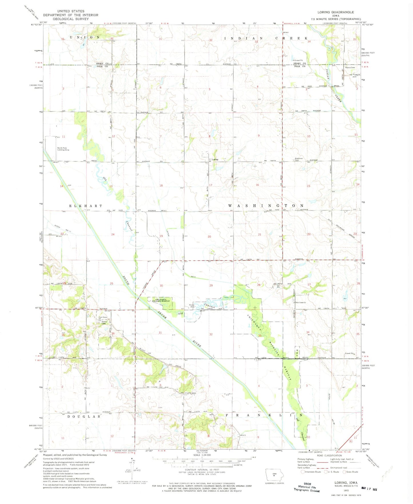
Historical USGS topographic quad map of Loring in the state of Iowa. Map scale may vary for some years, but is generally around 1:24,000. Print size is approximately 24" x 27"
This quadrangle is in the following counties: Polk, Story.
The map contains contour lines, roads, rivers, towns, and lakes. Printed on high-quality waterproof paper with UV fade-resistant inks, and shipped rolled.
Contains the following named places: Byers Cemetery, Calamus Creek, Chichaqua Wildlife Habitat Park, Church of the Brethren Cemetery, Cory Grove Church, Ditch Number 11, Ditch Number 4, Farrar Airport, Holy Cross Cemetery, Holy Cross Church, Loring, Loring Post Office, Mount Zion Cemetery, North Polk Landing Strip, Old Channel, Oldfield, Oldfield Post Office, Peoria Cemetery, Tibbitt Post Office, Township of Washington, Woodland Lake, Woodland Lake Dam, ZIP Code: 50161