MyTopo
Classic USGS Lorraine Florida 7.5'x7.5' Topo Map
Couldn't load pickup availability
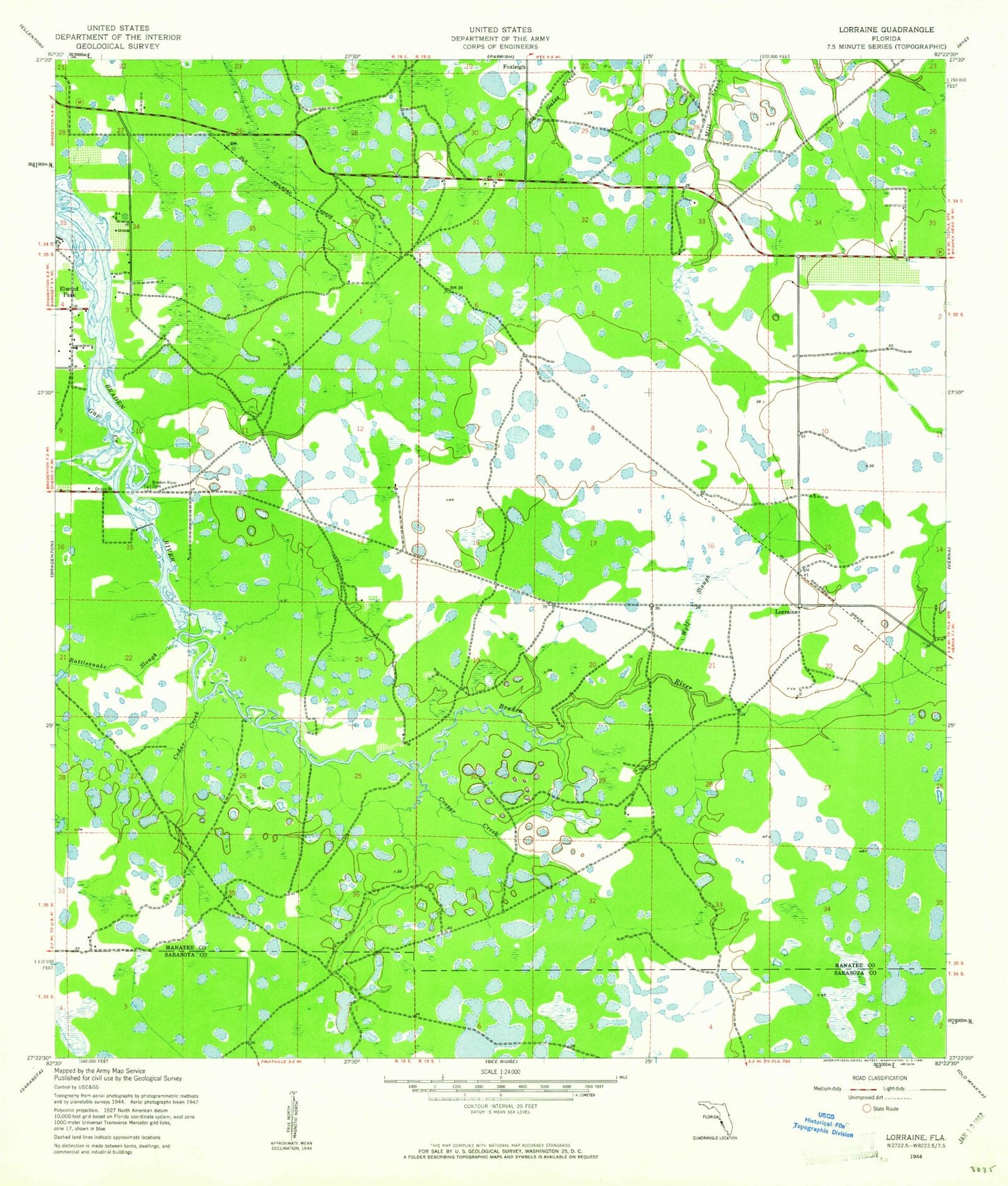
Historical USGS topographic quad map of Lorraine in the state of Florida. Map scale may vary for some years, but is generally around 1:24,000. Print size is approximately 24" x 27"
This quadrangle is in the following counties: Manatee, Sarasota.
The map contains contour lines, roads, rivers, towns, and lakes. Printed on high-quality waterproof paper with UV fade-resistant inks, and shipped rolled.
Contains the following named places: Bashaw Elementary School, Braden River Cemetery, Braden River Church, Braden River United Church, Cedar Creek, Christian School of Fine Arts, Cooper Creek, Desoto Lakes Census Designated Place, East Manatee Fire Rescue Station 1, East Manatee Fire Rescue Station 2, East Manatee Fire Rescue Station 3, East Manatee Fire Rescue Station 4, East Manatee Fire Rescue Station 5, Florida Department of Law Enforcement Sarasota Field Office, Florida Highway Patrol Troop F Bradenton Station, Foxleigh, Gap Creek, Harvest United Methodist Church, Jiggs Landing, Lakewood Ranch, Lakewood Ranch Census Designated Place, Lakewood Ranch Medical Center, Lakewood Ranch Post Office, Lorraine, Manatee County, Manatee County Sheriff's Office - Mounted Patrol, Manatee County Sheriff's Office District 3, Rattlesnake Slough, Riverhills Christian School, Southern Manatee Fire and Rescue District Station 5, Ward Lake, Williams Creek, WJKB-AM (Siesta Key), Wolf Slough, ZIP Codes: 34201, 34202, 34211, 34212