MyTopo
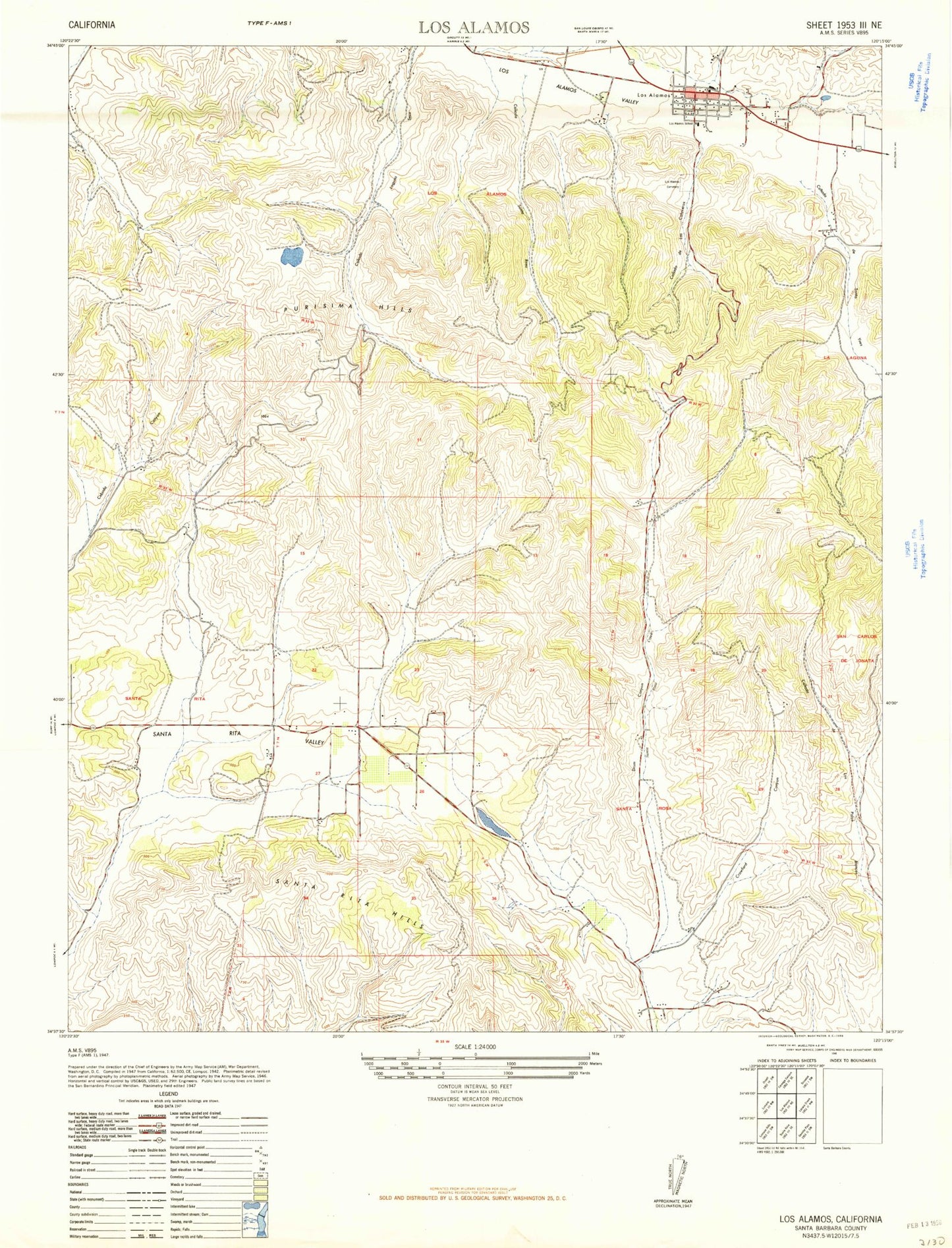
Classic USGS Los Alamos California 7.5'x7.5' Topo Map
Couldn't load pickup availability
Historical USGS topographic quad map of Los Alamos in the state of California. Map scale may vary for some years, but is generally around 1:24,000. Print size is approximately 24" x 27"
This quadrangle is in the following counties: Santa Barbara.
The map contains contour lines, roads, rivers, towns, and lakes. Printed on high-quality waterproof paper with UV fade-resistant inks, and shipped rolled.
Contains the following named places: Acin Farms, Arthur Ferrini Park, Babcock Winery and Vineyards, Canada De Las Calaveras, Canada De Santa Rosa, Canada de Santa Ynez, Canada Laguna Seca, Crawford Canyon, Drum Canyon, Los Alamos, Los Alamos Cemetery, Los Alamos Census Designated Place, Los Alamos County Park, Los Alamos Post Office, Melville Vineyards and Winery, Olga Reed Elementary School, Purisima Hills, Redrock Mountain, Santa Barbara County Fire Department Station 24, Santa Rita Hills, Santa Rita Valley