MyTopo
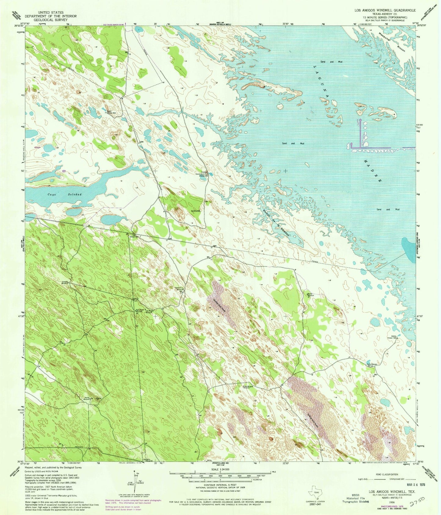
Classic USGS Los Amigos Windmill Texas 7.5'x7.5' Topo Map
Couldn't load pickup availability
Historical USGS topographic quad map of Los Amigos Windmill in the state of Texas. Map scale may vary for some years, but is generally around 1:24,000. Print size is approximately 24" x 27"
This quadrangle is in the following counties: Kenedy.
The map contains contour lines, roads, rivers, towns, and lakes. Printed on high-quality waterproof paper with UV fade-resistant inks, and shipped rolled.
Contains the following named places: Agua Dulee Windmill, Agujas Artesian Well, Andres Artesian Well, Bano Windmill, Bonita Windmill, Candilia Well, Cayo Soledad, Encino de la Cruz Artesian Well, Guajolote Windmill, Los Amigos Windmill, Mesquite Rincon, Parrita Windmill, Rincon de la Soledad, Rode Artesian Well, San Jose Windmill, Santa Cruz Windmill, Soledad Windmill, Topo Artesian Well