MyTopo
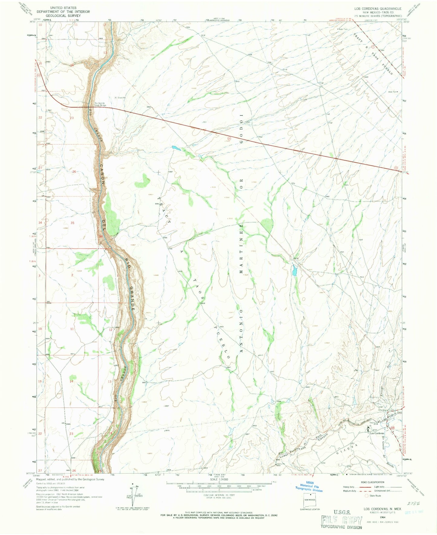
Classic USGS Los Cordovas New Mexico 7.5'x7.5' Topo Map
Couldn't load pickup availability
Historical USGS topographic quad map of Los Cordovas in the state of New Mexico. Typical map scale is 1:24,000, but may vary for certain years, if available. Print size: 24" x 27"
This quadrangle is in the following counties: Taos.
The map contains contour lines, roads, rivers, towns, and lakes. Printed on high-quality waterproof paper with UV fade-resistant inks, and shipped rolled.
Contains the following named places: Penas Negras Cemetery, Rio Grande del Rancho, Tract A Taos Pueblo, Tract B Taos Pueblo, Rio Grande Placer District, Power Line Falls Rapid, Ski Jump Rapid, Dead Car Rapid, High Bridge Rapid, Yellow Bank Rapid, Rock Garden, RG-35518 Water Well, Airport Water Well, Rio Gorge Water Well, Arroyo Seco, Los Cordovas, Rio Grande Gorge Bridge, Rio Grande Gorge Historical Marker, San Ysidro Oratorio, Taos Regional Airport