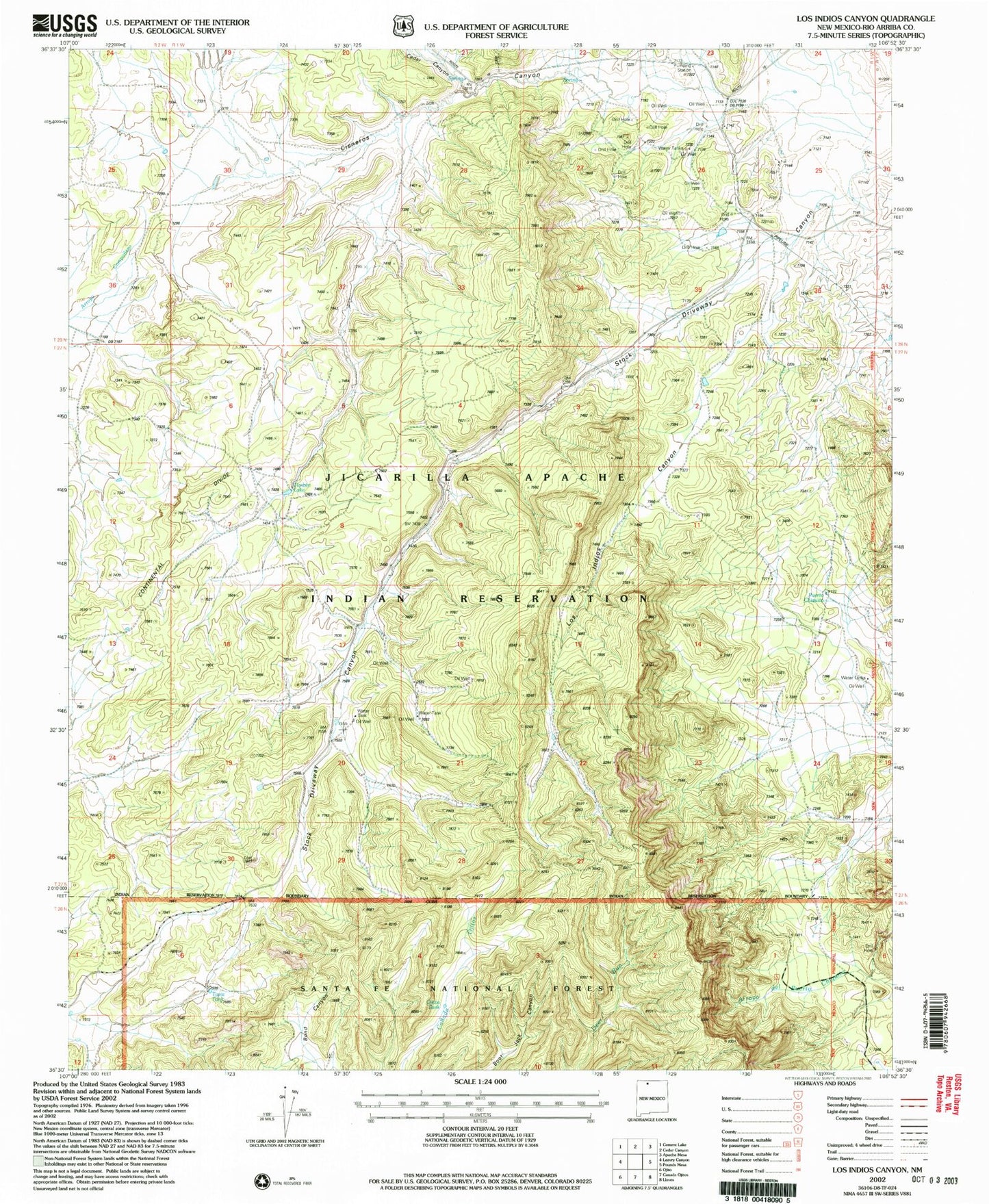
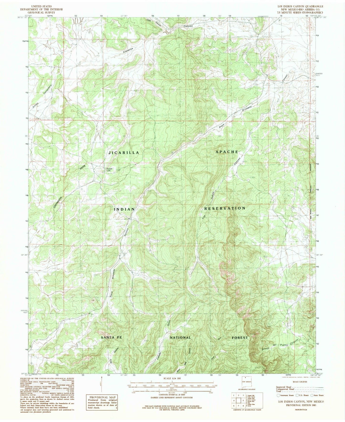
MyTopo
Classic USGS Los Indios Canyon New Mexico 7.5'x7.5' Topo Map
Regular price
$16.95
Regular price
Sale price
$16.95
Unit price
per
Couldn't load pickup availability
Historical USGS topographic quad map of Los Indios Canyon in the state of New Mexico. Map scale may vary for some years, but is generally around 1:24,000. Print size is approximately 24" x 27"
This quadrangle is in the following counties: Rio Arriba.
The map contains contour lines, roads, rivers, towns, and lakes. Printed on high-quality waterproof paper with UV fade-resistant inks, and shipped rolled.
Contains the following named places: Boundary Tank, Burford Lake Wildlife Station, Cedar Canyon, Cisneros Canyon, Los Indios Canyon, Ojitos Tank, Puerto Chiquito, Stock Driveway Canyon, Tapia Tank, Timber Lake