MyTopo
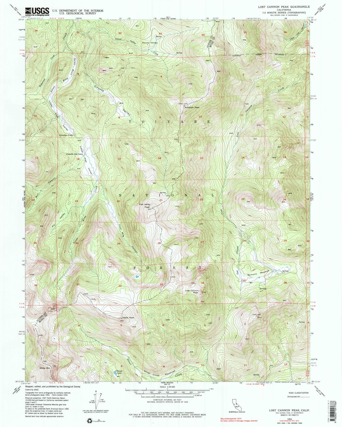
Classic USGS Lost Cannon Peak California 7.5'x7.5' Topo Map
Couldn't load pickup availability
Historical USGS topographic quad map of Lost Cannon Peak in the state of California. Typical map scale is 1:24,000, but may vary for certain years, if available. Print size: 24" x 27"
This quadrangle is in the following counties: Alpine, Mono.
The map contains contour lines, roads, rivers, towns, and lakes. Printed on high-quality waterproof paper with UV fade-resistant inks, and shipped rolled.
Contains the following named places: Antelope Peak, Bull Canyon, Chango Lake, Connells Cow Camp, Corral Valley, Corral Valley Creek, Coyote Valley, Fish Valley Peak, Fly Valley, Four Mile Canyon, Llewellyn Falls, Long Valley, Lost Cannon Peak, Lower Fish Valley, Silver Creek Meadows, Summit Meadow, Tamarack Creek, Upper Fish Valley, White Mountain, Wells Peak, Corral Valley Trail (historical), Silver King Trail, Little Lost Canyon, Coyote Valley Creek, Early Emigrant and Indian Trail