
MyTopo
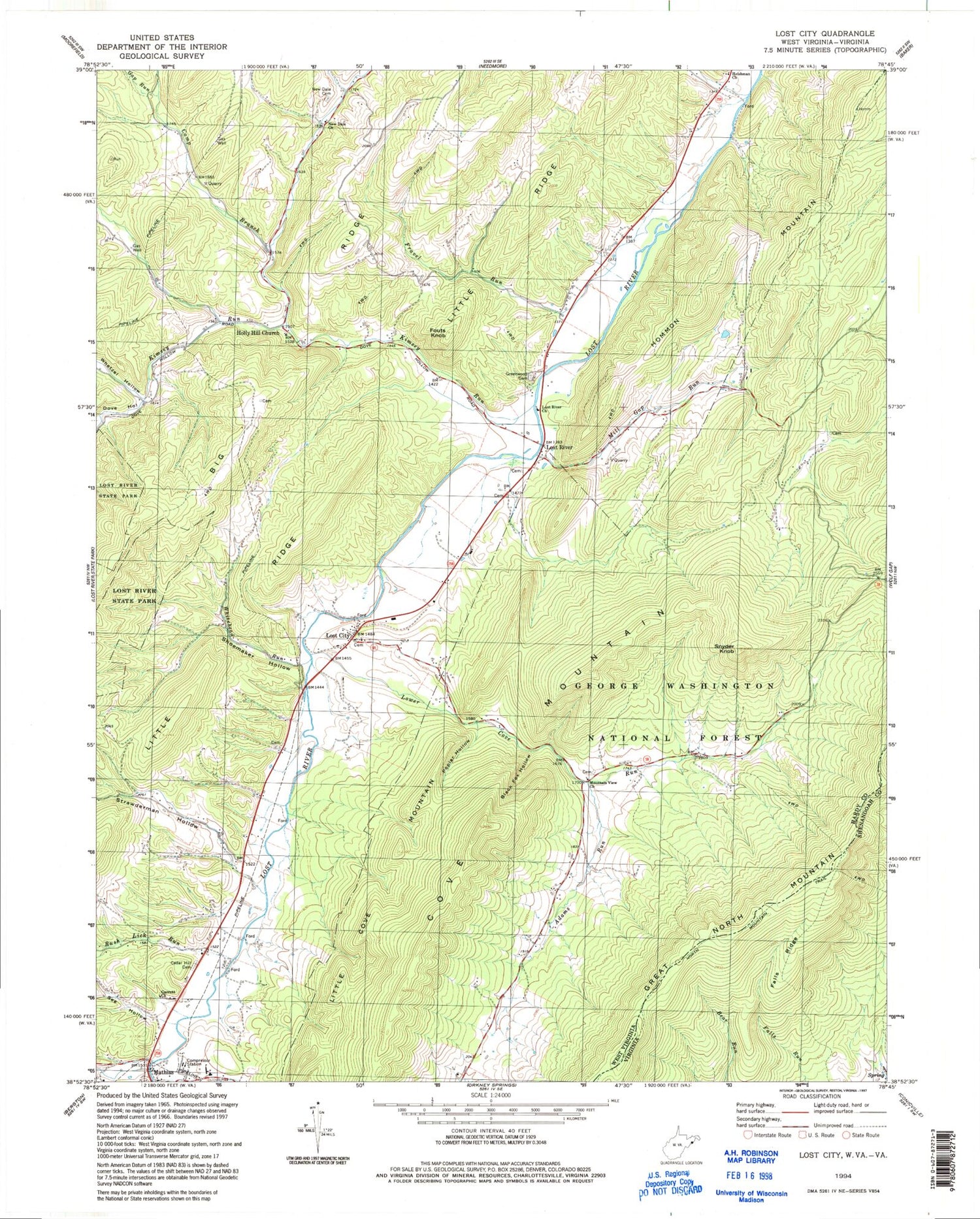
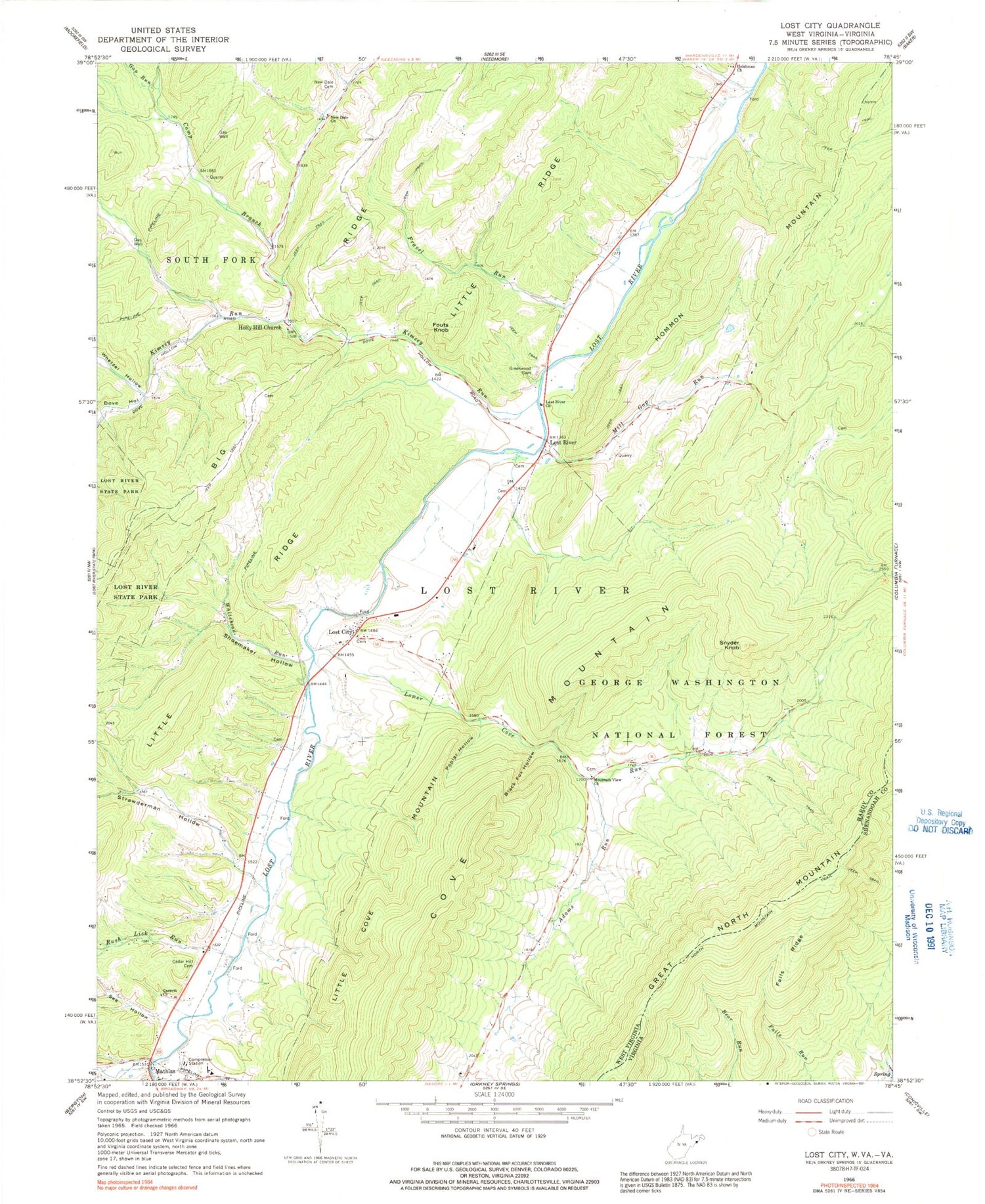
Classic USGS Lost City West Virginia 7.5'x7.5' Topo Map
Couldn't load pickup availability
Historical USGS topographic quad map of Lost City in the states of West Virginia, Virginia. Typical map scale is 1:24,000, but may vary for certain years, if available. Print size: 24" x 27"
This quadrangle is in the following counties: Hardy, Shenandoah.
The map contains contour lines, roads, rivers, towns, and lakes. Printed on high-quality waterproof paper with UV fade-resistant inks, and shipped rolled.
Contains the following named places: Adams Run, Black Fox Hollow, Camp Branch, Cedar Hill Cemetery, Dove Hollow, Fouts Knob, Fravel Run, Gap Run, Garrett's Chapel United Methodist Church, Greenwood Cemetery, Heishman Church, Holly Hill Church, Hommon Mountain, Howards Lick Run, Kimsey Run, Little Cove Mountain, Lost City, Lost River, Lost River Baptist Church, Lower Cove Run, Mill Gap Run, Mountain View Church, New Dale Cemetery, New Dale Church, North Mountain Trail, Poplar Hollow, Rush Lick Run, See Hollow, Shoemaker Hollow, Snyder Knob, Strawderman Hollow, Upper Cove Run, Whetzel Hollow, Whitehead Run, Cove Mountain, Mathias, Bowman School (historical), Fravel Run School (historical), Gap Run School (historical), Mill Gap School (historical), Mountain View School (historical), Shoemaker School (historical), Terra Alta School (historical), Stranderman Spring, Free Mason Spring, Gerdie Vance Spring, Wilkens Spring, Kimzies School (historical), Lost City Post Office, Lost River Post Office, Mathias Post Office, Lost River District, Mathias Baker Volunteer Fire Department and Rescue, Falls Ridge, North Mountain Trail


