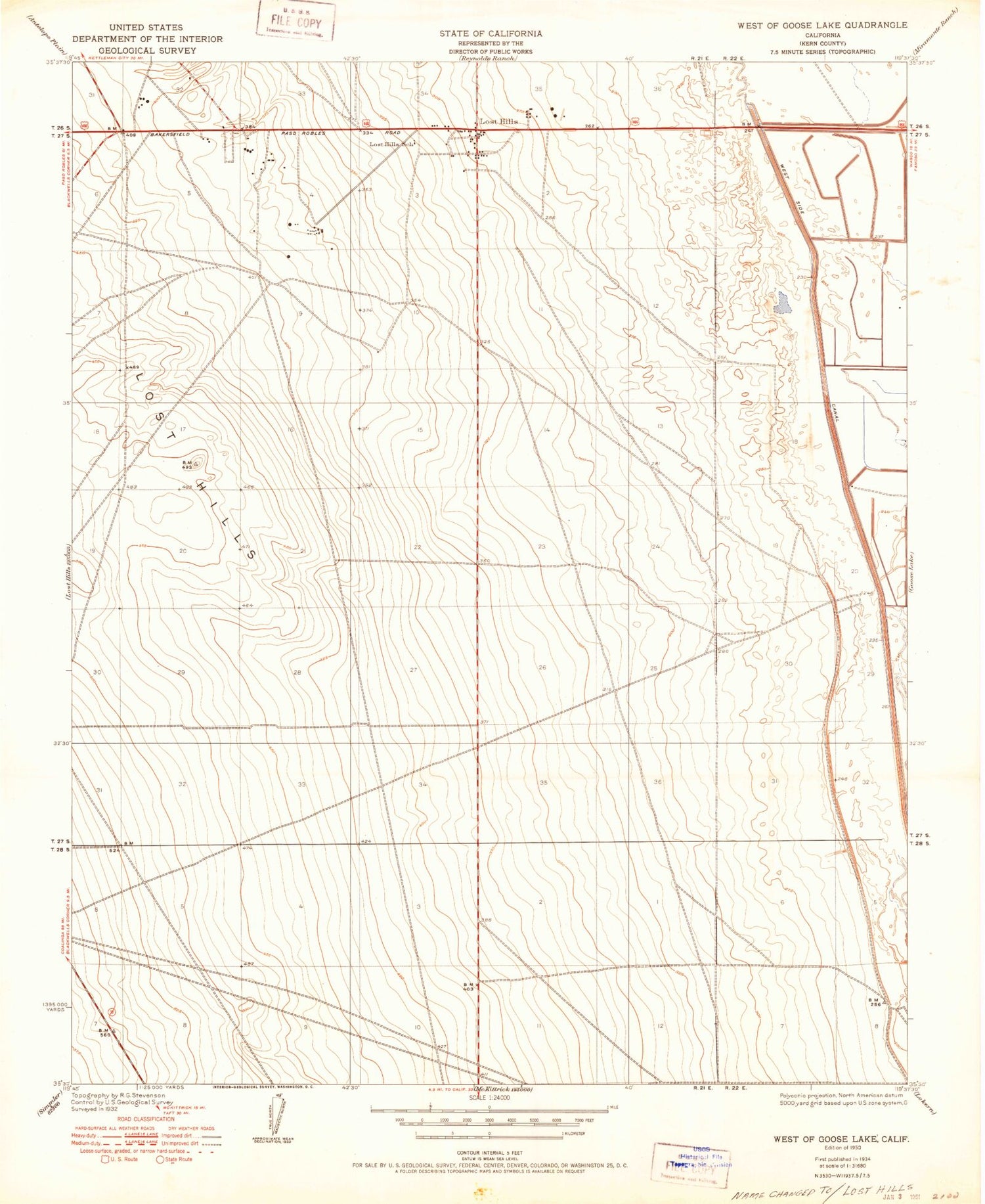


MyTopo
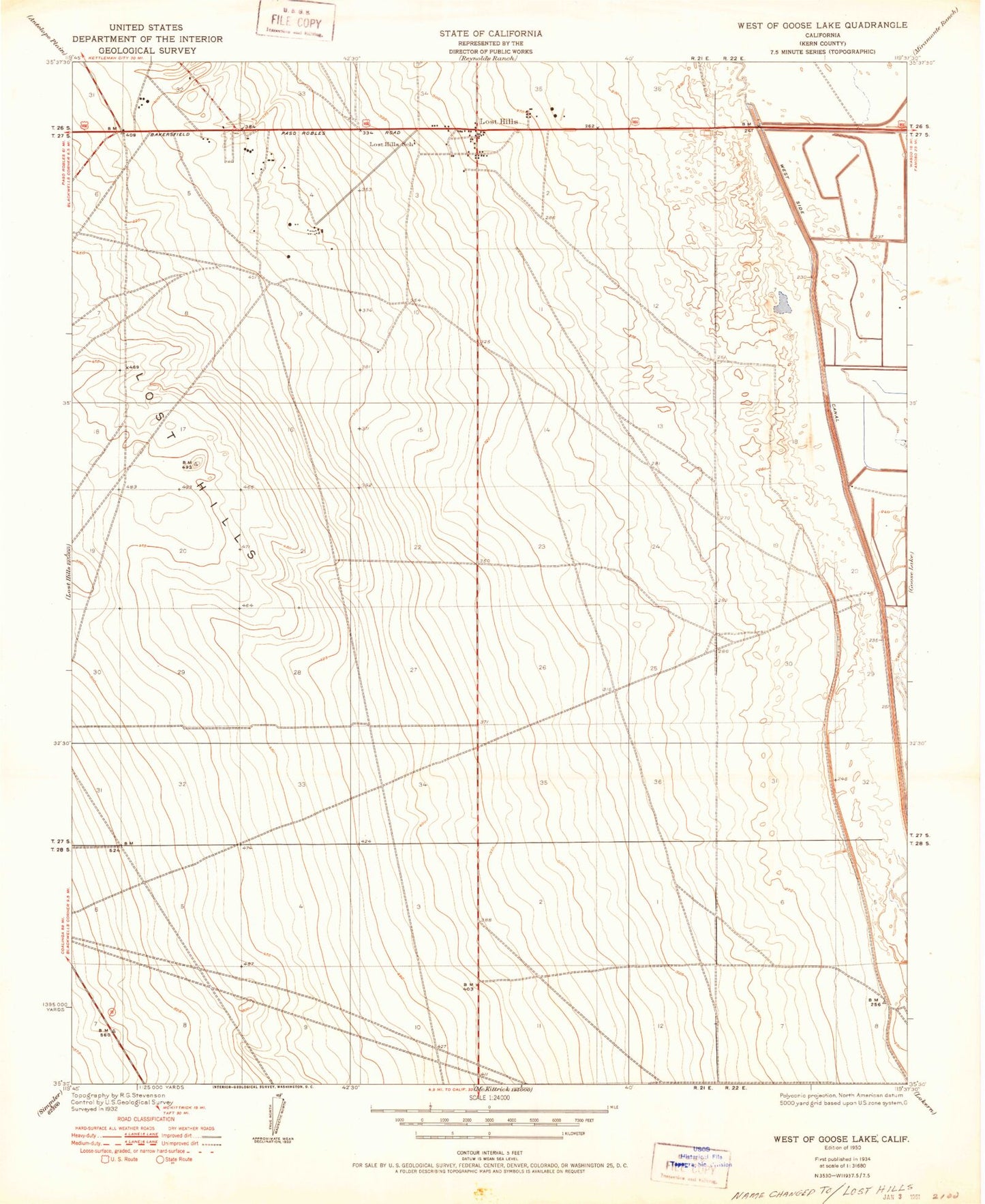
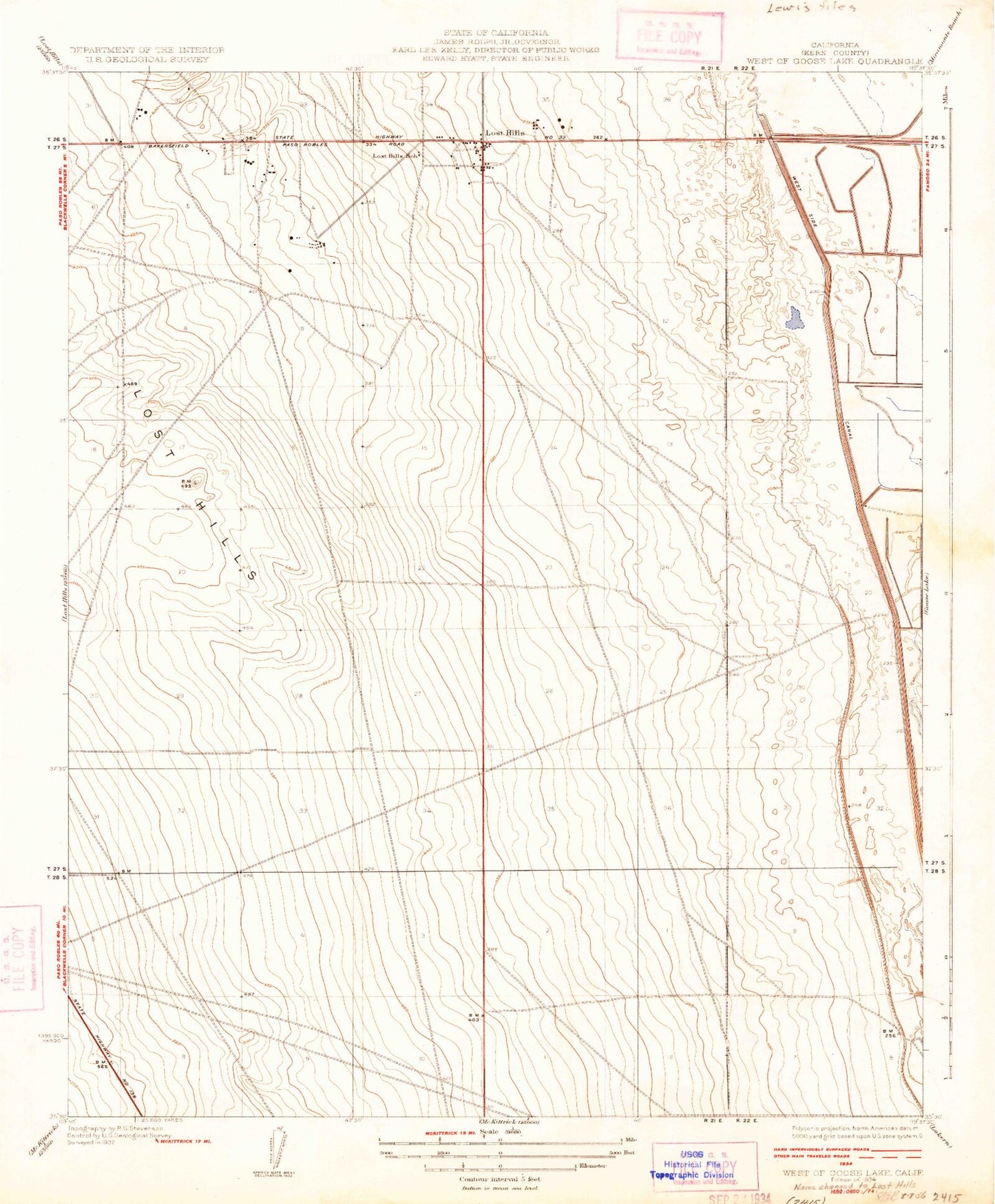
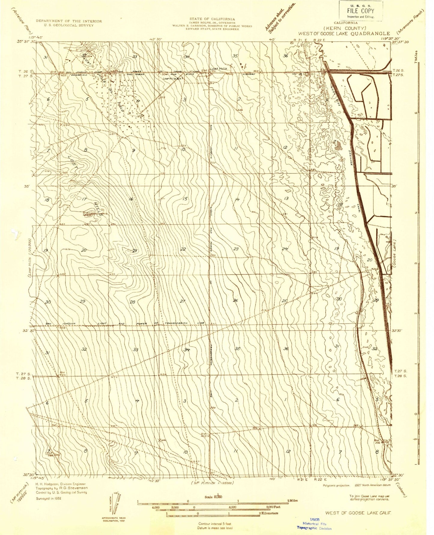
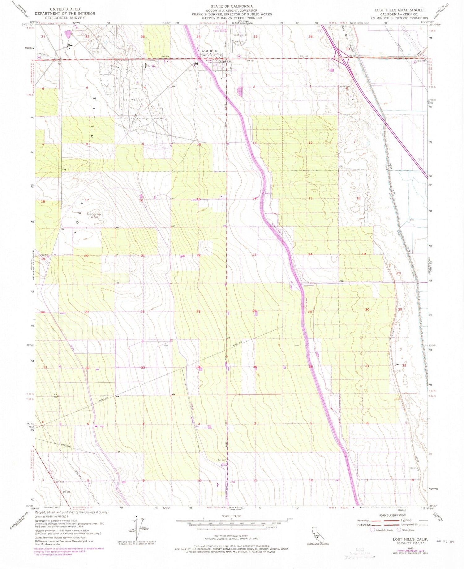
Classic USGS Lost Hills California 7.5'x7.5' Topo Map
Regular price
$16.95
Regular price
Sale price
$16.95
Unit price
per
Couldn't load pickup availability
Historical USGS topographic quad map of Lost Hills in the state of California. Map scale may vary for some years, but is generally around 1:24,000. Print size is approximately 24" x 27"
This quadrangle is in the following counties: Kern.
The map contains contour lines, roads, rivers, towns, and lakes. Printed on high-quality waterproof paper with UV fade-resistant inks, and shipped rolled.
Contains the following named places: Governor Edmund G Brown California Aqueduct, Kern County Fire Department Station 26 - Lost Hills, Lost Hills, Lost Hills Elementary School, Lost Hills Park, Lost Hills Post Office, Lost Hills-Kern County Airport, Old Hart Station