MyTopo
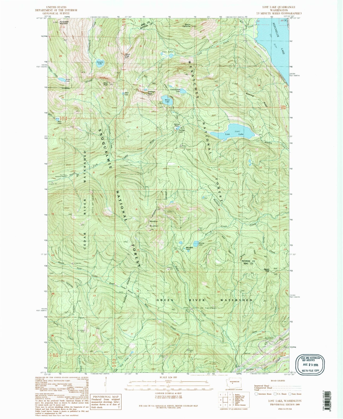
Classic USGS Lost Lake Washington 7.5'x7.5' Topo Map
Couldn't load pickup availability
Historical USGS topographic quad map of Lost Lake in the state of Washington. Typical map scale is 1:24,000, but may vary for certain years, if available. Print size: 24" x 27"
This quadrangle is in the following counties: King, Kittitas.
The map contains contour lines, roads, rivers, towns, and lakes. Printed on high-quality waterproof paper with UV fade-resistant inks, and shipped rolled.
Contains the following named places: Abiel Lake, Abiel Peak, Annette Lake, Annette Lake Trail, Bear Lake, Cascade Crest Trail, Mount Catherine, Cedar Notch, Cold Creek, Cottonwood Lake, Dandy Pass, East Creek, Fort Tilton Historical Marker, Humpback Mountain, Lost Lake, Meadow Mountain, Meadow Pass, Mill Creek, Mirror Lake, Roaring Ridge, Rocky Run, Scout Lake, Silver Peak, Snow Creek, Stirrup Creek, Stirrup Lake, Tinkham Creek, Tinkham Peak, Twilight Lake, Twin Lakes, West Creek, Yakima Pass, Roaring Ridge Lookout, Dandy Creek