MyTopo
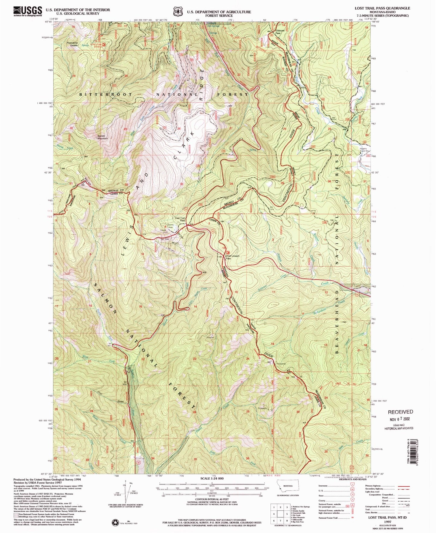
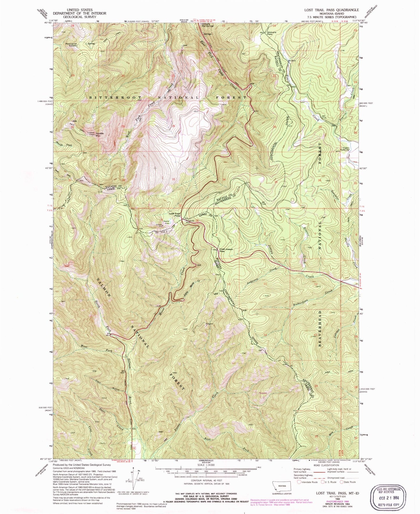
Classic USGS Lost Trail Pass Montana 7.5'x7.5' Topo Map
Couldn't load pickup availability
Historical USGS topographic quad map of Lost Trail Pass in the states of Montana, Idaho. Typical map scale is 1:24,000, but may vary for certain years, if available. Print size: 24" x 27"
This quadrangle is in the following counties: Beaverhead, Lemhi, Ravalli.
The map contains contour lines, roads, rivers, towns, and lakes. Printed on high-quality waterproof paper with UV fade-resistant inks, and shipped rolled.
Contains the following named places: Anderson Creek, Chief Joseph Pass, Gallogly Spring, Gibbons Pass, Hogans Guard Station, Porcupine Saddle, Prairie Creek, Richardson Creek, Saddle Mountain, Scooter Creek, Lost Trail Sports Area, Big Hole National Recreation Trail, Porcupine Saddle Trailhead, Lost Trail Sprots Area, Saddle Mountain Fire Area Poin of Interest, Lost Trail Powder Mountain, Speedway Ski Trail, Powder Bowl Ski Trail, Hideout Ski Trail, North Bowl Ski Trail, B-2 Ski Trail, North Face Ski Trail, South Face Ski Trail, Drifter Ski Trail, Lightning Ski Trail, Thunder Ski Trail, West Meadow Ski Trail, Salmon Ski Trail, Chicken Out Ski Trail, Southern Comfort Ski Trail, Meadow Run Ski Trail, Meadow Trail Ski Trail, Far Out Ski Trail, Upper Far Out Ski Trail, Lewis and Clark Ridge, Gallogly Hot Springs, Cool Gulch, East Fork Pierce Creek, Little Moose Creek, Lost Trail Pass, Moose Creek, State Creek, West Fork North Fork Salmon River, Lost Trail Pass Picnic Area