MyTopo
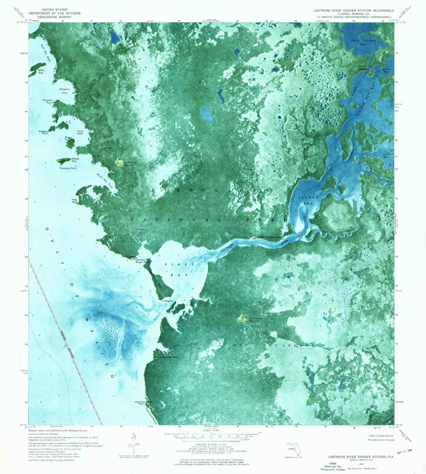
Classic USGS Lostmans River Ranger Station Florida 7.5'x7.5' Topo Map
Couldn't load pickup availability
Historical USGS topographic quad map of Lostmans River Ranger Station in the state of Florida. Map scale may vary for some years, but is generally around 1:24,000. Print size is approximately 24" x 27"
This quadrangle is in the following counties: Monroe.
The map contains contour lines, roads, rivers, towns, and lakes. Printed on high-quality waterproof paper with UV fade-resistant inks, and shipped rolled.
Contains the following named places: Alligator Cove, Alligator Point, Bird Key, Bird Key Bight, Boggess Point, Farm Creek, First Bay, Hamilton Mound, Highland Point, Hog Key, Johnson Mound, Key McLaughlin, Leon Hamilton Place, Little Creek, Lostmans Key, Lostmans River, Lostmans River Ranger Station, Onion Key Bay, Oyster Creek, Porpoise Point, Second Bay, Toms Bight, Toms Creek, Two Island Bay, Walter Hamilton Place, Wood Key, Wood Key Cove