MyTopo
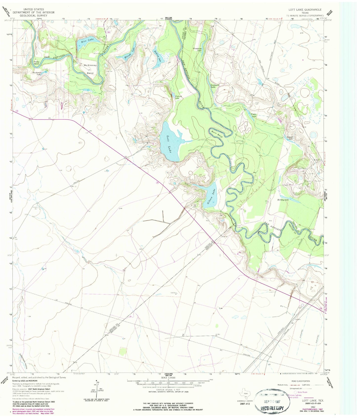
Classic USGS Lott Lake Texas 7.5'x7.5' Topo Map
Couldn't load pickup availability
Historical USGS topographic quad map of Lott Lake in the state of Texas. Map scale may vary for some years, but is generally around 1:24,000. Print size is approximately 24" x 27"
This quadrangle is in the following counties: Goliad, Refugio, Victoria.
The map contains contour lines, roads, rivers, towns, and lakes. Printed on high-quality waterproof paper with UV fade-resistant inks, and shipped rolled.
Contains the following named places: Burn Bend, Duke Bridge, Fagan Cemetery, Fagan Lake, Flemming Lake, Fulcrod Lake, Gaffney Oil Field, Gibson Lake, Hardaman Lake, Holiday Lake, Hovey Bend, Lott Cemetery, Lott Lake, McKinney Bend, Milinda Lake, Mount Zion Church, Raisin Volunteer Fire Department Station 3, Redding Lake, Rice Lake, Sample Cemetery, Sample Lake, Simms Footbridge, Summers Lake, Terrell Cemetery