
MyTopo
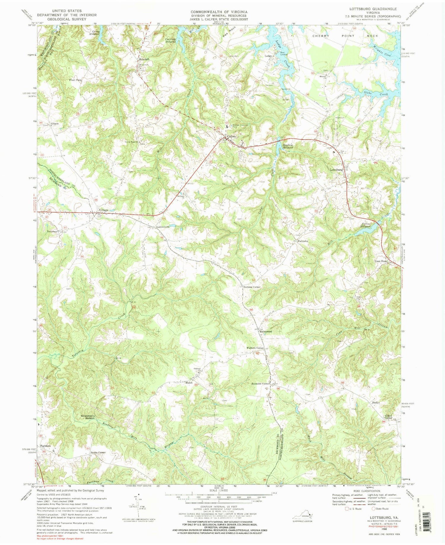
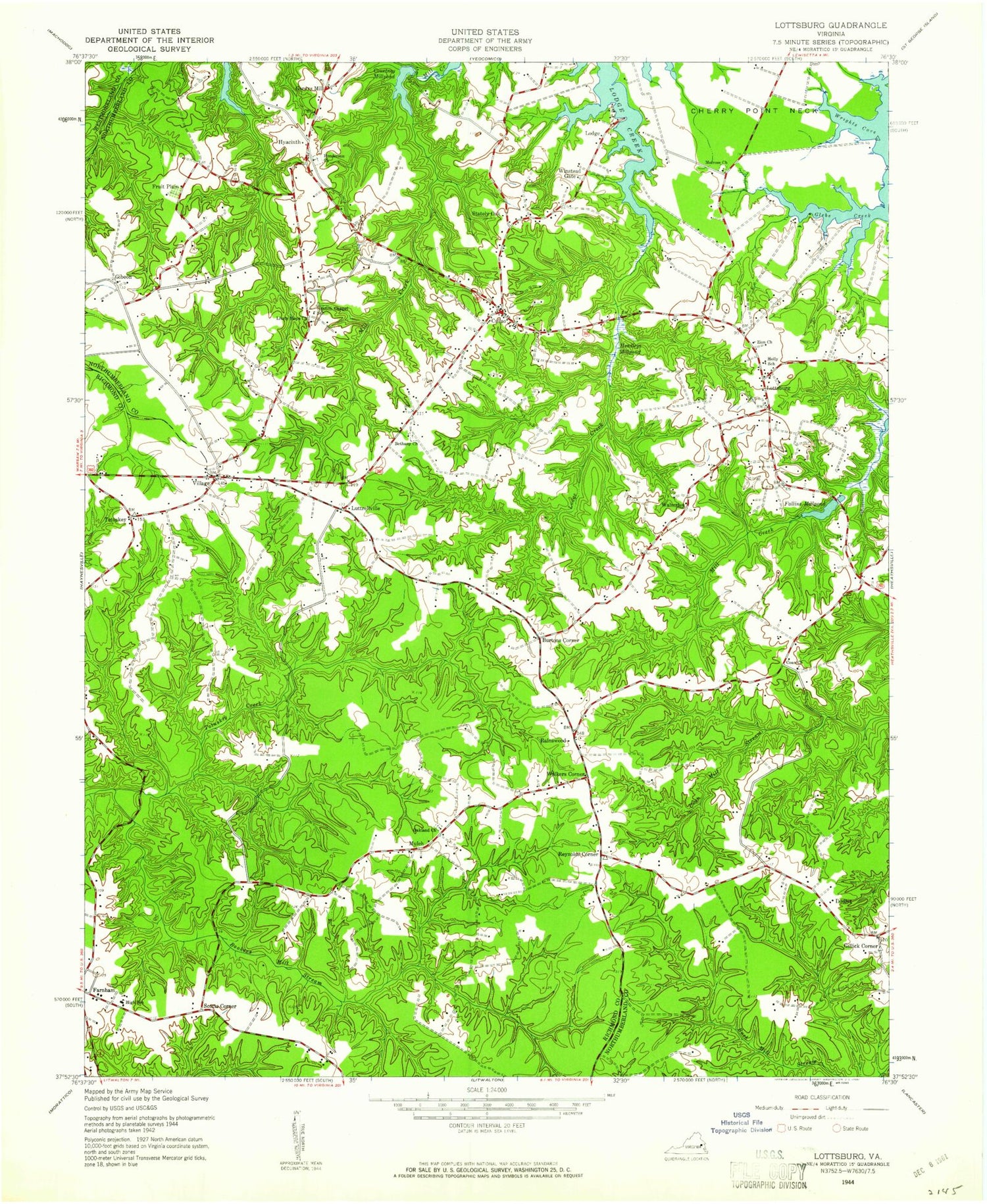
Classic USGS Lottsburg Virginia 7.5'x7.5' Topo Map
Couldn't load pickup availability
Historical USGS topographic quad map of Lottsburg in the state of Virginia. Map scale may vary for some years, but is generally around 1:24,000. Print size is approximately 24" x 27"
This quadrangle is in the following counties: Northumberland, Richmond, Westmoreland.
The map contains contour lines, roads, rivers, towns, and lakes. Printed on high-quality waterproof paper with UV fade-resistant inks, and shipped rolled.
Contains the following named places: Bethany Church, Bookers Mill Stream, Branch Chapel School, Burtons Corner, Callao, Callao Elementary School, Callao Post Office, Callao Volunteer Fire Department, Callao Volunteer Rescue Squad, Callo Rescue Squad, Coan Church, Coan School, Coan Stage, Courtney Millpond, Courtney Millpond Dam, District 1, Dodlyt, Falling Milldam, Falling Millpond, Fallins Mill, Fallins Millpond, Farnham, Farnham Manor Adult Residence, Farnham Post Office, Fruit Plain, Gibeon, Gibeon Baptist Church, Gibeon Baptist Church Cemetery, Gibeon School, Gillick Corner, Good Shepherd Lutheran Church, Hale Dam, Headleys Mill, Headleys Millpond, Henderson Church, Holley Graded School, Hyacinth, Lively Hope Church, Lodge, Lodge Landing, Lodge Neck, Lottsburg, Lottsburg Post Office, Luttrellville, Melrose Church, Mount Zion Corner, Mulch, North Farnham Episcopal Church Cemetery, Northern Neck Baptist Church, Northern Neck Regional Special Education, Oakland Cemetery, Oakland Church, Piedmont School, Quinton Oaks Golf Course, Rainswood, Reynolds Corner, Scotts Corner, Stately Oak, Strawberry Bottom, Totuskey, Village, Village Green Golf Course, Walkers Corner, Walmsley, Winstead Gate, Wrights Cove, Yeocomico Baptist Church, Zion Church, ZIP Codes: 22435, 22511


