
MyTopo
Classic USGS Loudon New Hampshire 7.5'x7.5' Topo Map
Couldn't load pickup availability
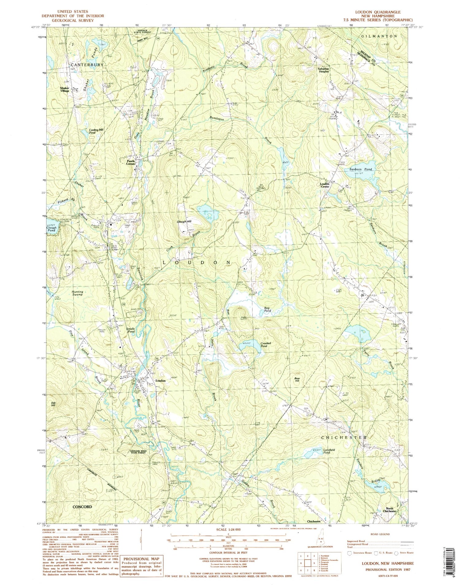
Historical USGS topographic quad map of Loudon in the state of New Hampshire. Typical map scale is 1:24,000, but may vary for certain years, if available. Print size: 24" x 27"
This quadrangle is in the following counties: Belknap, Merrimack.
The map contains contour lines, roads, rivers, towns, and lakes. Printed on high-quality waterproof paper with UV fade-resistant inks, and shipped rolled.
Contains the following named places: Academy Brook, Bear Hill, Bee Hole Brook, Bog Pond, Bumfagon Brook, Carding Mill Pond, Chichester Central School, Clark Brook, Clough Hill, Clough Pond, Crooked Pond, Giddis Brook, Gues Meadow Brook, Hunting Swamp, Loudon, Loudon Center, Loudon Center Church, Lovering Cemetery, Lynxfield Pond, Pearls Corner, Pickard Brook, Pine Island Brook, Sabattus Heights, Sanborn Pond, Shaker Branch, Shaker Ponds, Shaker Village, Smalls Pond, Soucook River State Forest, Speedway Heliport, Crowley Heliport, Town of Chichester, Town of Loudon, Sanborn Pond Outlet Dam, Long Pond Dike, Long Pond, West Turning Pond Dam, West Turning Pond, East Turning Pond Dam, East Turning Pond, Center Dam, Center Pond, East Dam, Runaway Pond, Cooper Farm Airport, Loudon Cemetery, Loudon Center Freewill Baptist Church, Loudon Elementary School, New Hampshire International Speedway, Shaker Cemetery, Loudon Fire Department Station 1, Loudon Fire Department Station 2, Meadow Ledge Farm, Loudon Census Designated Place, Loudon Police Department


